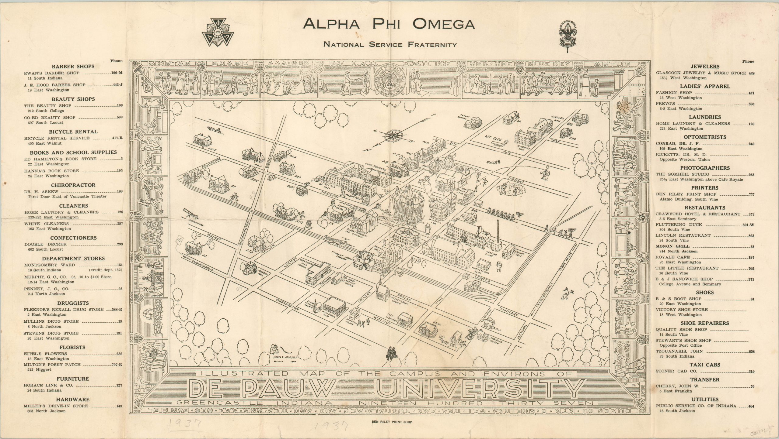
Illustrated Map of the Campus and Environs of De Pauw University
Rare and charming prewar view of DePauw University.
Out of stock
Description
This terrific bird’s eye view shows the campus of DePauw University in Greencastle, Indiana. It was originally drawn by John D. Samuels in 1937, but this particular example has been updated to 1940 and was printed locally by the Ben Riley Print Shop.
The central view shows a humorous interpretation of the campus; featuring exaggerated buildings, transportation routes, and several comedic vignettes. Ongoing construction is also referenced with a tongue in cheek cartoon. Surrounding the main view in a short directory of local businesses and services, providing an interesting economic record of the city before the outbreak of the Second World War.
Scarce, with no recorded examples in OCLC, Rumsey, or elsewhere I can find.
Map Details
Publication Date: 1940
Author: John D. Samuels
Sheet Width (in): 22.00
Sheet Height (in): 12.50
Condition: B
Condition Description: Originally folded into 10 segments. Creasing, discoloration, and moderate wear along fold lines, plus one small stain in the upper right corner of the border. Remains in good condition for a scarce, ephemeral map.
Out of stock

