Illustrated Map of Chicago and the Century of Progress Exposition
The Century of Progress beckons!
Out of stock

Description
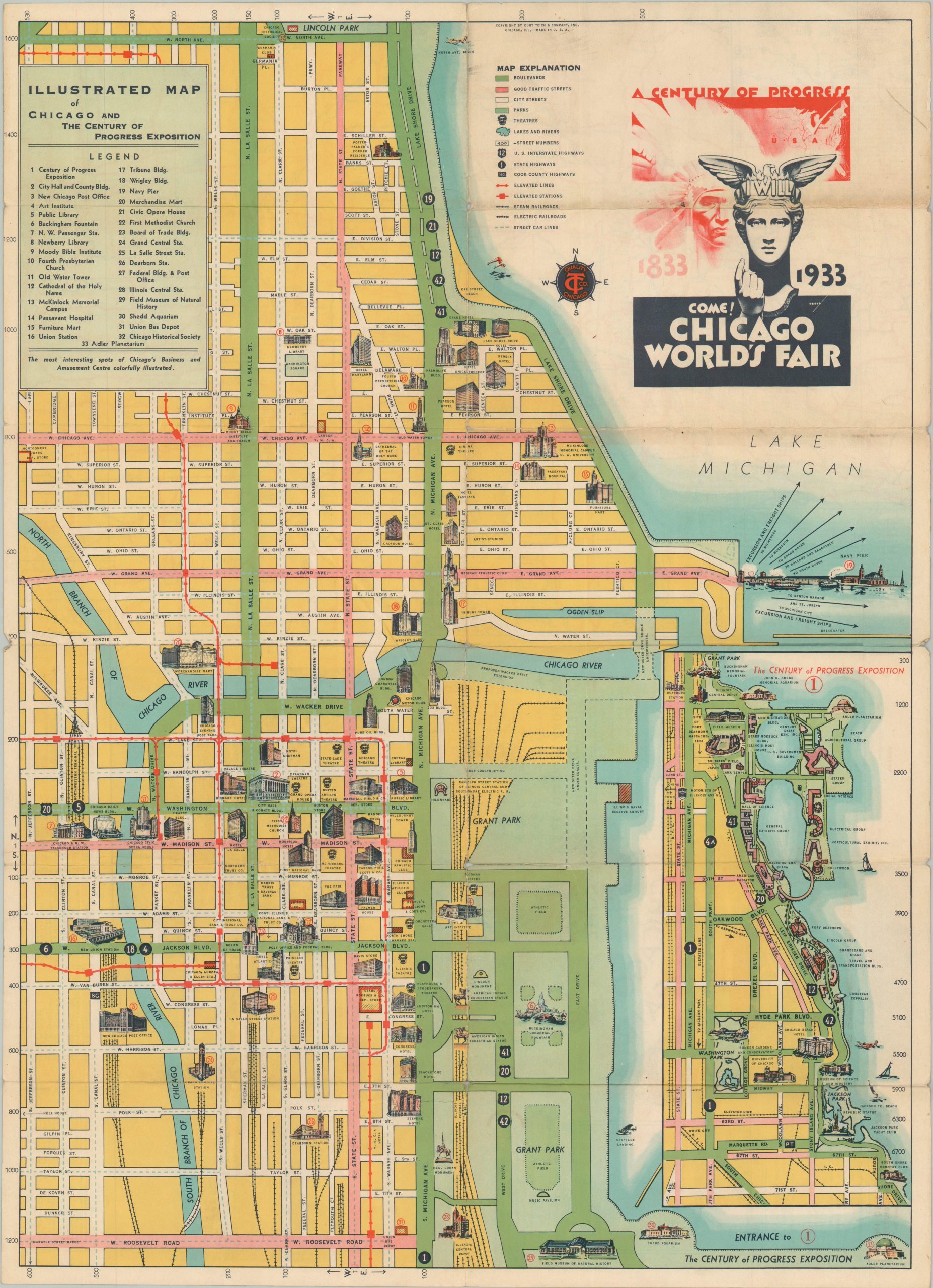
This colorful map of Chicago’s Loop and North Side districts was published locally in 1933 by Curt Teich & Company, Inc. The firm was renowned for its iconic postcards, and they sought to expand the brand as millions of visitors made their way to the city for the Century of Progress Exposition. A relatively straightforward street plan highlights the city’s easily navigable grid pattern, with boulevards and ‘good traffic streets’ highlighted in green and pink, respectively. The local transit system (streetcar, elevated, electric lines, etc.) is also noted.
Illustrated vignetttes represent local attractions, accommodations, and important buildings. An inset of the World’s Fair grounds, adjacent to Lake Michigan, can be seen in the lower right. The distinctive logo of the Century of Progress reflects the futuristic motto, “Science Finds, Industry Applies, Man Conforms.” A road map of the Upper Midwest and an attractive bird’s eye view of the fair by Joseph Kubricht can be found on the verso.
Map Details
Publication Date: 1933
Author: Curt Teich & Company, Inc.
Sheet Width (in): 17.00
Sheet Height (in): 23.25
Condition: B
Condition Description: Double-sided map brochure with heavy wear along folds, including sharp creasing, toning, holes at the fold joints, and several areas of splits (repaired on verso with archival tape). About good condition overall.
Out of stock