Illinois Waterways Cruise Map
$75.00
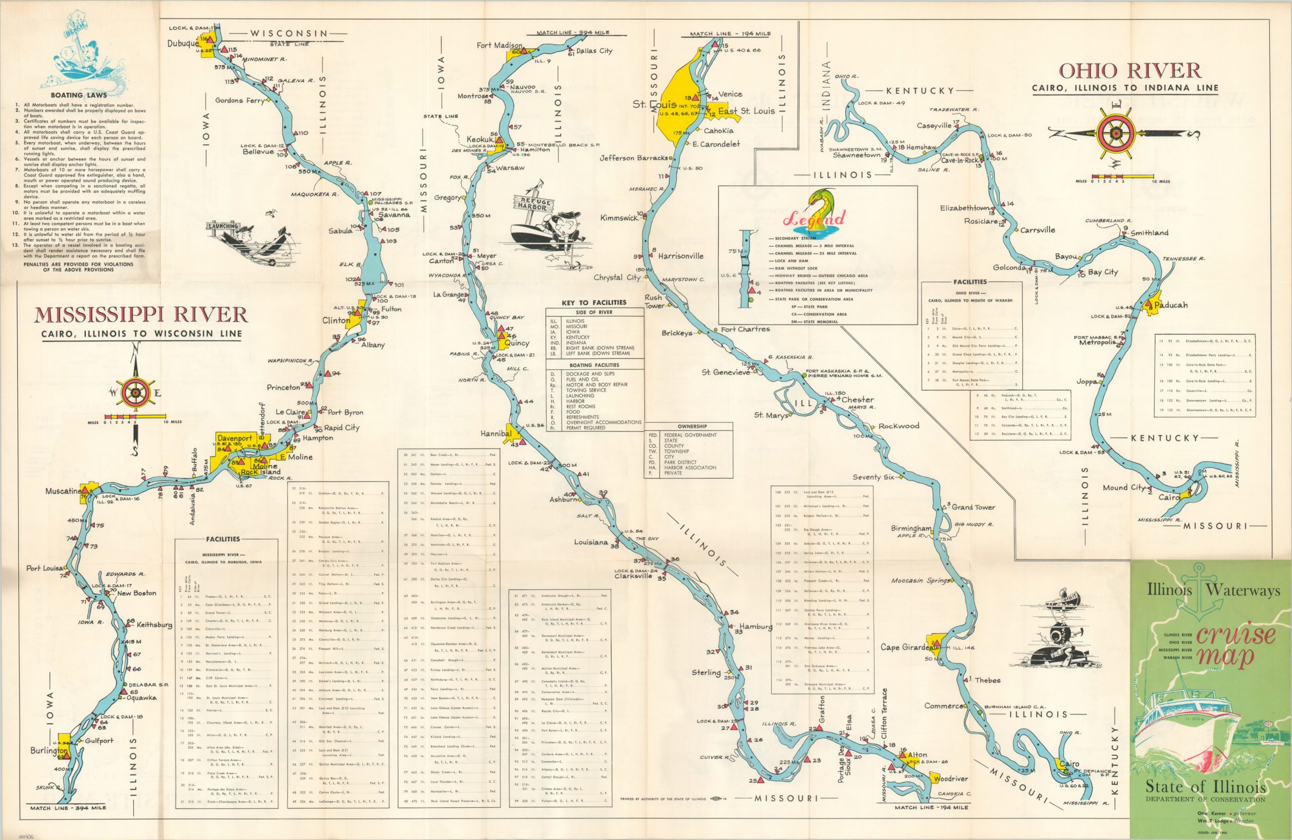
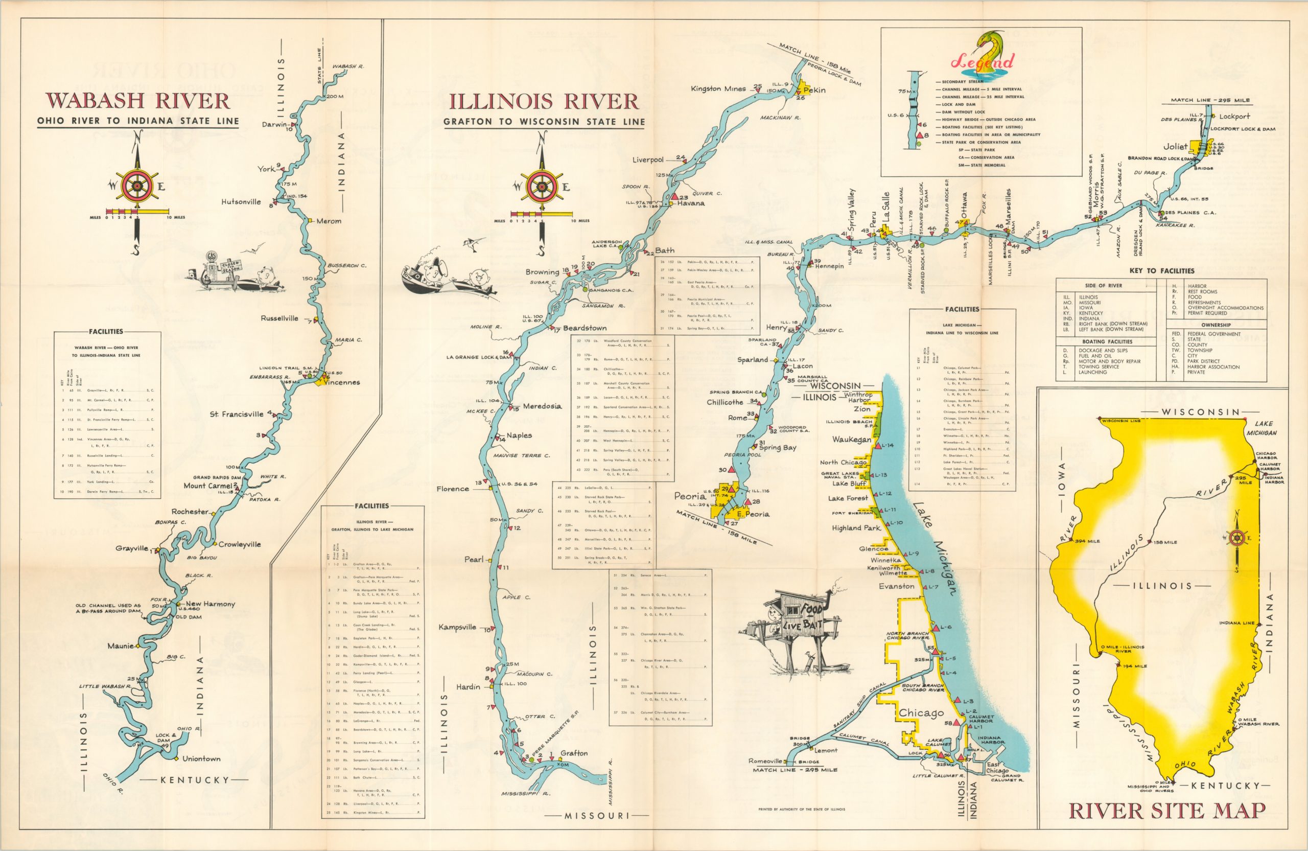
Useful double sided navigation guide to various rivers in Illinois.
Description
The available space on this sheet was cleverly utilized by the Illinois Department of Conservation when it published this map of the state’s major navigable rivers. The length of the Mississippi, Ohio, Wabash and Illinois Rivers are simply depicted to maximize legibility. Boating facilities, the side of the river on which they can be found, and under whose management is all provided according to a complex system of letters outlined in various legends on the sheet. Furthermore, locks, channels, bridges, parks and dams are also noted along each river’s path.
Charming illustrations reflecting on “boating life” can be found nestled between each map and a list of 13 boating laws is provided on the back panel.
Map Details
Publication Date: 1965
Author: Department of Conservation
Sheet Width (in): 33.90
Sheet Height (in): 21.90
Condition: A
Condition Description: Fold lines, as issued, and a slight smudge in the ink of the text on the back panel. Otherwise near perfect condition.
$75.00