
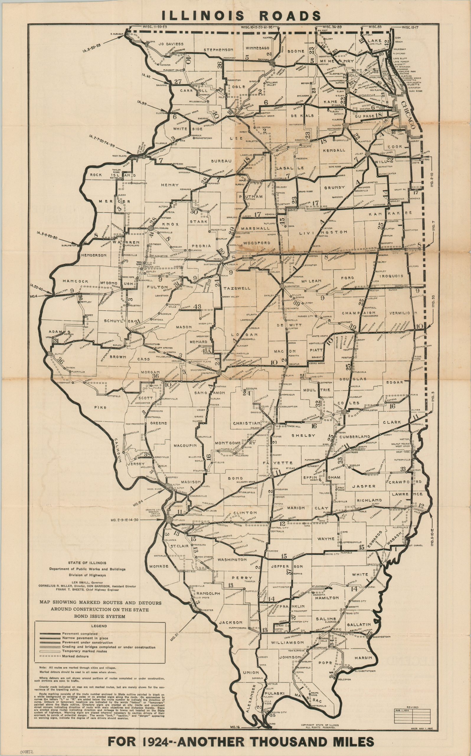
Illinois Roads For 1924 – Another Thousand Miles
$200.00
Encouraging the public to vote for the 1924 Illinois State Bond Issue.
1 in stock
Description
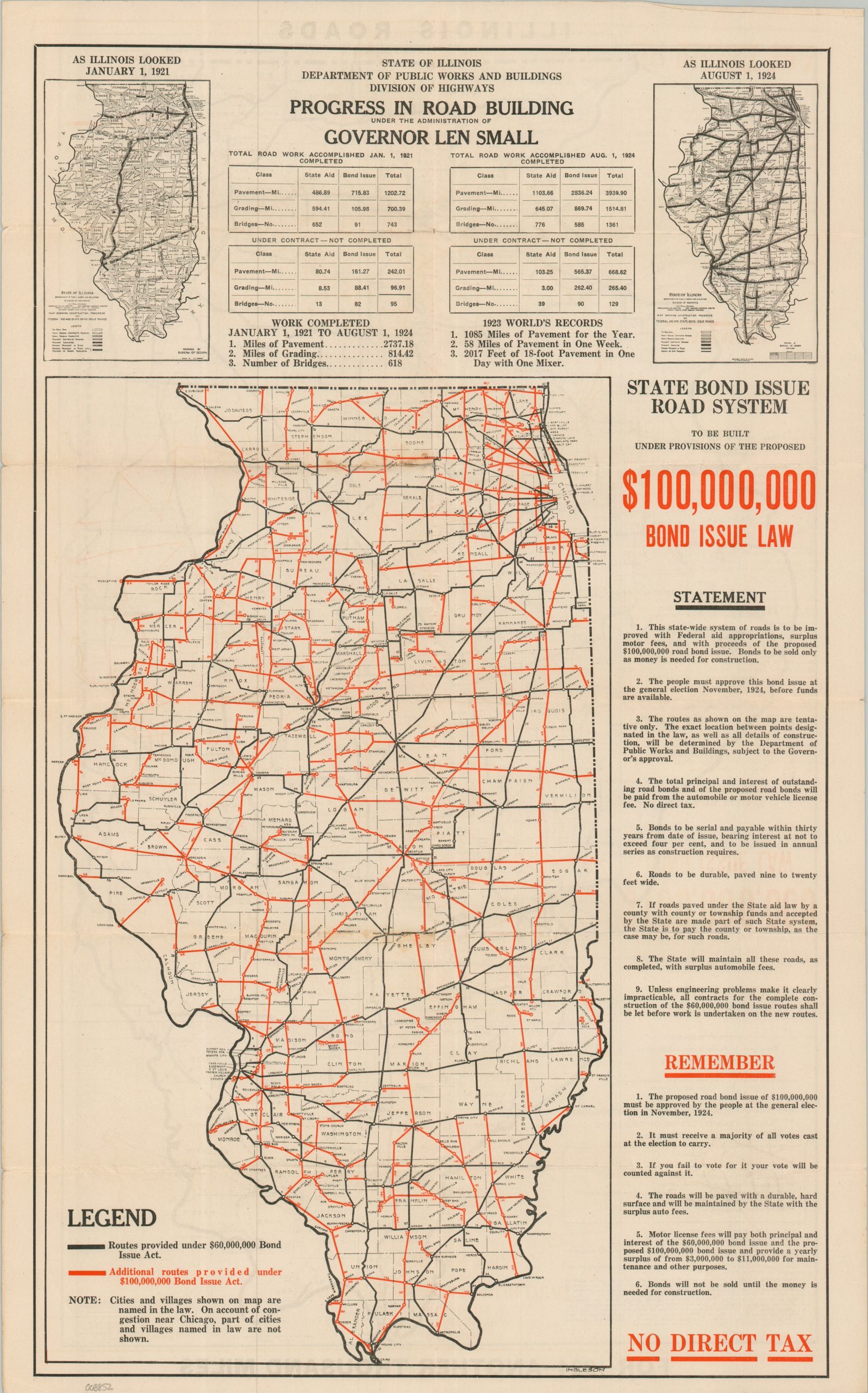
This uncommon persuasive map of Illinois was designed by civil engineer Robert Ingleson and published by the state’s Division of Highways in 1924. It was issued as part of the ongoing promotional campaign and debate surrounding the future funding of the Illinois road network. The $100 million bond issue, spearheaded by Governor Len Small, was organized to secure funding for an additional 5,100 miles of paved roads, largely completing the state “grid” and bringing automotive accessibility to every county across the Land of Lincoln. Buoyed by the campaign promise of “No Direct Tax” – with funds to be provided entirely by skyrocketing vehicle registration fees – the measure passed by a resounding majority that November.
One side of the sheet presents a skeletal map of Illinois using black and red lines to denote the routes sponsored by the 1918 and 1924 Bond Issue Acts, respectively. A key note indicates that “cities and villages shown on the map are named in the law” – a clever inclusion designed to drum up popular support by proving to rural and urban voters alike that their communities wouldn’t be bypassed. The exact terms of the bond are summarized on the right side of the sheet, while the top outlines the record-breaking construction progress achieved in the interim years between 1921 and 1924. The verso features a more detailed, traditional road map of Illinois outlining the real-time status of paving, grading, and detours.
Map Details
Publication Date: 1924
Author: Robert Ingleson
Sheet Width (in): 15.50
Sheet Height (in): 24.75
Condition: B
Condition Description: Double-sided map with moderate wear along old folds, including a small split in the upper center repairs with archival tape. Moderate to heavy toning visible in the upper right on one side (see scan). About good condition overall.
$200.00
1 in stock