Illinois One Hundred Years Ago
An uncommon look at a century of development across the state of Illinois.
Out of stock
Description
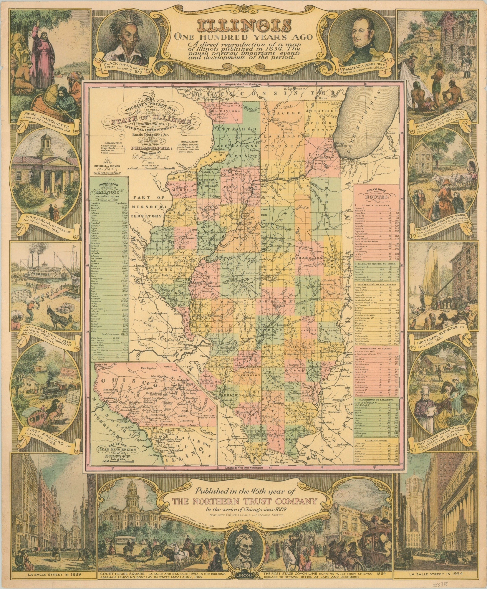
This retrospective look at Illinois between the years of 1834 and 1934 was published in Chicago by the T.N.T. Company. Text at the bottom indicates the image (illustrations by William Young) was created to commemorate the 45th anniversary of The Northern Trust Company, but it was also likely issued to coincide with the second year of the Century of Progress Exposition.
An 1834 map of Illinois by Samuel Augustus Mitchell is replicated in the center of the image, with pastel colors highlighting individual townships and the transportation system clearly defined through roads, railroads, canals, and distance tables. Surrounding the map are numerous vignettes highlighting events and notable ‘firsts’ across the history of Illinois and Chicago.
Map Details
Publication Date: 1934
Author: William Mark Young
Sheet Width (in): 17.75
Sheet Height (in): 21.6
Condition: A-
Condition Description: One 2" tear in the upper center has been repaired on the verso with archival tape and there's some light wear along the outer edges, consistent with age. Very good overall.
Out of stock