Illinois Official Road Map
$325.00
The roads of Illinois a century ago (at the time of writing).
1 in stock

Description
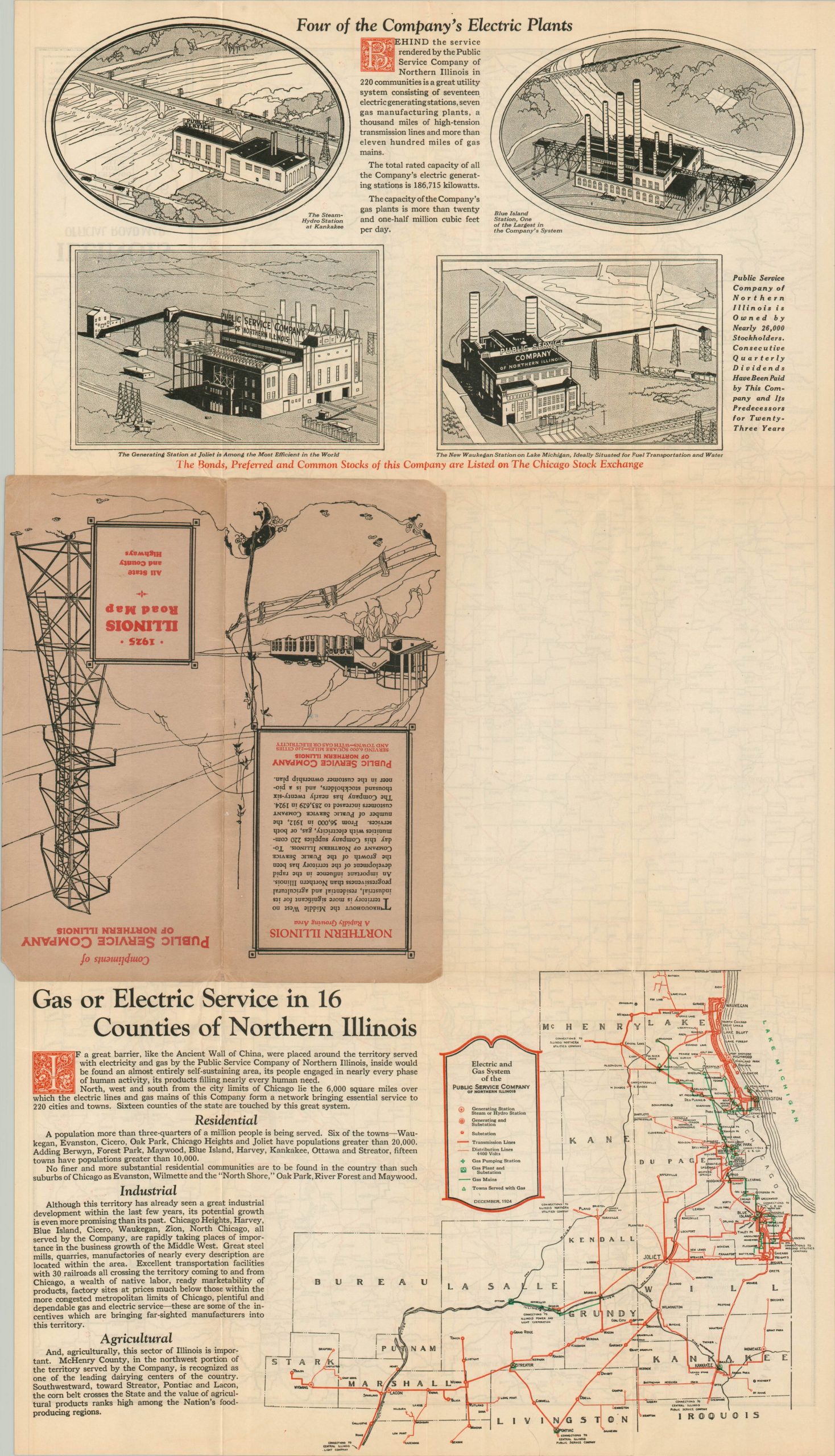
“Throughout the Middle West no territory is more significant for its industrial, residential and agricultural progressiveness than Northern Illinois.” – Text, back cover.
This eminently useful road map of Illinois and parts of surrounding states was compiled in early 1925 by the Chicago Motor Club. The surface composition of primary and secondary roads, ranging from dirt to permanent pavement, is noted according to the legend in the lower left. Locations of tourist camps and state parks are noted with triangles and squares, respectively. Posted route numbers reflect the series of State Bond Issues floated by the Illinois legislators to help pay for their construction. Many of these would be changed with the introduction of the U.S. Numbered Highway System in 1926, but a surprising number of modern county roads and highways retain their original SBI numbers. Interestingly, one route just south of Mineral, IL is marked with a question mark!
The verso of the map reveals an entirely new theme and the primary financial sponsor of the piece – the Public Service Company of Northern Illinois. The top of the sheet shows four illustrated views of the company’s electric plants in Kankakee, Joliet, Blue Island, and Waukegan (new). The lower third presents a map of the electric and gas distribution system across sixteen counties in Northern Illinois, with accompanying text praising the region’s features. “If a great barrier, like the Ancient Wall of China, were placed around the territory served with electricity and gas by the Public Service Company of Northern Illinois, inside would be found an almost entirely self-sustaining area, its people engaged in nearly every phase of human activity, its products filling nearly every human need.”
The map reflects a keen sense of marketing savvy. Samuel Insull’s Public Service Company of Northern Illinois was established in the early 20th century as part of his broader effort to consolidate and expand electric utilities across the Midwest. The company centralized electric service for northern Illinois communities outside Chicago, using Insull’s model of regulated monopolies and long-term financing to deliver reliable power at lower rates. It became a key component of Insull’s vast utility empire before collapsing during the Great Depression, contributing to one of the largest financial scandals of the era.
Map Details
Publication Date: 1925
Author: Chicago Motor Club
Sheet Width (in): 28.1
Sheet Height (in): 15.75
Condition: A
Condition Description: Double-sided folding map affixed to original stiff paper covers. Wraps a bit worn and there is some toning along the outer edges of the sheet, but overall in near fine condition.
$325.00
1 in stock