Illinois Official 1926 Auto Trails Map
$125.00
Legislating the spectacular rise of the automobile.
1 in stock

Description
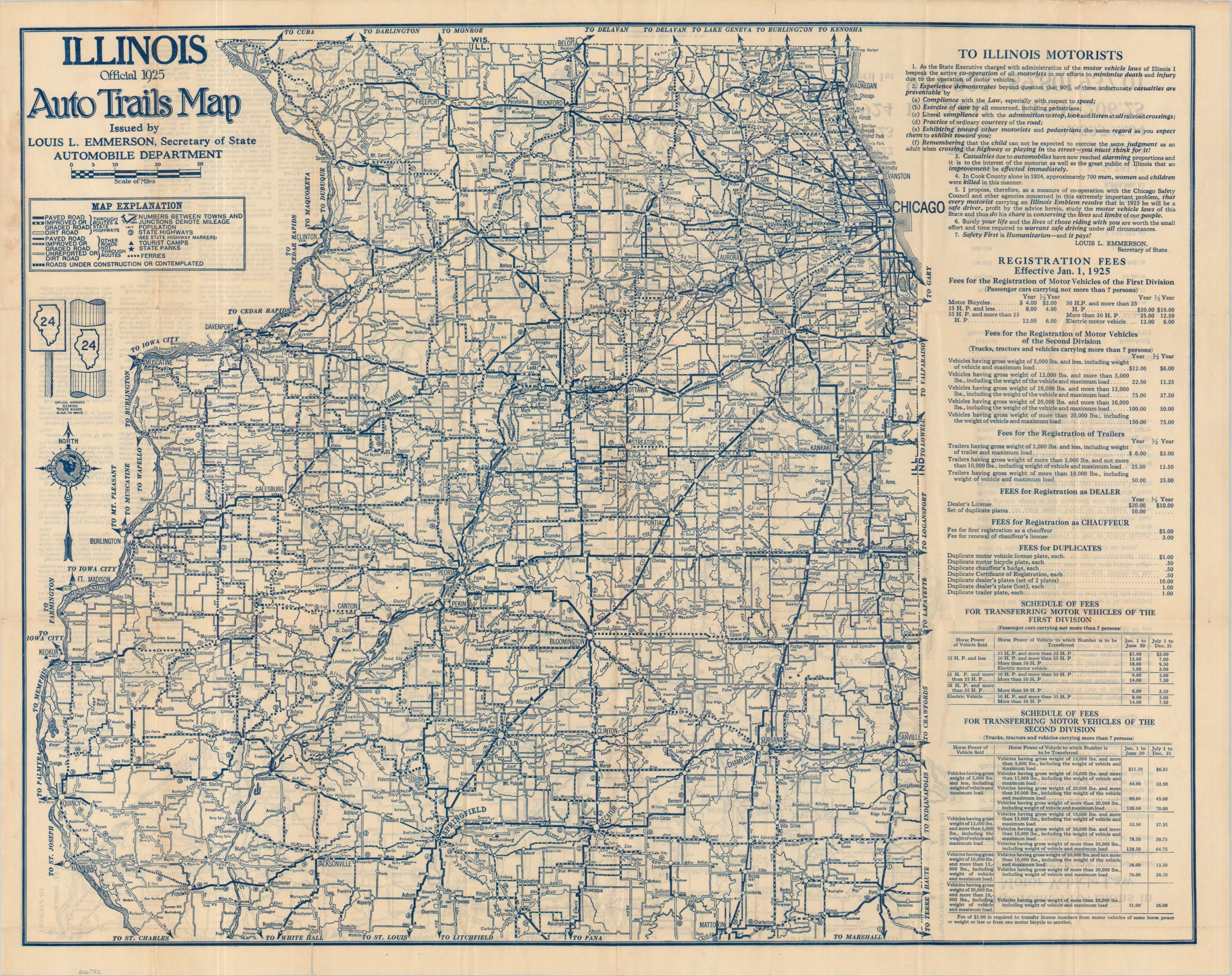
This detailed road map of Illinois was published in 1925 by Rand McNally and issued by Louis Emerson, the Secretary of State. As shown by a table in the lower left, the number of statewide automobile licenses had skyrocketed from 131,140 in 1914 to 1,132,641 in 1924 – resulting in heavy road usage, increased accidents, and a need for maintained roads. Legislation tried to keep up, and many of the ‘Rules of the Road’ are printed in the negative space.
The map itself divides Illinois into approximately northern and southern halves around Springfield. Various types of roads are shown according to their quality, ranging from Paved to Unreported or Dirt, and distances (in miles) between points are provided. Proposed routes, state parks, and tourist camps are also shown. With regards to the last, in the era before the ubiquitous hotel, roadside camps were organized to accommodate intrepid motorists. The map is an interesting reminder of how our current, seemingly static, system of roads gradually evolved from preceding decades.
Map Details
Publication Date: 1925
Author: Louis L. Emerson
Sheet Width (in): 27.75
Sheet Height (in): 22
Condition: B+
Condition Description: Double-sided folded map disbound from original stiff paper wraps (present). About 4 clean tears along the lower edge as a result of sharp creases and some scattered toning and oxidization, consistent with age and use. Good condition overall.
$125.00
1 in stock