Illinois Its Geography Its History
$95.00
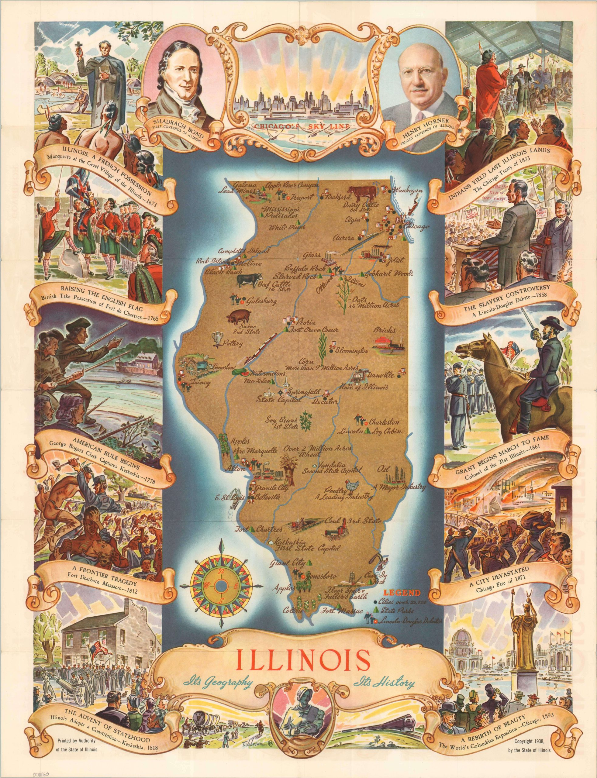
Beautiful pictorial map of The Prairie State.
1 in stock
Description
“From north to south, east to west, Illinois offers scenic beauty of great diversity…Throughout this vast bold work of Nature is the additional beauty wrought by Man; splendid highways, 14,000 acres of Illinois parks rich in history and recreational facilities; many works of art and magnificent structures.” [Text, verso].
This vibrantly illustrated map of Illinois was drawn by T. Johnson (artist’s signature in the lower center) and published by the state in 1938. Scattered vignettes emphasize industrial products and agricultural exports while state parks, large cities (over 20,000), and sites of the Lincoln-Douglas debates are identified according to the legend in the lower right. The map is bordered by ten scenes of important historic events across the state’s history, ranging from Marquette’s arrival in 1673 to the Columbian Exposition of 1893. Portraits of Shadrach Bond and Henry Horner, the first and present governors of Illinois, flank a simple view of the Chicago skyline at the top of the page. A neat commemoration of Illinois as the state struggled to shake off the woes of the Great Depression.
Map Details
Publication Date: 1938
Author: T. Johnson
Sheet Width (in): 16.90
Sheet Height (in): 21.90
Condition: A-
Condition Description: Creased along originally issued fold lines, with a 3" split in the upper center (repaired on the verso). Small holes at fold joints and a few tiny marginal tears. Good to very good overall.
$95.00
1 in stock