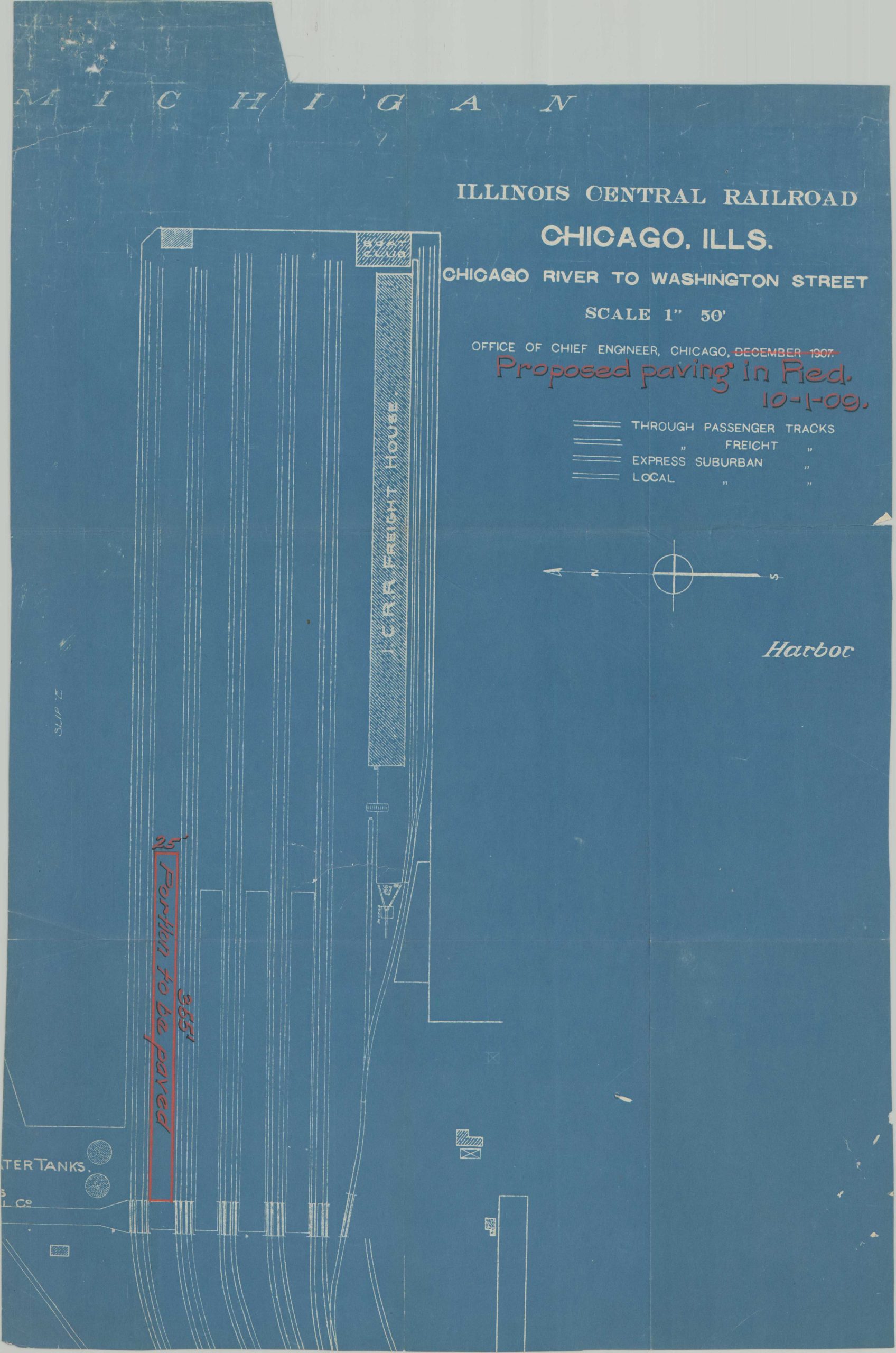
Illinois Central Railroad Chicago, Ills. Chicago River to Washington Street
$425.00
Improving the Illinois Central property along the Chicago River.
1 in stock
Description
This unusual large-scale blueprint shows a portion of the tracks and a freight house of the Illinois Central Railroad, situated near the mouth of the Chicago River. Credited to the I.C. Chief Engineer, the plan is originally dated 1907 but has been updated with red ink to October 1st, 1909. A 355′ x 25′ segment of the property, adjacent to Slip E, is marked for proposed pavement.
The image is oriented with east at the top and also notes the location of the Boat Club adjacent to the harbor. The depicted area is just a small portion of the larger Illinois Central property along the river – comprised of numerous freight terminals, a massive grain elevator, boat slips, and warehouses. Landfill and natural deposits from Lake Michigan have since dramatically changed the contours and location of the shoreline.
Source: Industrial Scenery;
Map Details
Publication Date: 1909
Author: Illinois Central Railroad Office of Chief Engineer
Sheet Width (in): 18
Sheet Height (in): 25.75
Condition: B+
Condition Description: A fragment of a larger blueprint, apparently specially issued for a paving project. Annotations in red and black ink. Soft creasing along old fold lines and wear and tear along the outer edges, consistent with age and use.
$425.00
1 in stock