
I.A. & C. Division Situation As At 9 Jan 1947
$325.00
Documenting the Allied occupation of Germany.
1 in stock
Description
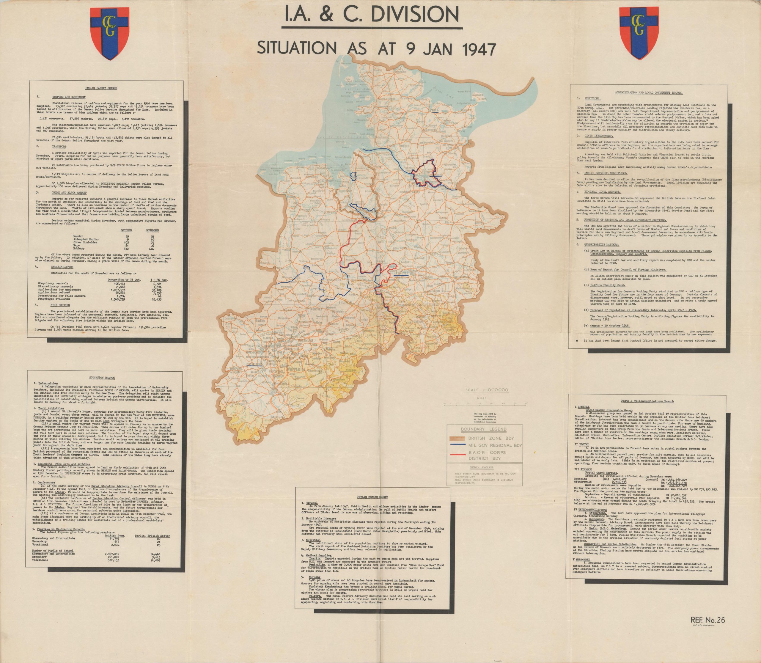
This uncommon cartographic broadside documents the British zone of occupation in Germany in the years following World War II. It was published, probably in London, in January 1947 by the Information and Civil Division, an administrative body overseeing civilian life in the occupation area. The central map offers a somewhat basic overview of the British Occupation Zone in the northwest part of Germany; consisting of Schleswig-Holstein, Hamburg, Lower Saxony, and the present-day state of North Rhine-Westphalia.
The borders of Military Government Regional Bodies and British Army of the Rhine Corps District Bodies are outlined in blue and red, respectively. American enclaves are circled around Bremen and Bremerhaven, to allow U.S. access to the North Sea. Surrounding the map are boxes of text that outline the objectives and responsibilities of each branch of the Information and Civil Division. Public Safety, Education, Public Health, Telecommunications, and Local Government operations are all described in detail.
Following Germany’s unconditional surrender in May 1945, the Allied powers (United States, Soviet Union, Great Britain, and France) divided the country into four zones of occupation. Initially intended as a temporary measure to demilitarize and denazify Germany, the occupation evolved into a proxy battle between the ideologies of Capitalism and Communism. The Western zones, influenced by democratic ideals and economic recovery plans like the Marshall Plan, formed the basis of West Germany. Conversely, the Soviet zone became the communist East Germany, marked by authoritarian rule and economic dependence on the USSR. This division of Germany, a stark and lasting symbol of the Cold War, persisted until reunification in 1990.
The map is rare and unlisted in WorldCat as of August 2024. One other market example has been identified, noting the map as one of a series published annually.
Example at Barry Ruderman Rare Maps.
Map Details
Publication Date: 1947
Author: Information and Civil Division
Sheet Width (in): 40
Sheet Height (in): 34.75
Condition: A-
Condition Description: Hard creasing along old folds and small holes at fold intersections. A handful of scattered spots within the image. Very good condition overall. Blank on verso.
$325.00
1 in stock