
Hyetographic or Rain Map of the World
$150.00
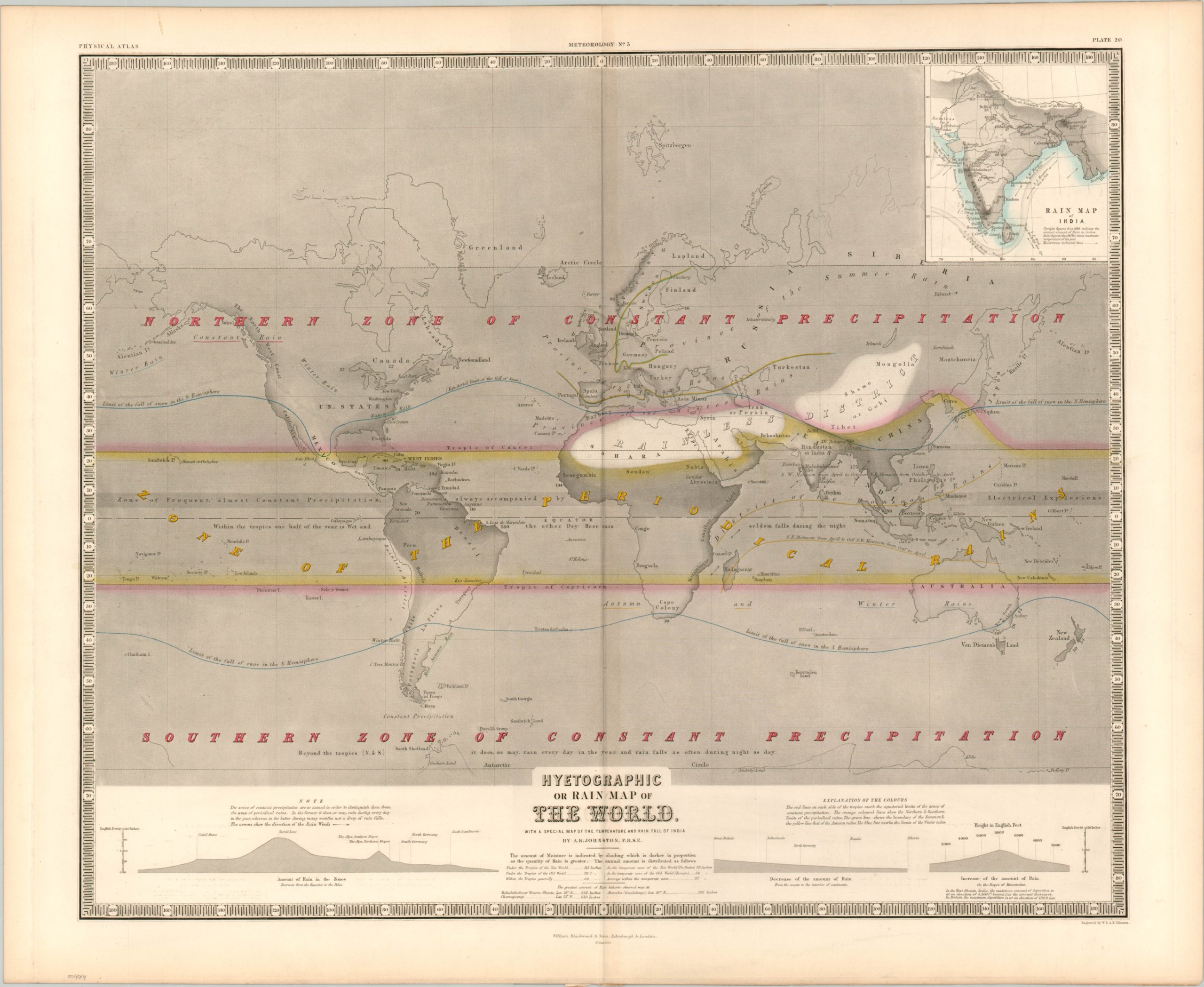
Global rainfall in the mid-19th century.
1 in stock
Description
This skillfully engraved map of the world was originally published by William Blackwood & Sons in 1854 as part of Alexander Keith Johnston’s Physical Atlas. The image shows the distribution of global rainfall, with broad bands of constant precipitation north and south of the tropics, while the central ‘Zone of the Periodical Rains’ is bracketed within yellow. Running through the center is a “Zone of Frequent, almost Constant Precipitation, always accompanied by Electrical Explosions.”
Additional lines of blue denote the limitation of snowfall in the Northern and Southern Hemispheres. A large ‘Rainless District’ can be seen across the Sahara and Gobi Deserts. Annual precipitation, in inches, is provided in numerous places throughout, with Cherrapoongi, India topping the scales at nearly 51 ft. (610 in.) of rain!
An inset in the upper right shows further hyetographic details of the Indian Subcontinent and reflects English interests in the region. Four years after publication, the British Crown would take direct control from the British East India Company.
Map Details
Publication Date: 1854
Author: A.K. Johnston
Sheet Width (in): 26.5
Sheet Height (in): 21.5
Condition: A-
Condition Description: Faint toning around the outer margins, away from the image, and some faint discoloration from the plate strike visible in the lower diagram. Very good overall. A clean strike issued on thick paper.
$150.00
1 in stock