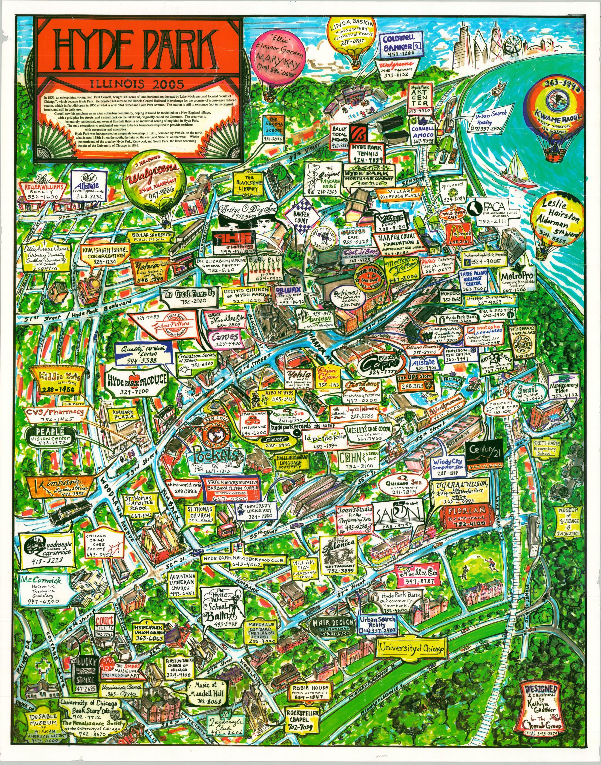
Hyde Park Illinois 2005
A rare look at Chicago’s Hyde Park neighborhood about 150 years after it was first settled.
Out of stock
Description
This colorful view of Hyde Park, Illinois presents the South Side Chicago community almost as a distinct entity, away from the city looming in the background. The insulated neighborhood is separated by green trees and the blue waters of Lake Michigan, with 47th Street and the iconic Midway Plaisance delineating the north and south borders.
Dozens of buildings – businesses, churches, schools, etc. – are sketchily illustrated and often accompanied by large advertisements. Apart from its minimal function as a geographic reference, the map operates as a commercial directory for the region in the mid-2000s, prior to the devastating crash that completely changed the economic landscape. The Museum of Science and Industry, University of Chicago, and DuSable Museum of African American History are also prominently featured.
The map was designed and illustrated by Kathryn Gauthier for The Cherub Group in 2005. Rare, with no entries in OCLC or online market records.
Map Details
Publication Date: 2005
Author: Kathryn Gauthier
Sheet Width (in): 22
Sheet Height (in): 28
Condition: A-
Condition Description: Light wear and faint wrinkling throughout from where previously rolled. Very good overall.
Out of stock