
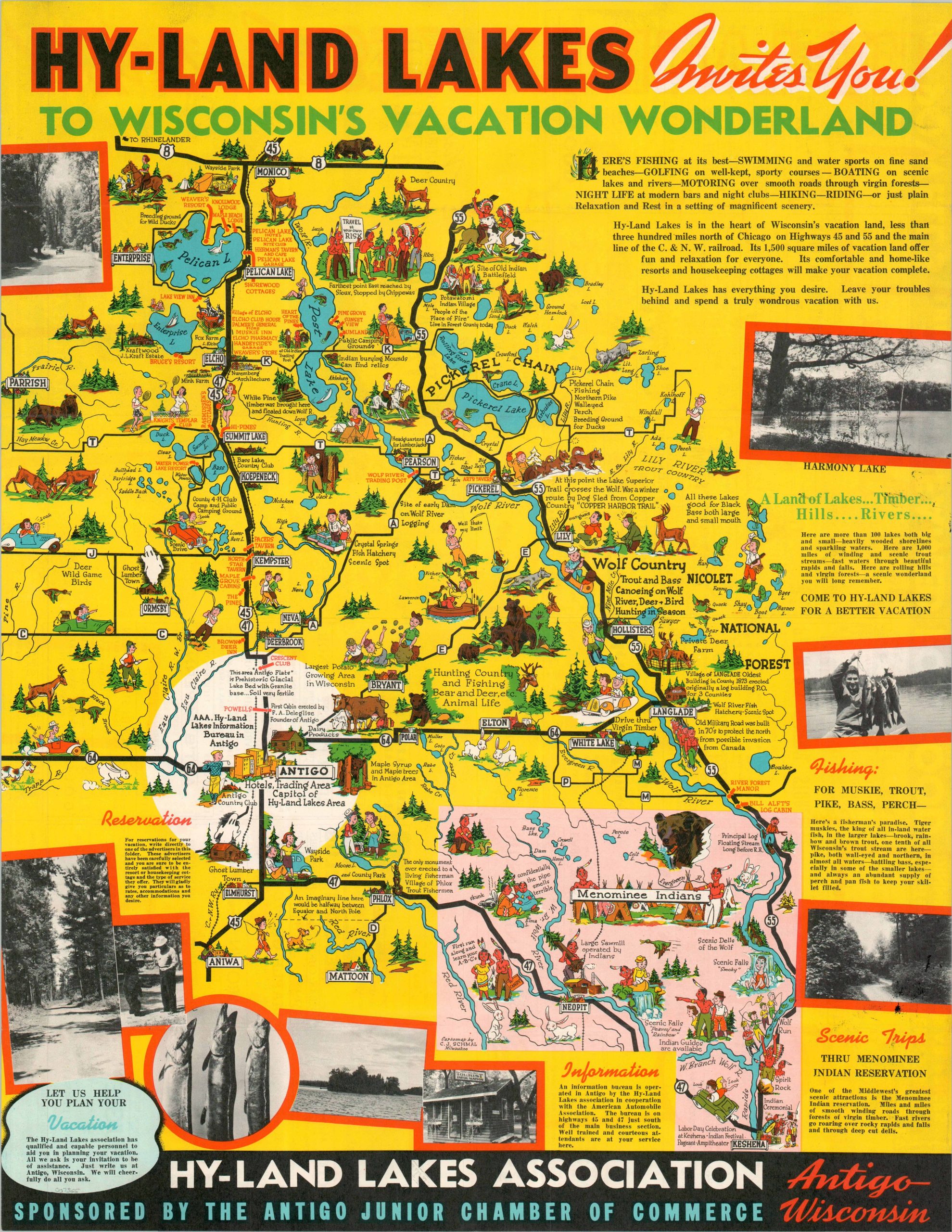
Hy-Land Lakes Invites You! To Wisconsin’s Vacation Wonderland
$295.00
“Hy-Land Lakes has everything you desire. Leave your troubles behind and spend a truly wondrous vacation with us.”
1 in stock
Description
This rare pictorial ‘colormap’ was illustrated by C.J. Schmal and issued in the mid-1930s to promote Wisconsin’s Hy-Land Vacation Region. It appears that the Hy-Land Lakes Area was arbitrarily constructed for tourism purposes by the association of the same in the nearby town of Antigo, population of about 9,000, and the self-proclaimed Capital. Fishing, camping, hunting, and the Menominee Indian Reservation are among the various promoted local attractions. Dozens of colorful vignettes reflect recreational opportunities, locations of interest, prominent industries, and geographic features. Numerous advertisements are present on the verso, along with a small map showing transportation routes to Chicago.
The map was published in 1935 by the Hy-Land Lakes Association, with financial sponsorship by the Antigo Junior Chamber of Commerce. Lithographed in Milwaukee by W.A. Krueger Co. The piece is rare in both institutional collections and on the market. As of August 2025, only one entry is listed in WorldCat, at the Wisconsin Historical Society. OCLC# 1368406959
Map Details
Publication Date: 1935
Author: C.J. Schmal
Sheet Width (in): 17
Sheet Height (in): 21.75
Condition: A
Condition Description: Color centerfold map in a double-sided brochure. Light wear and creasing along folds and a bit of surface inking in the lower right corner (see scan), but overall in very good condition.
$295.00
1 in stock