Historical Trails Through New Mexico
$95.00
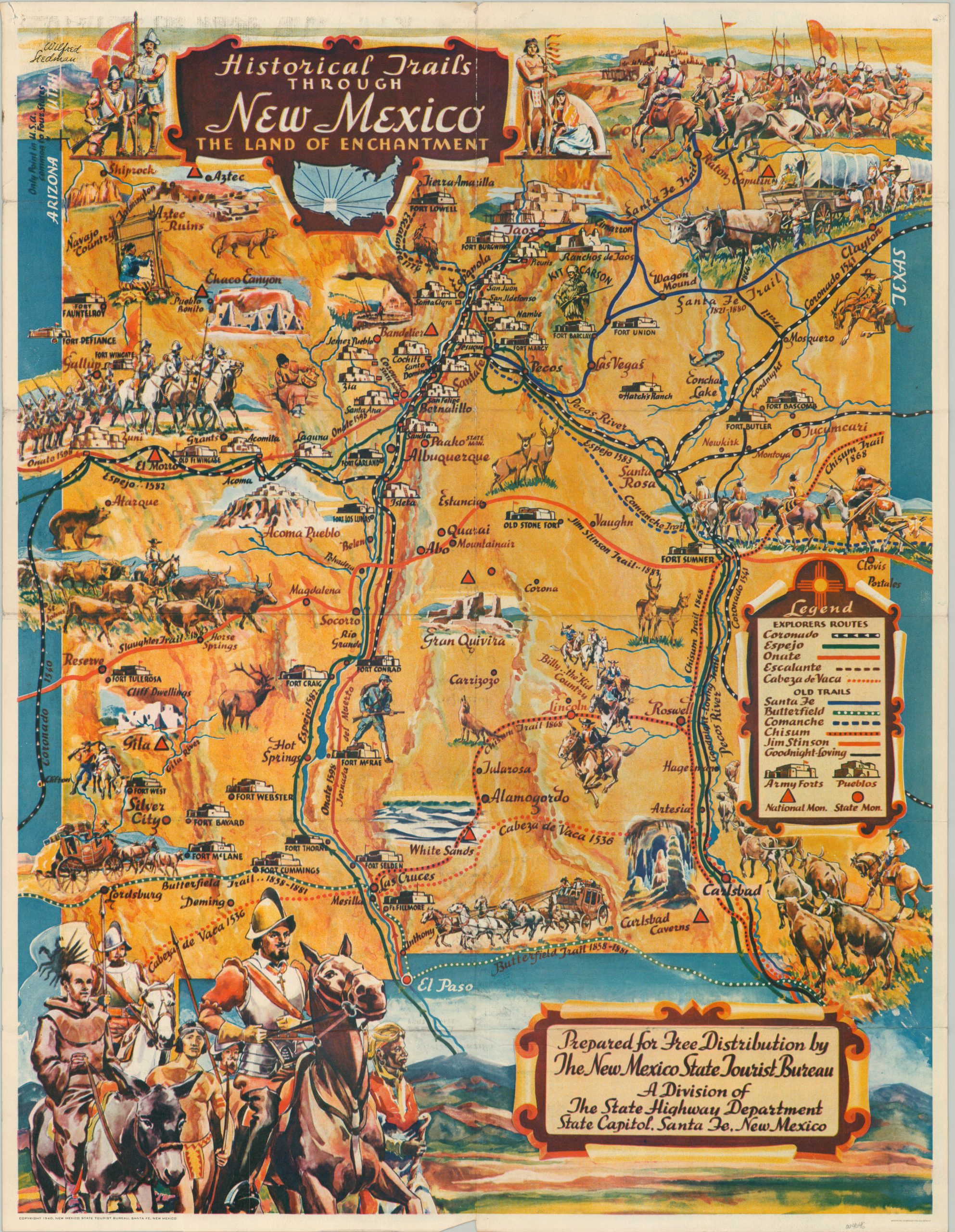
Enchanting promotional map of New Mexico published by the State Tourist Bureau.
1 in stock
Description
The Wild West seems ready to jump off the page when looking at this beautiful map of New Mexico. Cowboys driving cattle herds, stagecoaches, wagon trains and galloping Spanish conquistadors give the image a vibrant sense of action and adventure, while illustrations of Carlsbad Caverns, Chaco Canyon and the White Sands refer to the regions natural and historic beauty.
The routes of five early Spanish explorers are listed, along with six trails used by pioneers, cowboys and mountain men. The group in the lower right likely represents the remnants of the infamous Narváez expedition, which saw only 4 survivors from over 600 that originally left Mexico.
The author of the map, Wilfred Stedman, was a painter and sculptor who had a deep appreciation for the native peoples of the American southwest, and that respect is evident in his depiction of the American Indian and by using symbols of equal size to mark the locations of forts and pueblos.
Published in Sante Fe in 1940 by the New Mexico State Tourist Bureau. Printed in Denver by the Bradford-Robinson Printing Company.
Map Details
Publication Date: 1940
Author: Wilfred Stedman
Sheet Width (in): 17
Sheet Height (in): 21.9
Condition: A-
Condition Description: Creasing and minor wear along originally issued fold lines. Moderate wear visible in the margins, including pinholes in the upper corners and a small chip in the lower center. Very good overall.
$95.00
1 in stock

