Historical Map of the United States
Cartographic depiction of American history.
Out of stock


Description
This set of vintage wall maps was published in Sycamore, Illinois by the School & Library Publishing Company around 1972. The first sheet presents a historical map of the United States. A large pictorial map highlights many of the country’s most important historical events, agricultural products, and cultural icons. It includes two insets that show the original thirteen colonies and the territorial growth of the U.S. Immediately above is a chronology of selected historical events from between the discovery of the New World (1492) and the Apollo 14 Moon Walk (1971).
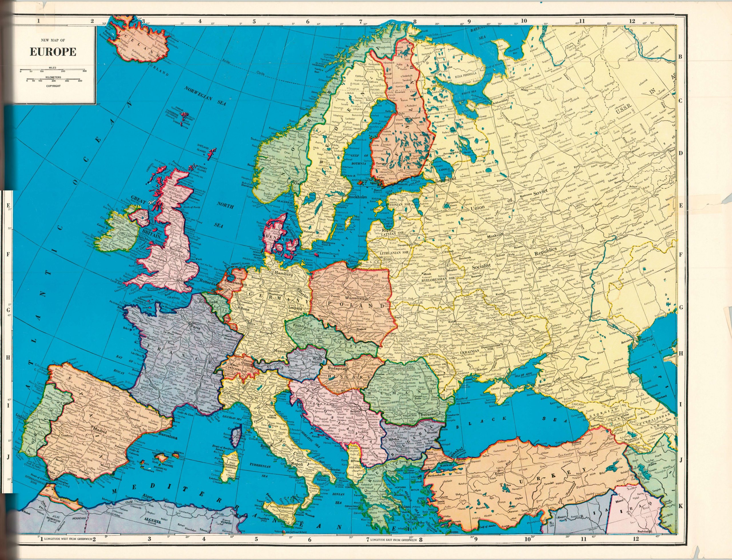
The verso is a large color lithograph map of Europe. The second sheet features maps of Palestine, Israel and Jordan, as well as a map of China and Formosa (verso).
Map Details
Publication Date: c. 1972
Author: R.L. McCollister
Sheet Width (in): 21.80
Sheet Height (in): 31.80
Condition: B
Condition Description: Two double sided sheets affixed to an upper iron bar. Two large tears at the top of the sheet that has resulted in some paper loss and tearing in the text. A few other large tears (see bottom center, lower right) have been repaired with archival tape. Nickel sized damp spot in the center of the cartouche and slight staining/a small chip in the lower margin.
Out of stock