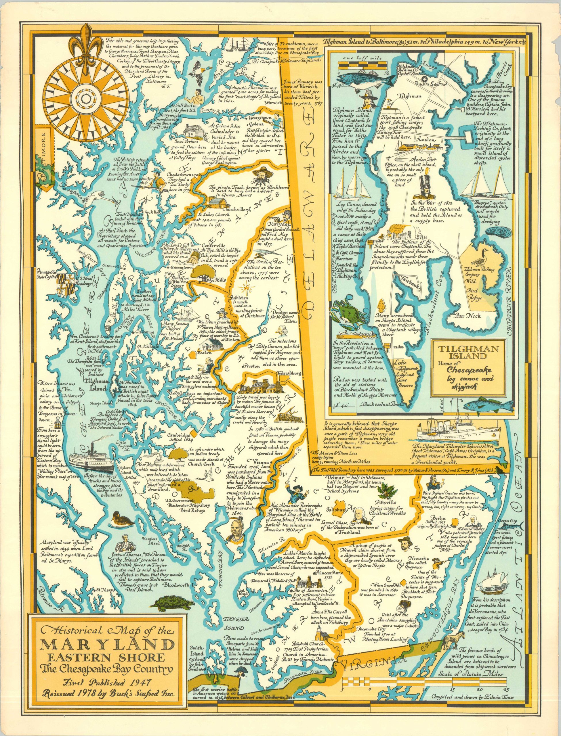
Historical Map of the Maryland Eastern Shore the Chesapeake Bay Country
$165.00
Third edition pictorial map of ‘The Chesapeake Bay Country.’
1 in stock
Description
This brightly colored pictorial map of Maryland’s Eastern Shore was illustrated by the talented Edwin Tunis and first published in 1947. This is the third edition, published in 1978 by Buck’s Seafood, Inc., located on Tilghman Island. An inset of the small isle can be seen in the upper right, with obvious updates to the title cartouche reflecting the priorities of Bucks (located at the northern tip).
Elsewhere throughout the image, little has changed from the original. The region’s rich history is widely celebrated. Attractive vignettes are accompanied by descriptive text – outlining a variety of historic sites, events, notable industries, important people, and other interesting tidbits. Extensive research was evidently required by the author, who credited the generous help of several individuals near the top of the sheet.
Map Details
Publication Date: 1978
Author: Edwin Tunis
Sheet Width (in): 16.75
Sheet Height (in): 22.25
Condition: A-
Condition Description: Color printed map on a single-sided sheet. Minor marginal loss in the upper right and light wear along the edges of the sheet. Very good condition overall.
$165.00
1 in stock