
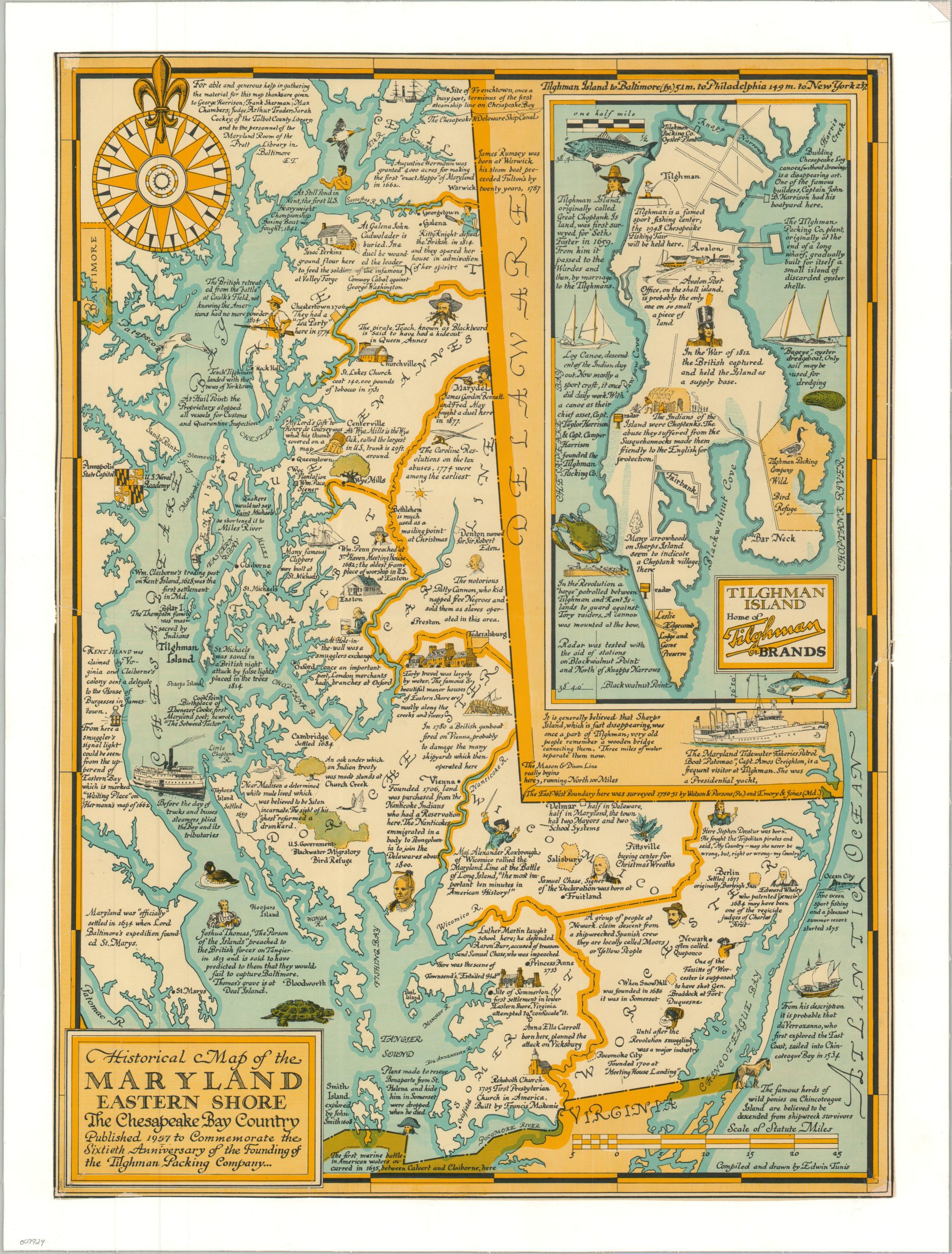
Historical Map of the Maryland Eastern Shore the Chesapeake Bay Country
$200.00
Second edition pictorial map of ‘The Chesapeake Bay Country.’
1 in stock
Description
This brightly colored pictorial map of Maryland’s Eastern Shore was illustrated by the talented Edwin Tunis and first published in 1947. This is the second edition, published in 1957 to celebrate the 60th anniversary of the Tilghman Packing Company, a large seafood processing operation located on Tilghman Island. (A third version was issued by Buck’s Seafood in 1978). An inset of the small isle can be seen in the upper right, which includes the brand’s logo.
Elsewhere throughout the charming image, little has changed from the original. The region’s rich history is widely celebrated. Attractive vignettes are accompanied by descriptive text – outlining a variety of historic sites, events, notable industries, important people, and other interesting tidbits. Extensive research was evidently required by the author, who credited the generous help of several individuals near the top of the sheet.
Map Details
Publication Date: 1957
Author: Edwin Tunis
Sheet Width (in): 16.75
Sheet Height (in): 22.25
Condition: B+
Condition Description: Color printed map on a single-sided sheet, professionally mounted onto linen for preservation and stability. Some marginal wear, including a few small chips, has been expertly repaired and infilled. Good condition overall.
$200.00
1 in stock