Historical Illinois
Pictorial history of the Land of Lincoln.
Out of stock
Description
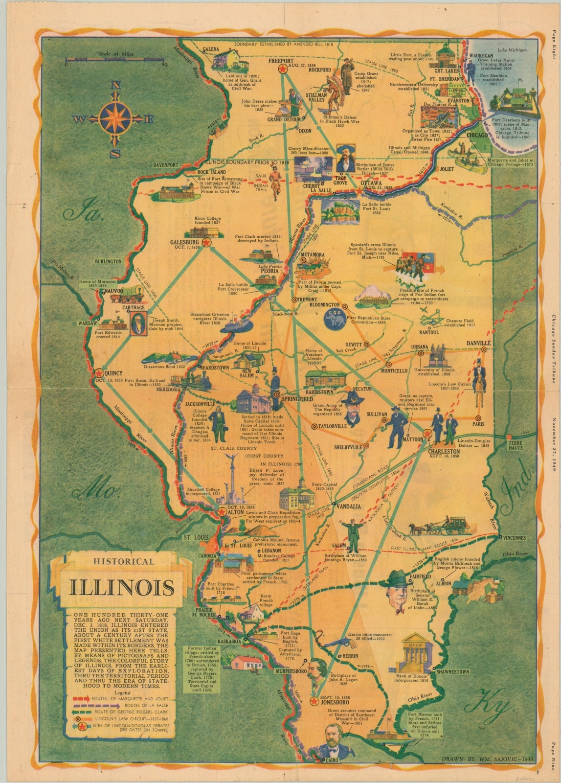
“The map presented here tells, by means of pictografs and legends, the colorful story of Illinois, from the earliest days of exploration, thru the territorial period and thru the era of statehood to modern times.” These words, found below the title in the lower left, briefly summarize this vibrant map from the November 27, 1949 issue of the Chicago Sunday Tribune.
The story is almost entirely a White one, with little mention of the original indigenous inhabitants or other minorities (notably Chicago’s first non-native inhabitant, Jean Baptiste Point DuSable). The routes of Marquette and Joliet, La Salle, George Rogers Clark, and Abraham Lincoln are shown in addition to numerous illustrated vignettes and the sites of the Lincoln-Douglas debates.
Map Details
Publication Date: 1949
Author: William Sajovic
Sheet Width (in): 14.9
Sheet Height (in): 20.8
Condition: A
Condition Description: Horizontal and vertical creases and two holes in the bottom margin. One .5" tear, center left, has been repaired on the verse. Very good overall.
Out of stock