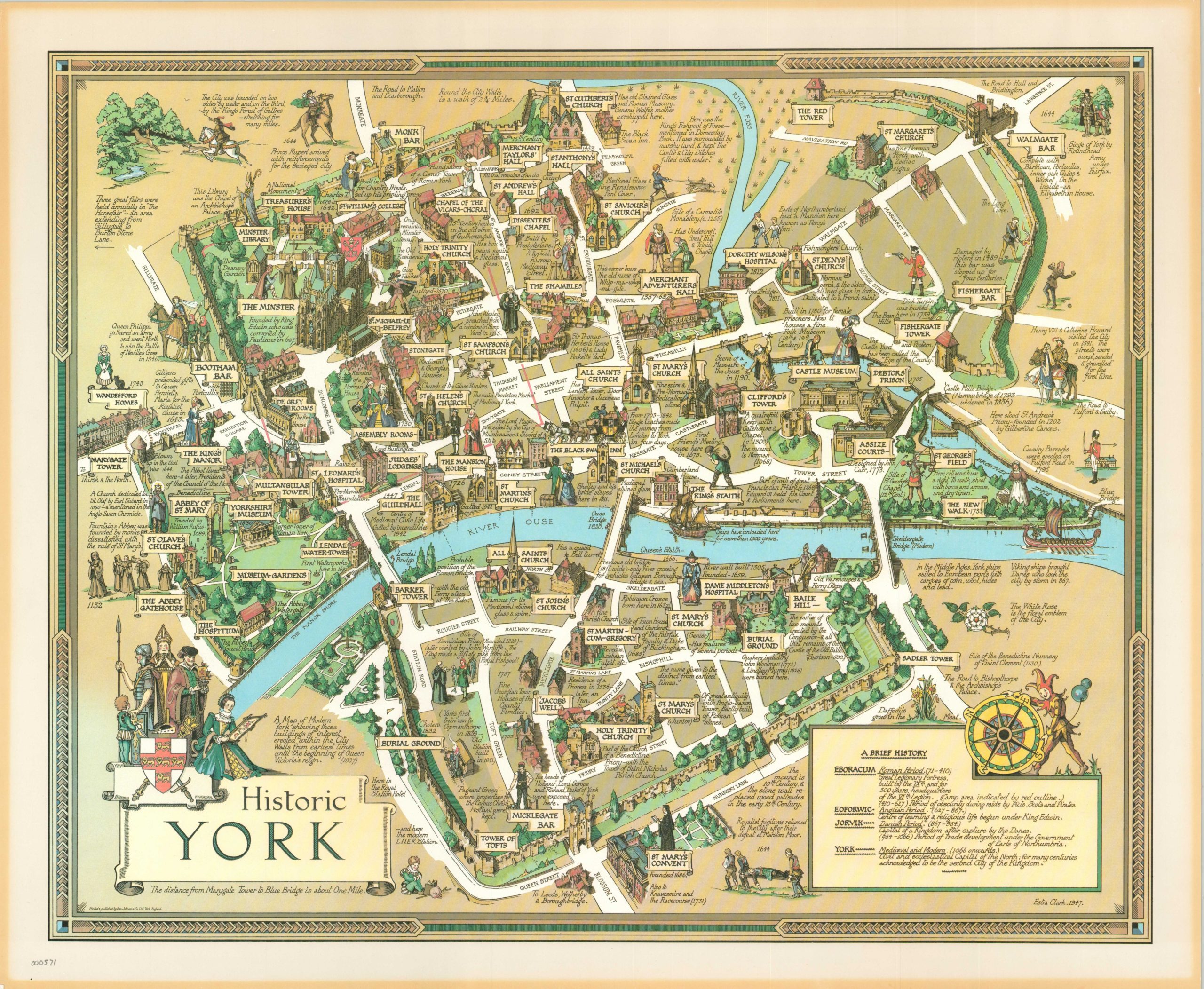
Historic York
Appealing bird’s eye view of the historic fortified city of York.
Out of stock
Description
Estra Clark was a remarkable young woman who was born in York in 1904. She grew up in a devout Methodist household, and began offering her artistic services to the local congregation and Weslyan Church at the age of twelve. She went on to attend (and teach) at the York School of Arts & Crafts, and ultimately illustrated or created from scratch numerous printed pamphlets and posters. Her interest in local history stemmed from her association with the York Archaeological Society and she would channel this passion into this pictorial map of her hometown.
According to text underneath the title, the entire area pictured is only about 2 square miles. The city is ringed by its famous medieval walls, with other prominent historical buildings drawn in profile. Blocks of text provide context for many objects on the map not individually labeled, including identifying those buildings that were destroyed by German aerial bombardment during WWII.
Map Details
Publication Date: 1947
Author: Estra Clark
Sheet Width (in): 27.25
Sheet Height (in): 20.25
Condition: A-
Condition Description: The map is in excellent condition, with a few minor spots of crinkling in the paper and discoloration along the extreme edges from previous framing.
Out of stock