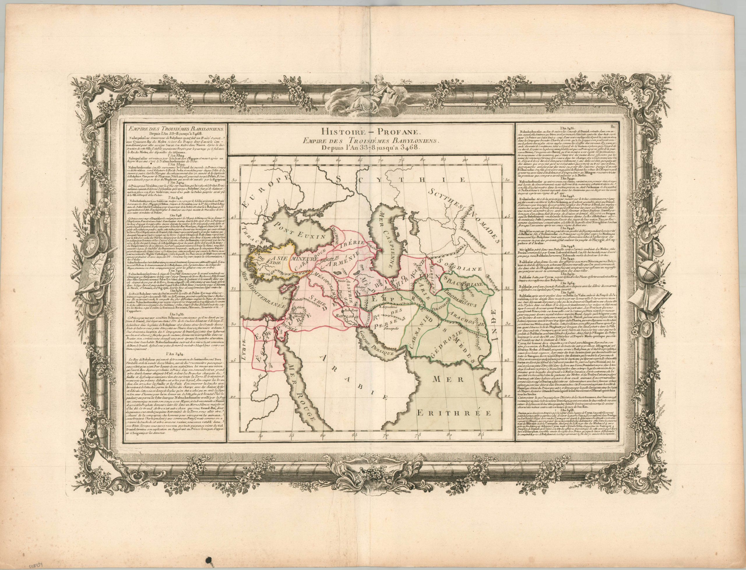
Histoire Profane Empire des Troisiemes Babyloniens
$125.00
Mapping approximately 100 years of Babylonian History in the 4th Millenia, BC.
1 in stock
Description
This striking sheet was published in Paris around 1762 as part of Claude Buy de Mornas’ Atlas Méthodique et Elémentaire de Géographie et d’Histoire. Buy de Mornas was a French geographer who served as the tutor to the Duke of Berry (the future King Louis XVI), and the work was an important learning mechanism by which geography and history were taught to the aristocracy. A rather straightforward map presents the breadth of the ancient Babylonian Empire, stretching from Egypt to the Desert of Karakum in Central Asia.
The image includes a handful of toponyms that identify important settlements (notably, Babylon, Jerusalem, and Persepolis) and geographic features. Blocks of text on either side offer a chronological summary of major events between 3468 BC (lower right) and 3394 BC (upper left). The entire work is enclosed by an elaborately decorated Rococo border, characteristic of the refined French aesthetic of the mid-18th century.
Map Details
Publication Date: c. 1762
Author: Claude Buy de Mornas
Sheet Width (in): 25.8
Sheet Height (in): 19.6
Condition: A-
Condition Description: Copperplate engraved image on a strong sheet of laid paper. A strong impression with nice full hand color. Minor foxing in the margins and some wrinkling along and adjacent to the vertical centerfold. Faint offsetting from the black printed ink. Very good condition overall. Blank on verso.
$125.00
1 in stock