Hinsdale, Ill.
$75.00
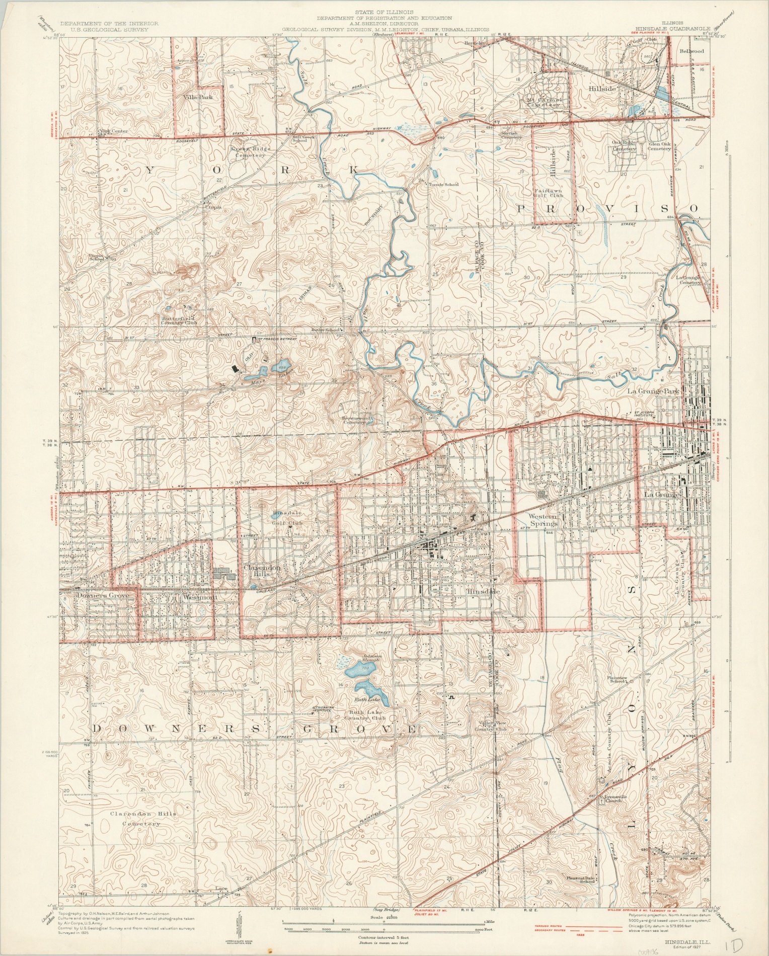
U.S.G.S. topographic map of Hinsdale, Illinois.
1 in stock
Description
This detailed map of Hinsdale, Illinois, and the surrounding area provides a fascinating snapshot of the suburb about 20 miles west of Chicago during the heyday of the Roaring ’20s. Buildings are individually outlined, roads are shown according to their surface composition (further info lower right), and geographic information is transmitted via pictorial elements and contoured topography.
Locations of interest within the image include the St. Francis Retreat, several golf clubs and country clubs, the lines of the Old Indian Boundary, and the Lithuanian Institute.
The map was published in 1927 by the United States Geological Survey under the authority of topographic engineers O.H. Nelson, W.E. Baird, and Arthur Johnson.
Map Details
Publication Date: 1927
Author: United States Geological Survey
Sheet Width (in): 19.9
Sheet Height (in): 24.75
Condition: A
Condition Description: Creased upper left corner and a small spot in the lower center margin. Very good to near fine overall.
$75.00
1 in stock