Highway Map of Northern California
$150.00
Hit the roads of Northern California with Shell motor oil and gasoline.
1 in stock


Description
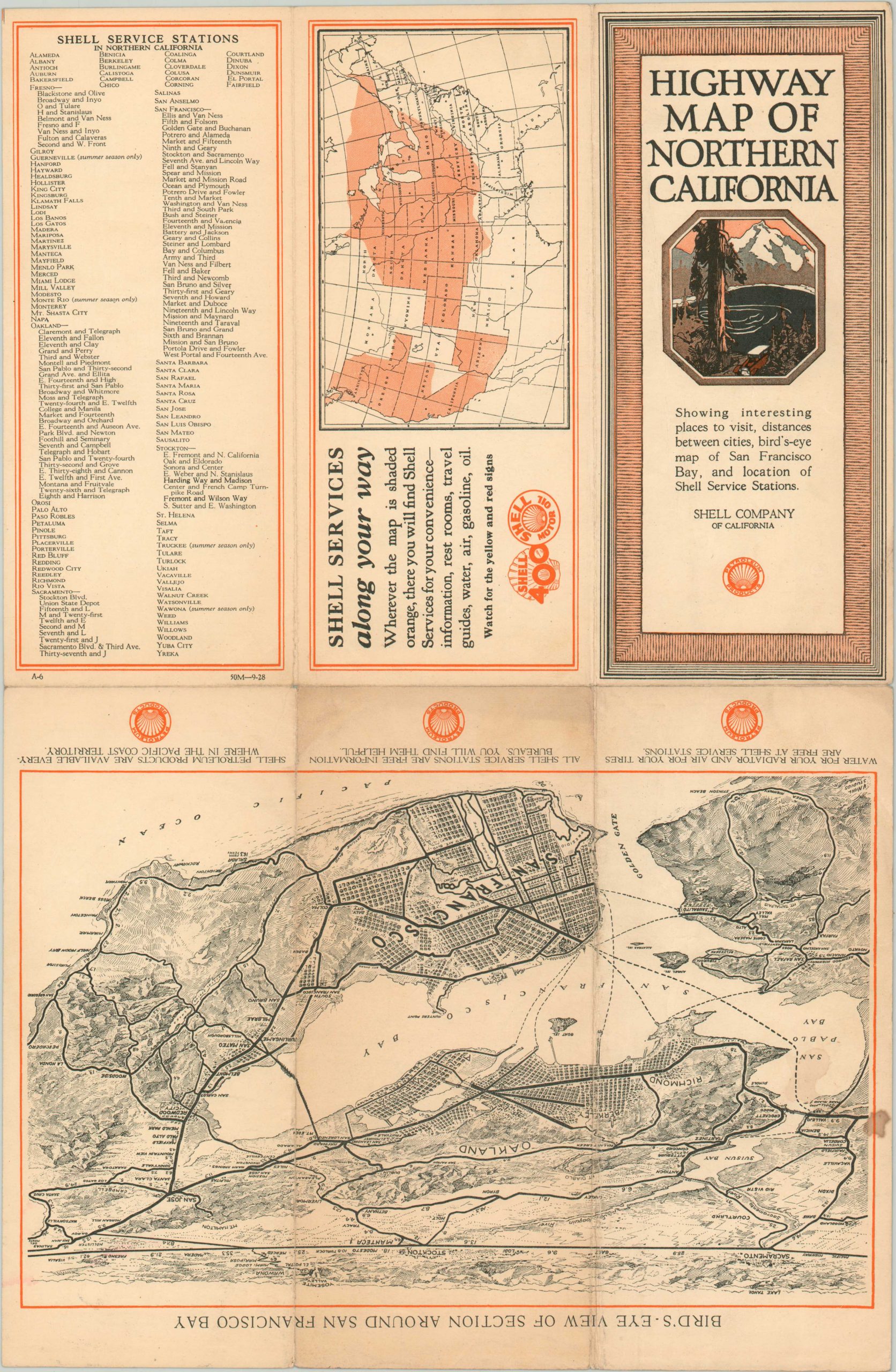
This lovely bit of promotional material was issued by the Shell Company of California in 1928. It shows the condition of various roads across California north of Santa Barbara; with paved highways, good dirt roads, and other roads noted according to the legend in the lower right. National Parks, forests, and other locations of interest are labeled within the image and distances between points are provided (in miles), where applicable.
A list of ‘Places Worth Visiting in Northern California’ is provided in the upper right and includes a whaling station near Del Monte, Jack London’s Ranch, and an experimental orchard, among more recognizable locations. The verso features a bird’s eye view of San Francisco Bay (pre-dating the Golden Gay and Bay Bridges) designed by V. Nahl Studios as well as a U.S. map highlighting the territories served by Shell.
Map Details
Publication Date: 1928
Author: Shell Company of California
Sheet Width (in): 11.80
Sheet Height (in): 17.90
Condition: B+
Condition Description: Creased and moderately worn along originally issued fold lines. One small stain in the lower left margin, and a bit of extraneous wrinkling visible in the sheet next to to the Shell ad (lower left). Toning on the verso does affect the bird's eye view of San Francisco, but not the primary image of the map.
$150.00
1 in stock