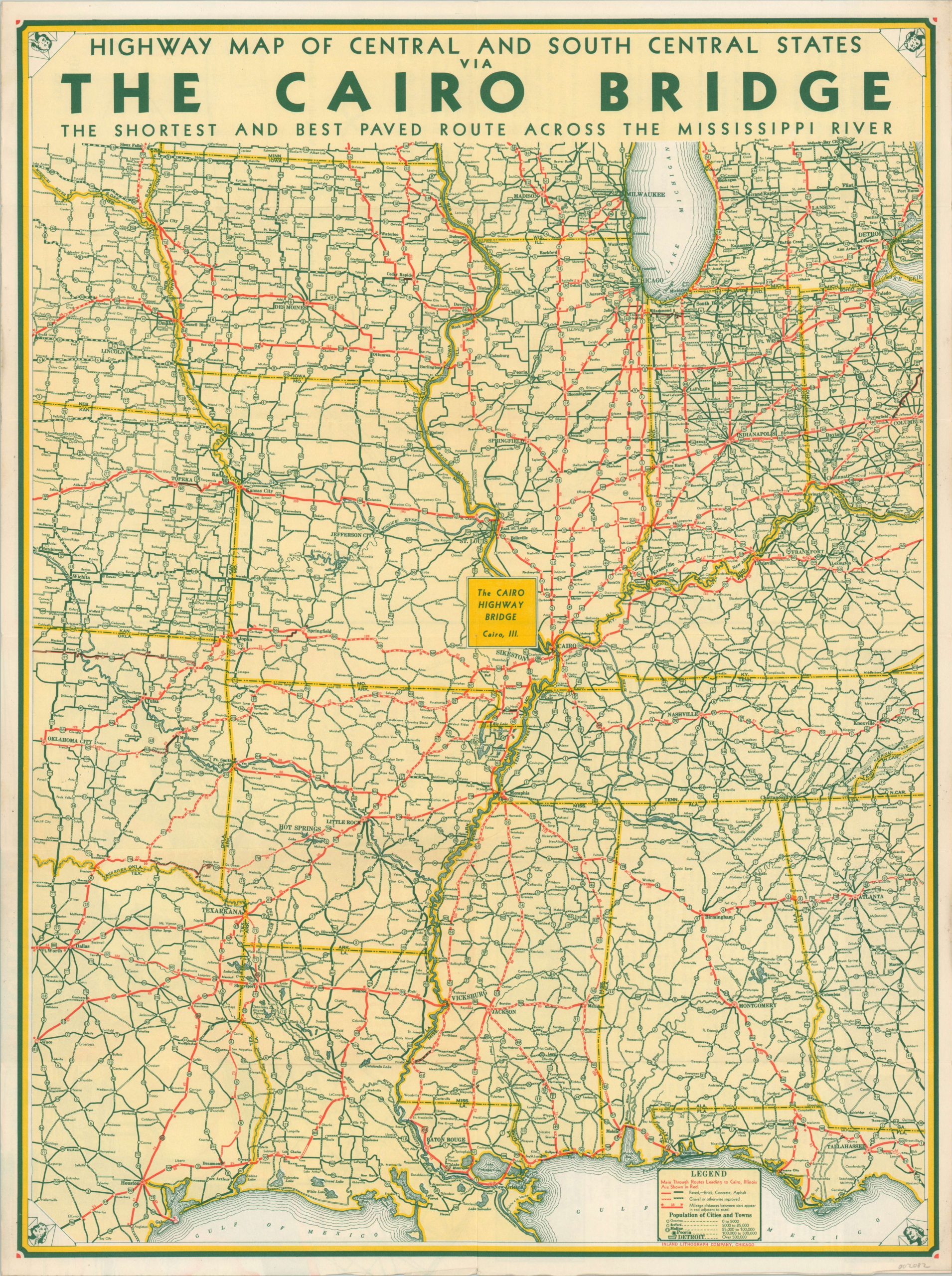
Highway Map of Central and South Central States via the Cairo Bridge
$60.00
An interesting perspective on the central U.S. designed to emphasize the geographic location of Cairo, Illinois.
1 in stock
Description
This road map of the central United States dates to the Great Depression and was issued by the Cairo Bridge Company to promote its easy access across the Mississippi River. Primary thoroughfares leading to Cairo are highlighted in red, while the various road surface types (paved vs. gravel) are identified according to the accompanying legend in the lower right. Geographic distortions are evident (note Indiana’s diminished size adjacent to Illinois) and accessibility to the south and western states are emphasized.
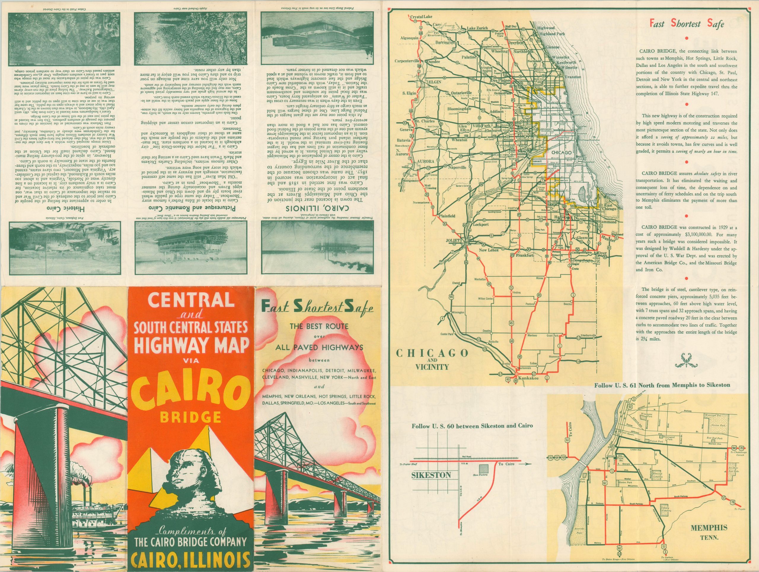
The map was published at a period of particularly high racial tensions in Cairo, as an infamous lynching that took place in 1909 unleashed a new Jim Crow era across the ‘Little Egypt’ region of southern Illinois. Text on the verso alludes to such sentiment, stating “Cairo is a ‘far below the Mason-Dixie line’ city although it is located in a northern state. the mannerism and the dialects of the people are much the same as those of their neighbors in Kentucky and Tennessee.”
Source: Campney, Brent M. S. “”The Peculiar Climate of This Region” The 1854 Cairo Lynching and the Historiography of Racist Violence Against Blacks in Illinois.” Journal of the Illinois State Historical Society (1998-) 107, no. 2 (2014): 143-70.
Map Details
Publication Date: c. 1931
Author: Inland Lithograph Company
Sheet Width (in): 18.00
Sheet Height (in): 23.75
Condition: A-
Condition Description: Originally issued folded into twelve panels. Faint creasing and wear along original fold lines and along the outer edges of the sheet, but in very good, or better, condition overall.
$60.00
1 in stock