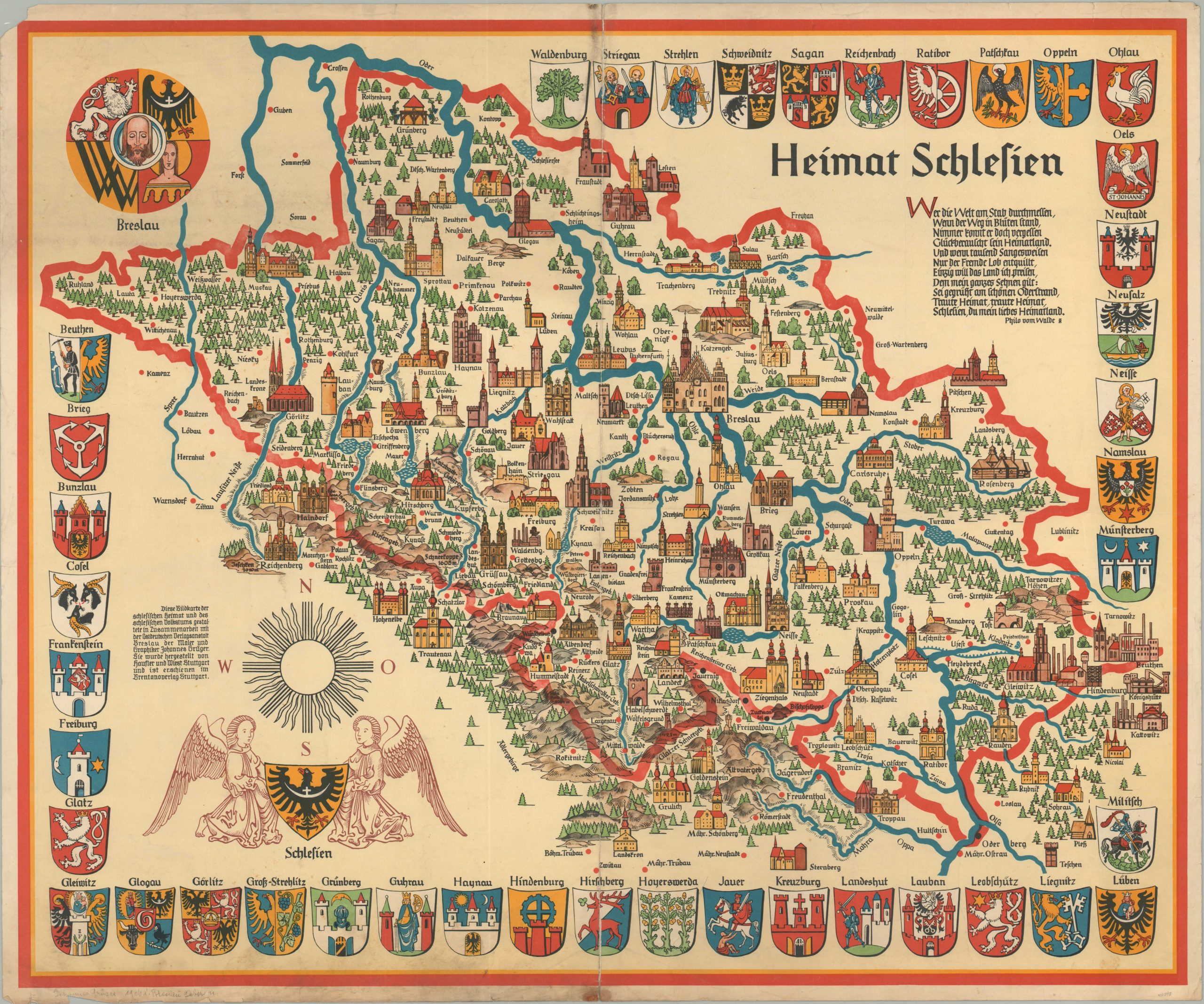
Hiemat Schlesien
Colorful map showing the historical region of Silesia in Europe.
Out of stock
Description
It’s evident at first glance that the creator of this map, Johannes Gruger, wanted to emphasize heavily the historical aspects of Silesia, in today’s Poland and Czech Republic. The image uses symbols lifted from maps from the 17th and 18th centuries as it identifies rivers, topographical details, and various types of urban areas. Coats of arms also reinforce the theme and add a wonderful decorative element to the page.
Map Details
Publication Date: c. 1955
Author: Johannes Gruger
Sheet Width (in): 33.40
Sheet Height (in): 27.80
Condition: B
Condition Description: The sheet shows moderate soiling concentrated most heavily along the lower edge, which also exhibits some wear. The creases are worn, and the top vertical fold exhibits soiling and discoloration. Old tape repairs on verso, and a chip in the margin in the upper left corner of the sheet. Despite the wear, the map shows vivid color and presents well.
Out of stock