“Hi-Spots” of Greenwich Village New York
$225.00
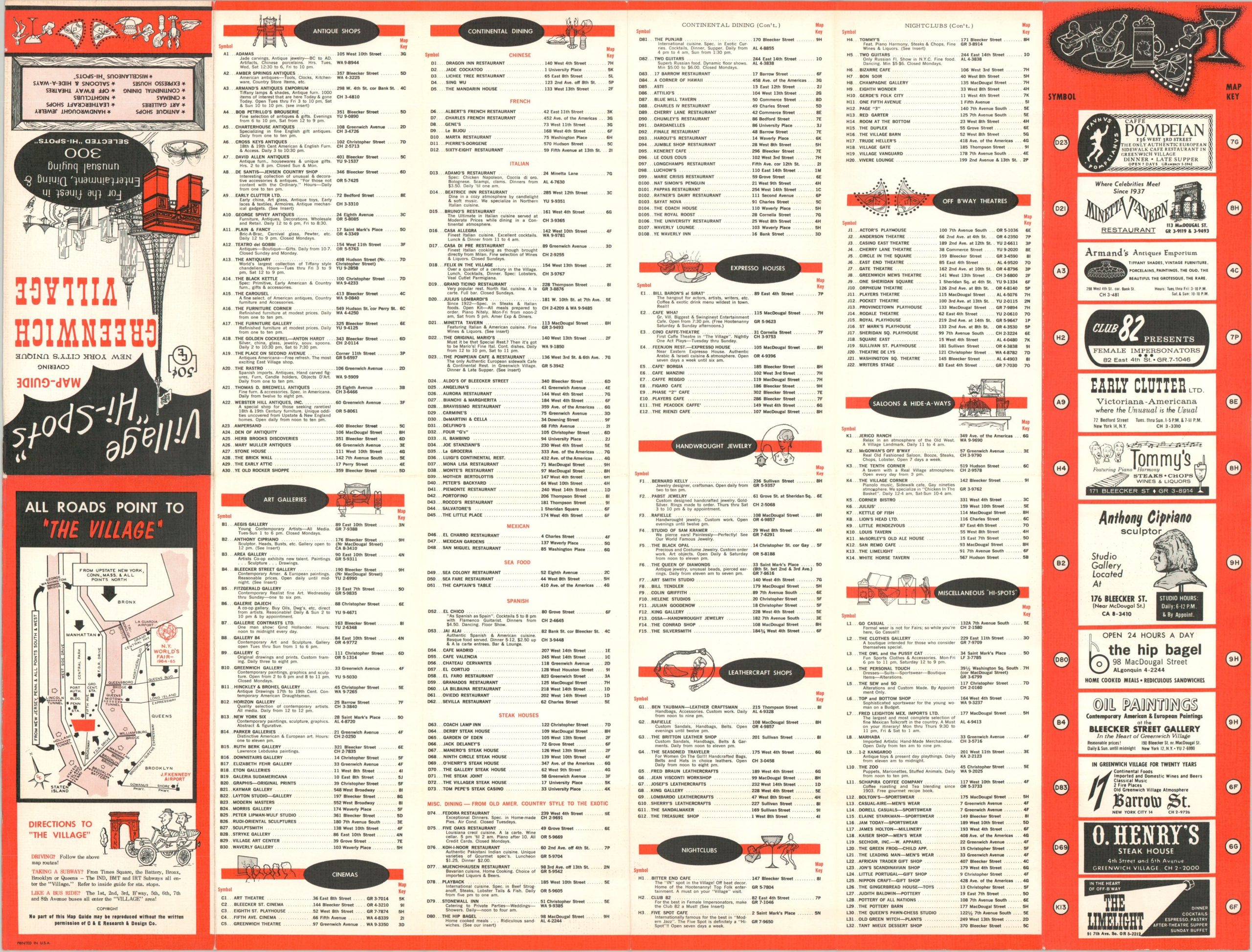
Detailed map of ‘The Village’ issued in conjunction with the 1964 New York World’s Fair.
1 in stock

Description
This simple street plan outlines the iconic Manhattan neighborhood of Greenwich Village in the mid-1960s. At the time, it was a hotspot for the counterculture movement, but the village has ‘cleaned up’ its image for this publication, intended for a broad audience attending the 1964/65 World’s Fair.
Nearly three hundred separate locations (listed on the verso) are numbered across the map, prefixed with letters that identify their respective category; Antique Shops, Art Galleries, Nightclubs, etc. Twelve particular points of interest, including NYU, the Thomas Paine House, and Washington Square Park, are noted according to the legend in the lower right. Subway stations are also identified according to their operator.
Map Details
Publication Date: c. 1964
Author: C. & E. Research & Design Company
Sheet Width (in): 21.75
Sheet Height (in): 16.60
Condition: A-
Condition Description: Some light discoloration and creasing is visible along the former fold lines, most evident on the right side of the page. Remains in very good condition overall. Printed on strong paper with bright colors.
$225.00
1 in stock