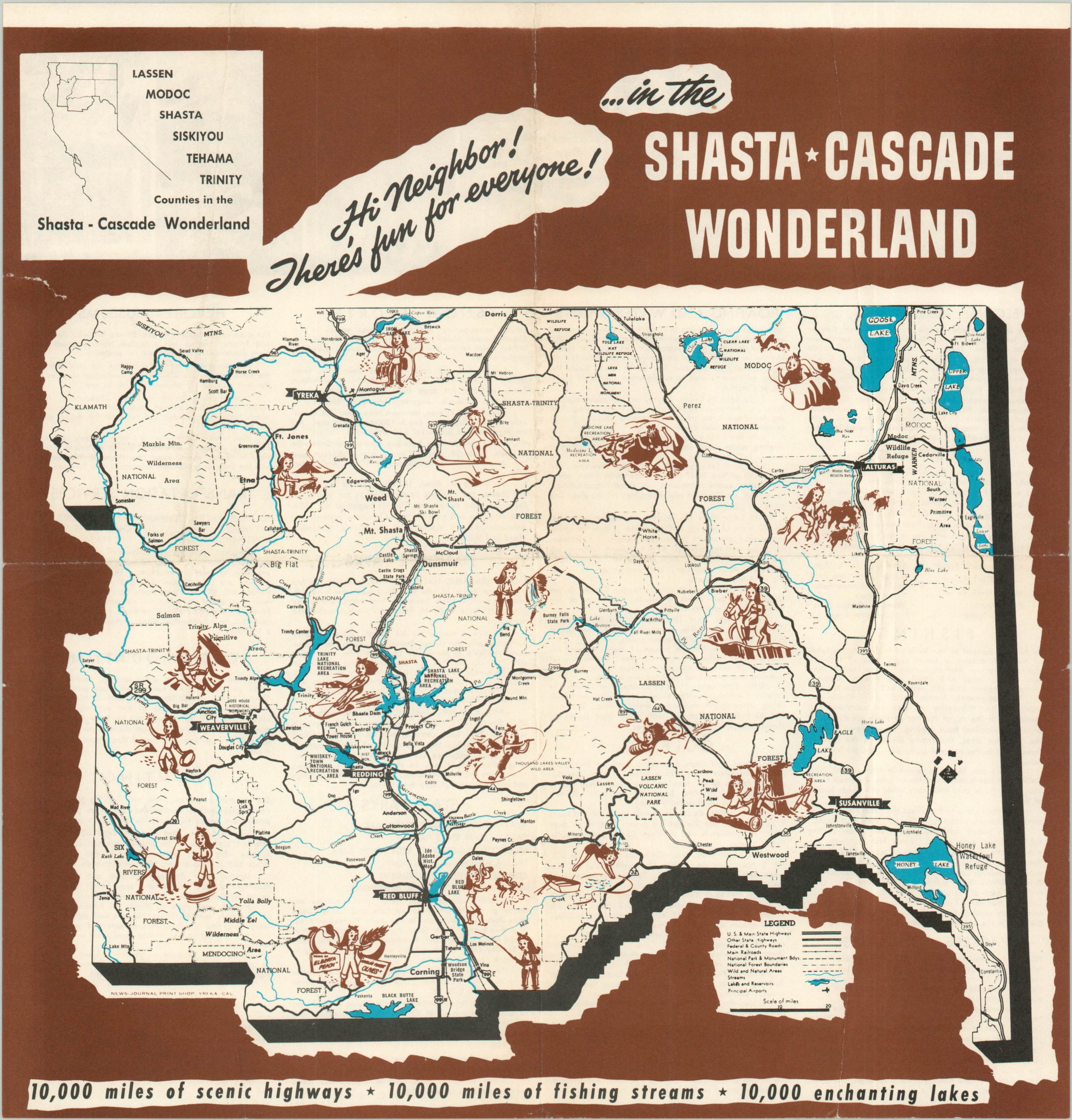
Hi Neighbor! There’s fun for everyone in the Shasta Cascade Wonderland
$60.00
Charming tourist map of the Shasta Cascade region in northern California.
1 in stock
Description
Allegedly containing some “10,000 miles of scenic highways, 10,000 miles of fishing stems, and 10,000 enchanting lakes”, the Shasta Cascade Wonderland is one of California’s most geographically diverse regions. In case you were curious about the extent of the area, an inset map in the upper left identifies the six specific counties in the far northern part of the state, on the border with Washington and Oregon.
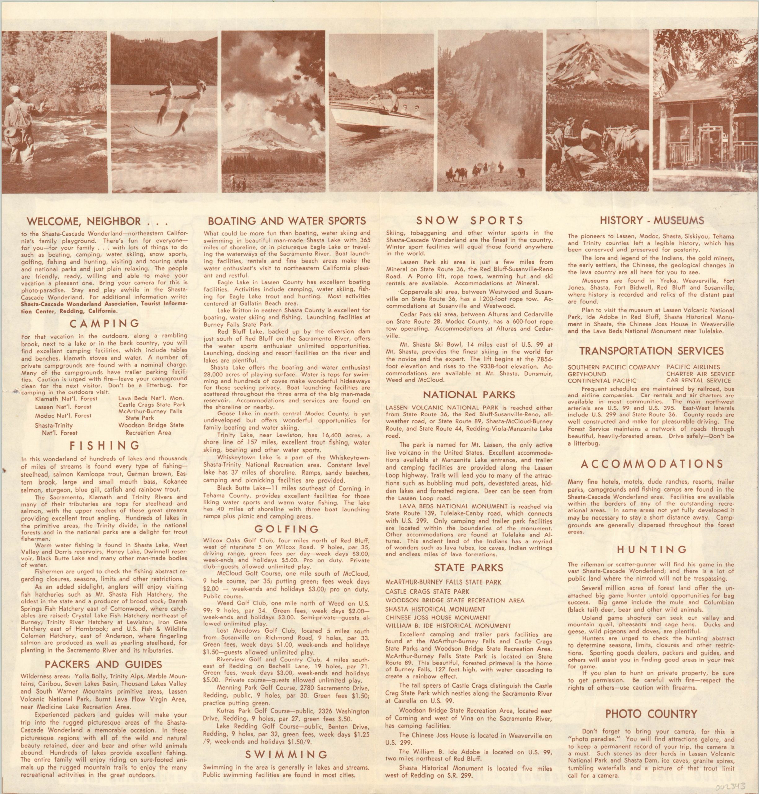
Within the image, major transportation routes, recreational areas, and geographic features are labeled while numerous vignettes feature the same female figure engaged in a variety of activities. Text and photographs on the verso provide additional reasons why one should be excited to visit.
Published in Yreka, California in the early 1960’s by the News-Journal Print Shop on behalf of the Shasta-Cascade Wonderland Association in Redding.
Map Details
Publication Date: c. 1960
Author: News-Journal Print Shop
Sheet Width (in): 11.90
Sheet Height (in): 12.25
Condition: B+
Condition Description: Moderate wear and creasing along former fold lines and two small tears along the outer edges that have been repaired on the verso.
$60.00
1 in stock