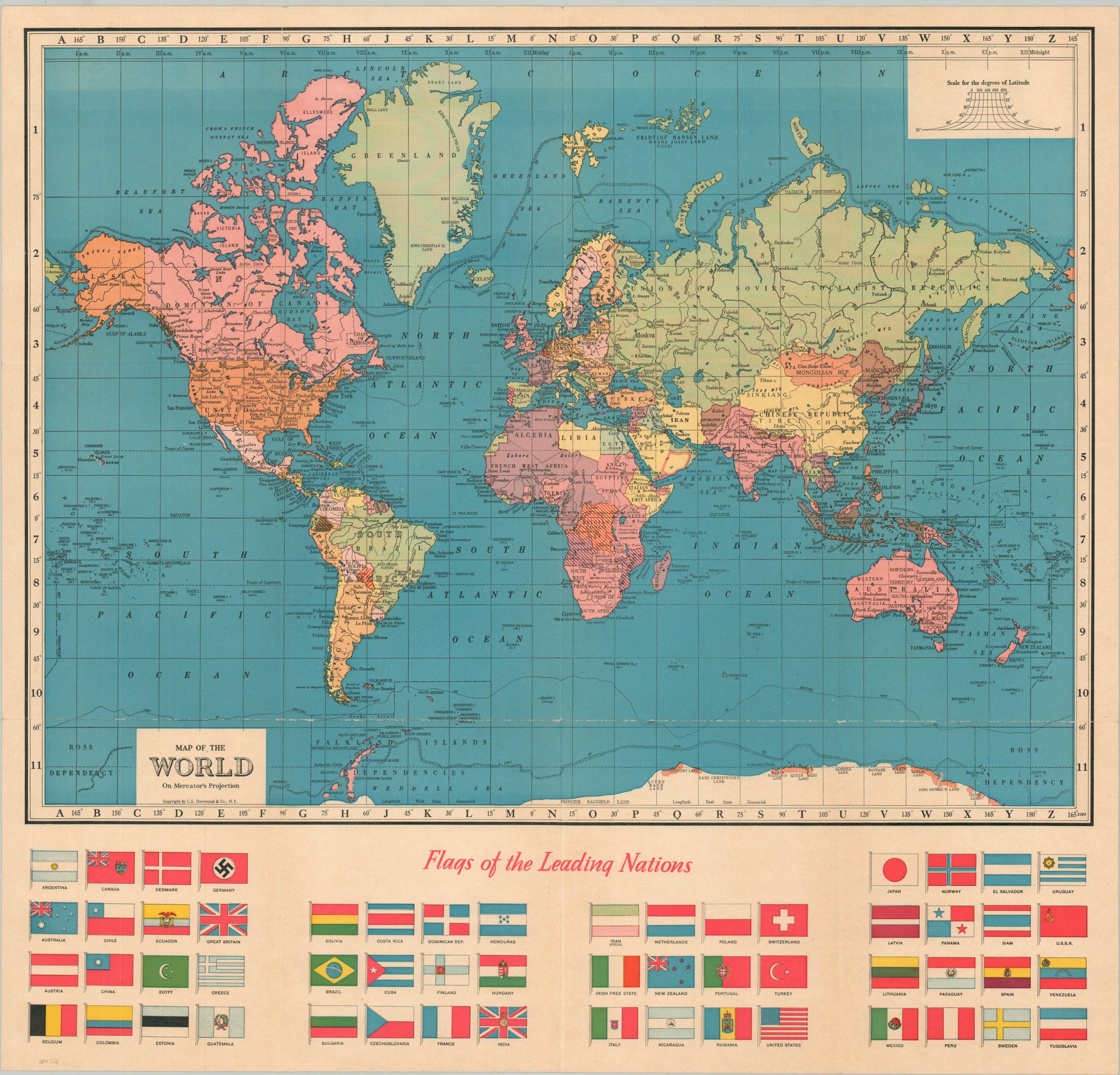
Hammond’s Map of the World with Flags of Leading Nations
Defining a world on the brink of war.
Out of stock
Description
A prewar world map in Mercator’s projection showing the state of political affairs in the last few years of peace. It’s uncertain what the red hash lines are meant to identify, but they cover the Portuguese Empire, Belgium, and contested territories in South America. The British Empire (red) is prominently featured, including claims in Antarctica and over the Falkland Islands.
The swastika flies among the Flags of Leading Nations, unencumbered by the well-deserved negative stigma associated with it today. Numerous tables and statistics about world geography, population, and history on the verso.
Published in New York by C.S. Hammond & Co. around 1937, based on the presence of Italian East Africa (1936).
Map Details
Publication Date: c. 1937
Author: C.S. Hammond
Sheet Width (in): 25
Sheet Height (in): 23.75
Condition: A-
Condition Description: Creased along originally issued fold lines, with small holes at fold intersections and visible wear along the bottom horizontal fold lines. Good to very good condition overall.
Out of stock

