Hammond’s Air Age Map of the World
$225.00
Incorporating aviation into a new global perspective.
1 in stock
Description
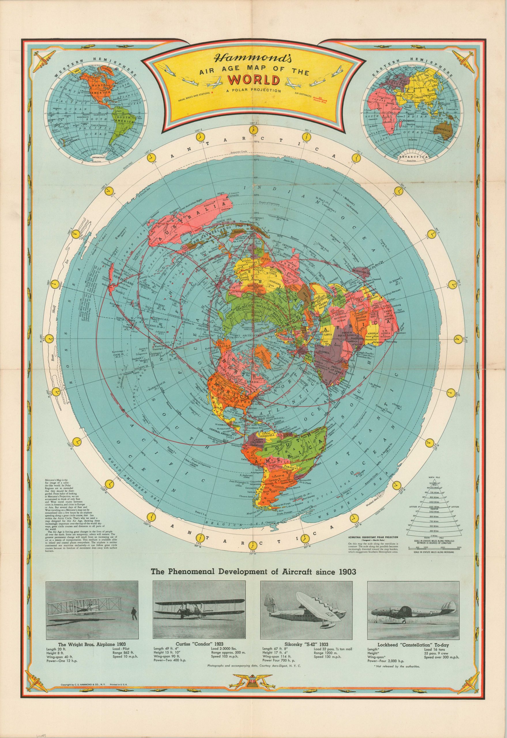
“The Air Age is forcing great changes in the lives of people all over the earth. Some are temporary, others will remain.” – Text, lower left.
This vibrantly colored WWII-era map shows the world on a polar projection, well-suited to emphasize distances by air across the globe. This new method of travel made formerly remote places more readily accessible and required a novel way of conceiving space and geographic relationships. In addition to the primary air routes between Allied powers, naval bases are identified with small red dots. The underlying image shows an interesting mix of pre-war territorial borders, omitting Italy’s 1936 conquest of Ethiopia but reflecting Britain’s split of Burma the following year.
Published in New York by C.S. Hammond & Company, probably in 1943. This was the same year the Lockheed Constellation was publicly introduced and continues the decade-long increments of ‘The Phenomenal Development of Aircraft since 1903’ seen at the bottom of the page.
Source: Rumsey Collection #13411
Map Details
Publication Date: c. 1943
Author: C.S. Hammond & Company
Sheet Width (in): 22
Sheet Height (in): 32
Condition: B
Condition Description: Creasing and toning along originally issued fold lines. Scattered spotting visible along the upper half of the page and in the margins. Good condition overall. Blank on verso.
$225.00
1 in stock