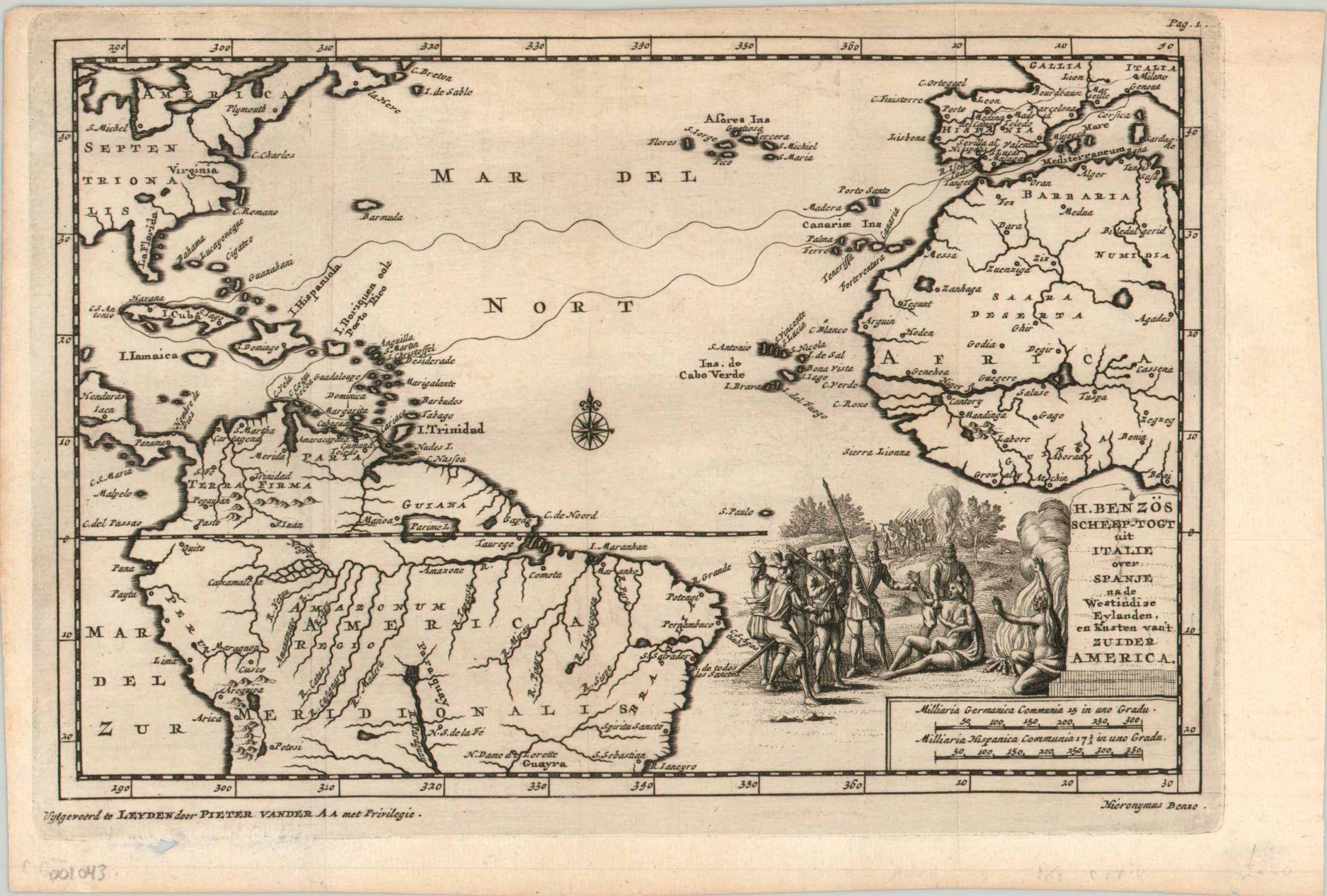
H. Benzos Scheep-togt uit Italie over Spanje na de Westindize Eylanden, en Kusten van’t Zuider America.
$275.00
Fantastic map of an explorer’s 16th century voyage to the New World.
1 in stock
Description
Even though this map was made in the first decade of the 18th century, its image depicts cartographic misconceptions dating back much earlier. Mysterious lakes in South America, phantom islands in the Atlantic, the mythical Northwest passage through Panama, the unfounded association between the Niger and Senegal Rivers in Africa, and an iteration of the Sea of Verrazano off America’s east coast are all represented in one form or another, and reflect decades (or centuries) of misinformation and wishful thinking. Important locations in the early colonial history of the New World are also depicted, including Plymouth, Potosi, and St. Michel (Montreal).
The map was designed by Pieter Van der Aa and also showcases the route undertaken by explorer Hieronymus Benzo, who left Spain in 1541 on a five year voyage that saw him travel extensively through the Caribbean and South America. On his trip, Benzo undoubtedly had numerous encounters with native inhabitants, and an example of such a meeting can be seen in the decorative vignette adjacent to the title.
Map Details
Publication Date: c. 1710
Author: Pieter van der Aa
Sheet Width (in): 10.20
Sheet Height (in): 6.90
Condition: A
Condition Description: The map is in excellent condition - a bold impression on strong paper. Slightly narrow upper margin and a small hole in the lower left, under the cartographer's credit. One faint vertical crease along the left side of the sheet.
$275.00
1 in stock

