
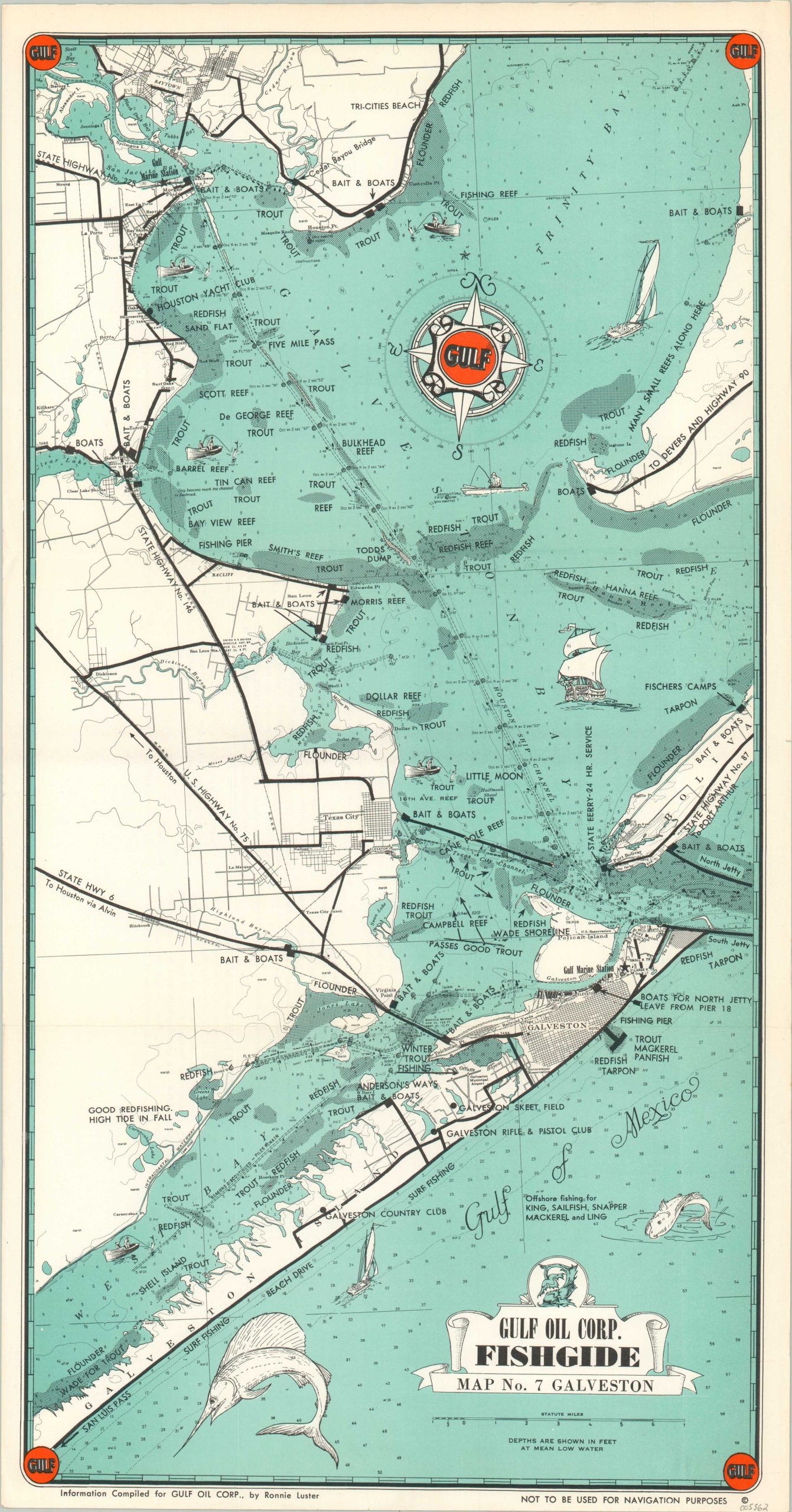
Gulf Oil Corp. Fishguide Map No. 7 Galveston
Mid-century fishing guide to the Texas coast around Galveston.
Out of stock
Description
In 1939, the Gulf Oil Corporation initiated the creation of a series of maps known as ‘fishguides,’ with a primary focus on the Texas Gulf Coast. These maps meticulously highlighted known spots for various fish species, offered comprehensive depth soundings, seasonal productivity areas, and the positions of Gulf marine stations.
Despite their extensive information, it’s important to note that these maps were explicitly designed for recreational fishing guidance rather than navigation, as indicated by cautionary language in the lower margin on this example. This Fishguide covers the Gulf of Mexico along the Texas coast around Galveston and Trinity Bay. Available species for local anglers include redfish, trout, flounder, and tarpon. Various locations of interest, navigational hazards, and transportation routes are also identified throughout the image.
Compiled by Ronnie Luster and published by the Gulf Oil Corporation around 1955.
Map Details
Publication Date: c. 1955
Author: Ronnie Luster
Sheet Width (in): 11.6
Sheet Height (in): 22
Condition: A
Condition Description: Creased along two horizontal fold lines and fait wear along the outer edges of the sheet. Very good to near fine condition.
Out of stock