Guide Map of Yellowstone National Park
$30.00
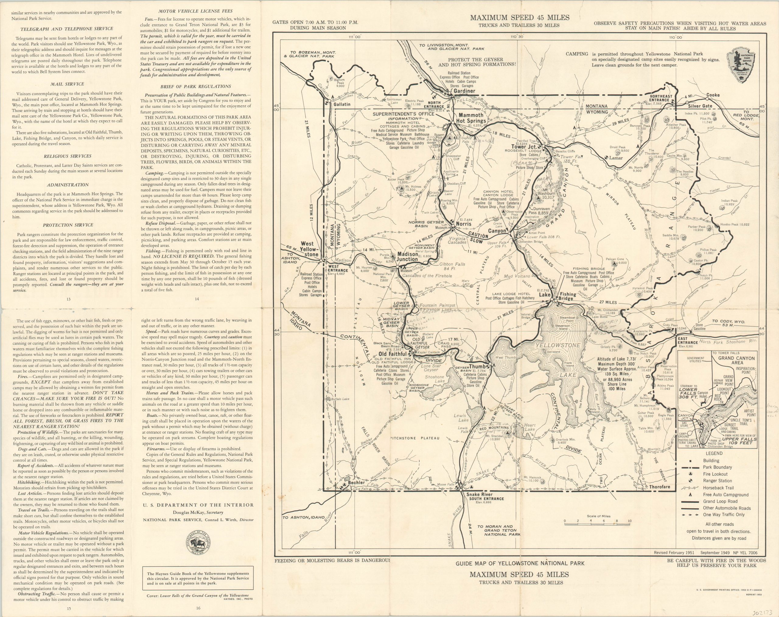
Map highlighting the relationship between the automobile and Yellowstone.
1 in stock
Description
Prior to 1916, automobiles were completely banned from Yellowstone National Park. Inadequate facilities, rough terrain, and inexperienced drivers made the National Park Service wary about allowing their entry, and as a result it was the site of the last commercially operated stagecoach in the country. However, in a few short decades the relationship would blossom, and automobile tourism generated millions in revenue by the early 1950’s.
This map, originally issued in 1949 and revised to 1953, emphasizes the Grand Loop road and other paved routes throughout the park. Horseback trails still play a predominant role in accessing certain areas. Rules and regulations can be found on the left side and verso, including a reminder that ‘Feeding or molesting bears is dangerous.”
Map Details
Publication Date: 1953
Author: Government Printing Office
Sheet Width (in): 23.40
Sheet Height (in): 18.50
Condition: B
Condition Description: Originally issued folded into 12 segments, with moderate wear, discoloration, and creasing along fold lines. Small holes at fold intersections and several areas of pencil annotations within the image.
$30.00
1 in stock