Guide Map of Tokyo
$85.00
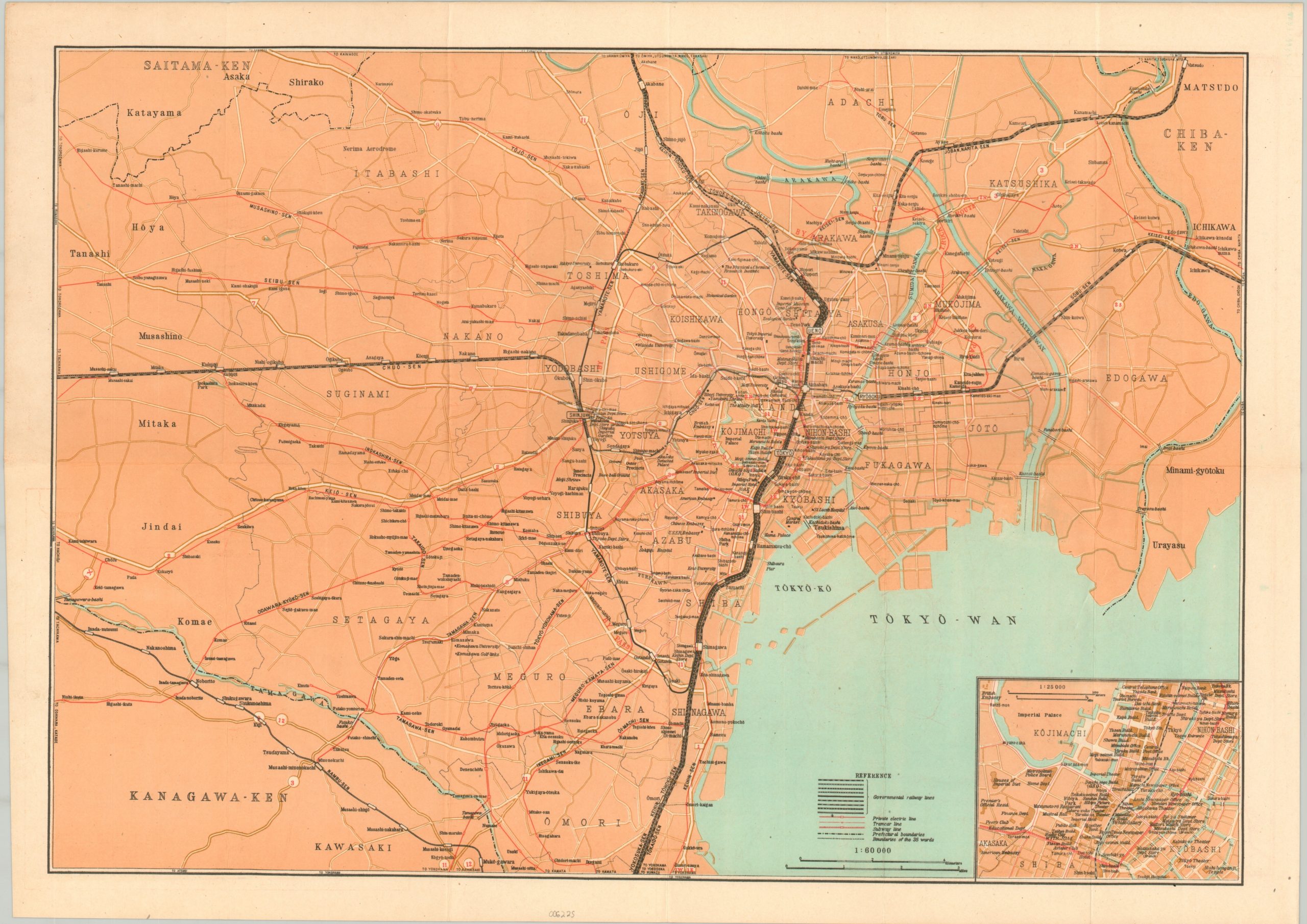
English-language map of Occupied Tokyo.
1 in stock
Description
This transportation map of Tokyo, Japan and the surrounding area was published in February 1946 by Nippon Chinzu Kaisha. A Willy’s Jeep on the front cover indicates it was likely intended for use by Allied soldiers on occupation duty in the months following V-J Day. Government railway lines, tramcar, subway, and private electric lines are noted throughout the image, along with major locations of interest and ward/prefectural boundaries.
Much of the central area would have remained a mix of ruins and makeshift buildings, having been largely destroyed in devastating firebombings less than a year prior to issue. However, an inset of downtown in the lower right shows theaters, department stores, clubs, and more – an impressive testament to the efforts to resume a sense of ‘normalcy’. The verso shows a small map of the numbered roads around the Tokyo-Yokohama area. It also presents a large transportation map of the Kanto Region that pinpoints the use of towns, golf courses, hot springs, shrines, and other attractions.
Map Details
Publication Date: 1946
Author: Nippon Chizu Kaisha
Sheet Width (in): 23.5
Sheet Height (in): 16.75
Condition: A
Condition Description: Fold lines, as issued, show light wear and toning, consistent with age and use. A few scattered spots, mostly in the margins. Very good to near fine condition.
$85.00
1 in stock