Greenwich Village Study
$250.00
Capturing the contemporary debate about the future of Greenwich Village.
1 in stock
Description
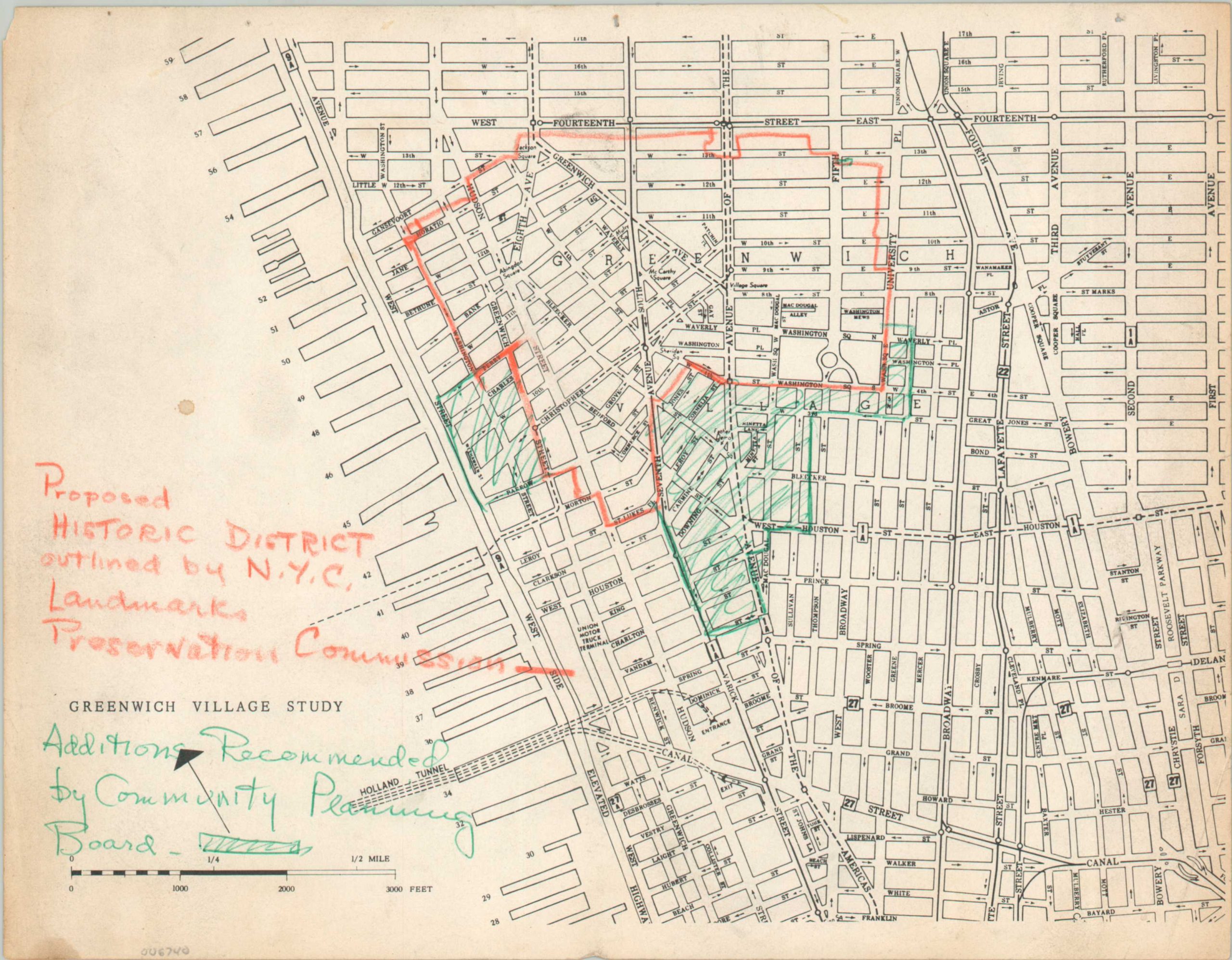
This somewhat rudimentary map was among the myriad produced during the ongoing deliberation over the preservation of New York’s Greenwich Village. When Greenwich Village Historical District was established in 1969, it was (and remains) the city’s largest, but this only occurred after several years of intense negotiations between community groups and government leaders.
This simple street map, updated by an unknown hand, reflects those differing priorities. The area of the proposed historic District is shown in orange, as outlined by the Landmark Preservation Commission. The Community Planning Board, on the other hand, though that the protected area should extend further south and west. Ultimately, the former’s proposal won the day (albeit with a few slight modifications to the borders shown here).
Map Details
Publication Date: c. 1968
Author: New York City Landmark Preservation Commission?
Sheet Width (in): 11
Sheet Height (in): 8.5
Condition: B
Condition Description: B&W map printed on a single side of 8.5 x 11 paper, creased in the center. Manuscript annotations in orange crayon and green ink. Heavily toned along the edges of the sheet, with creased corners, a few small pinholes, and two circular stains (left side). About good condition overall.
$250.00
1 in stock