“Great Thoughts” Empire Map
$395.00
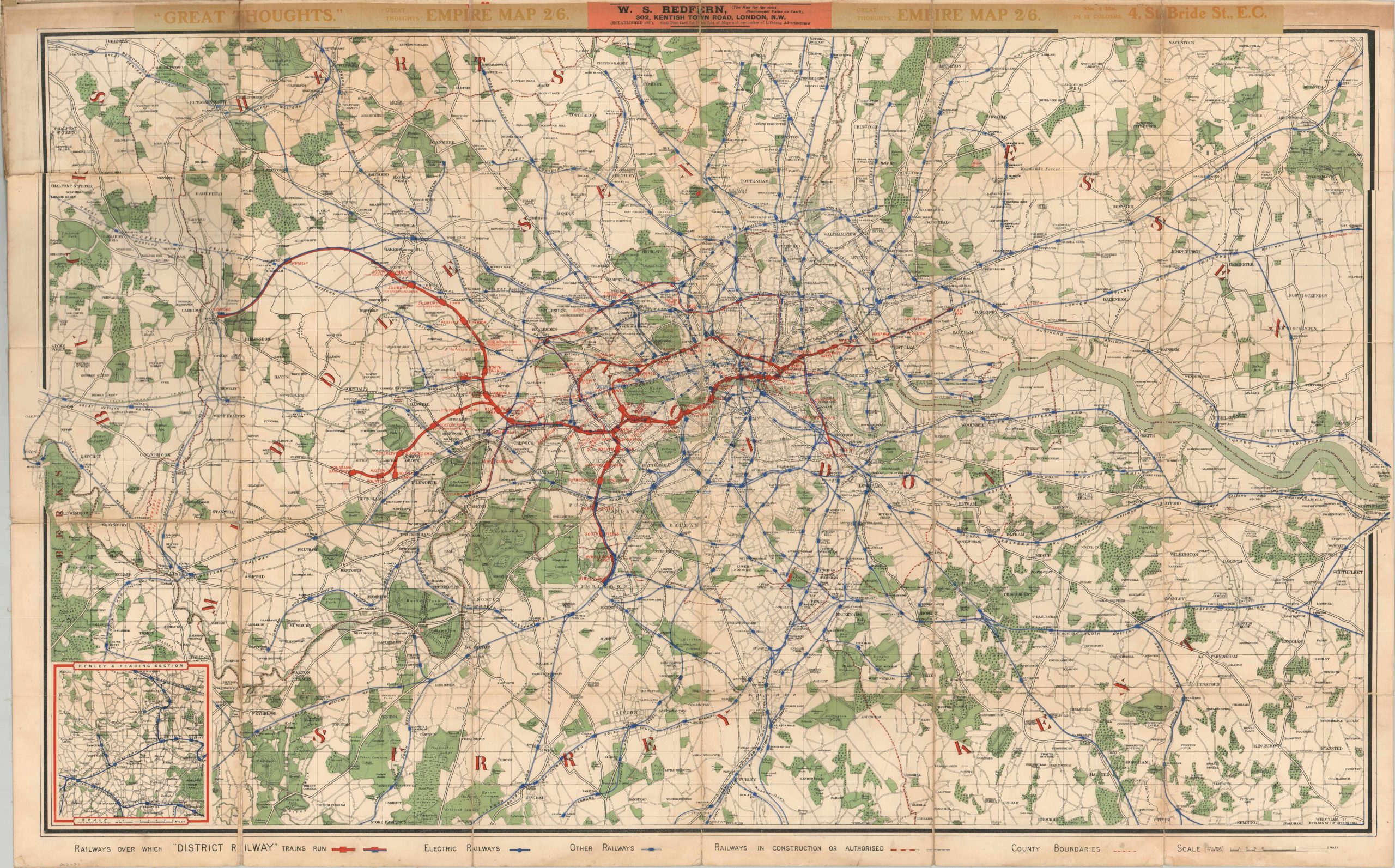
Early 20th century pocket map to London’s transportation system.
1 in stock
Description
This detailed transportation map of the Greater London area was published in the first decade of the 20th century by W.S. Redfern. Several advertisements for the dealer, “the man for the most phenomenal value on earth”, can be seen at the top and pasted onto the original covers.
It was apparently issued on behalf of (or perhaps to subscribers of) “Great Thoughts”, a weekly magazine that claims to contain “extracts from the MASTER MINDS of all countries and all ages.” The map shows the lines in operation by the London “District Railway” (a predecessor to today’s famous Underground), in addition to electric lines and other routes in operation or under construction.
An inset map in the lower left shows additional details around Henley and Reading, both of which are situated further to the east of the primary image. Dated using the presence of the Victoria & Albert Museum (opened in 1909) and the name of Mill Hill Park Station (renamed to Acton Town in 1910).
Map Details
Publication Date: 1909
Author: W.S. Redfern
Sheet Width (in): 42.00
Sheet Height (in):
Condition: A-
Condition Description: Folding map, dissected into 30 panels and mounted on linen. Some curling and minor wear along fold lines, including several spots of separation that accumulate to approximately 6" or so. Bookseller's stamp across the top of the sheet is slightly toned, and the original stiff boards are intact and attached, but heavily worn and soiled. Remains in very good condition overall.
$395.00
1 in stock


