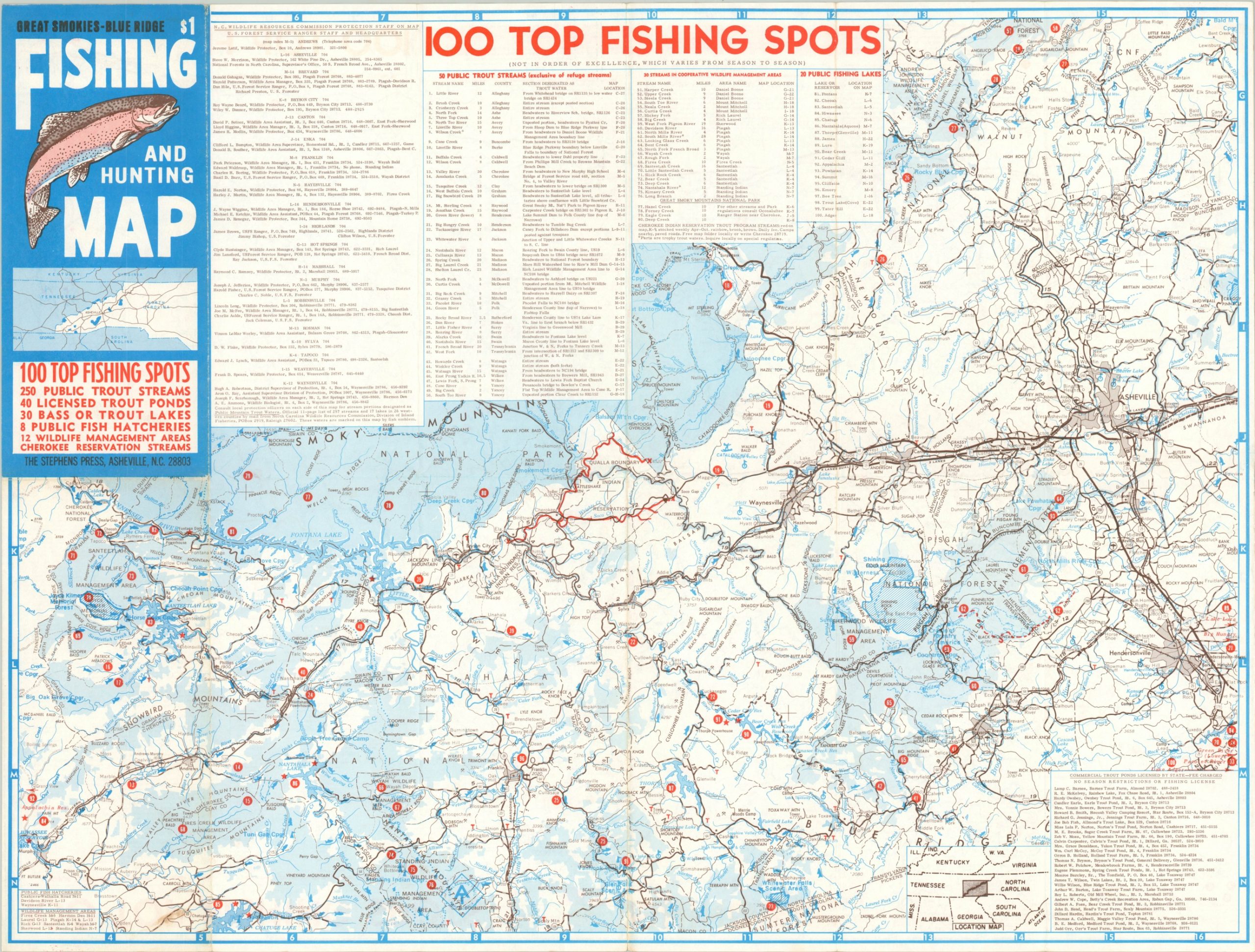
Great Smokies – Blue Ridge Fishing and Hunting Map
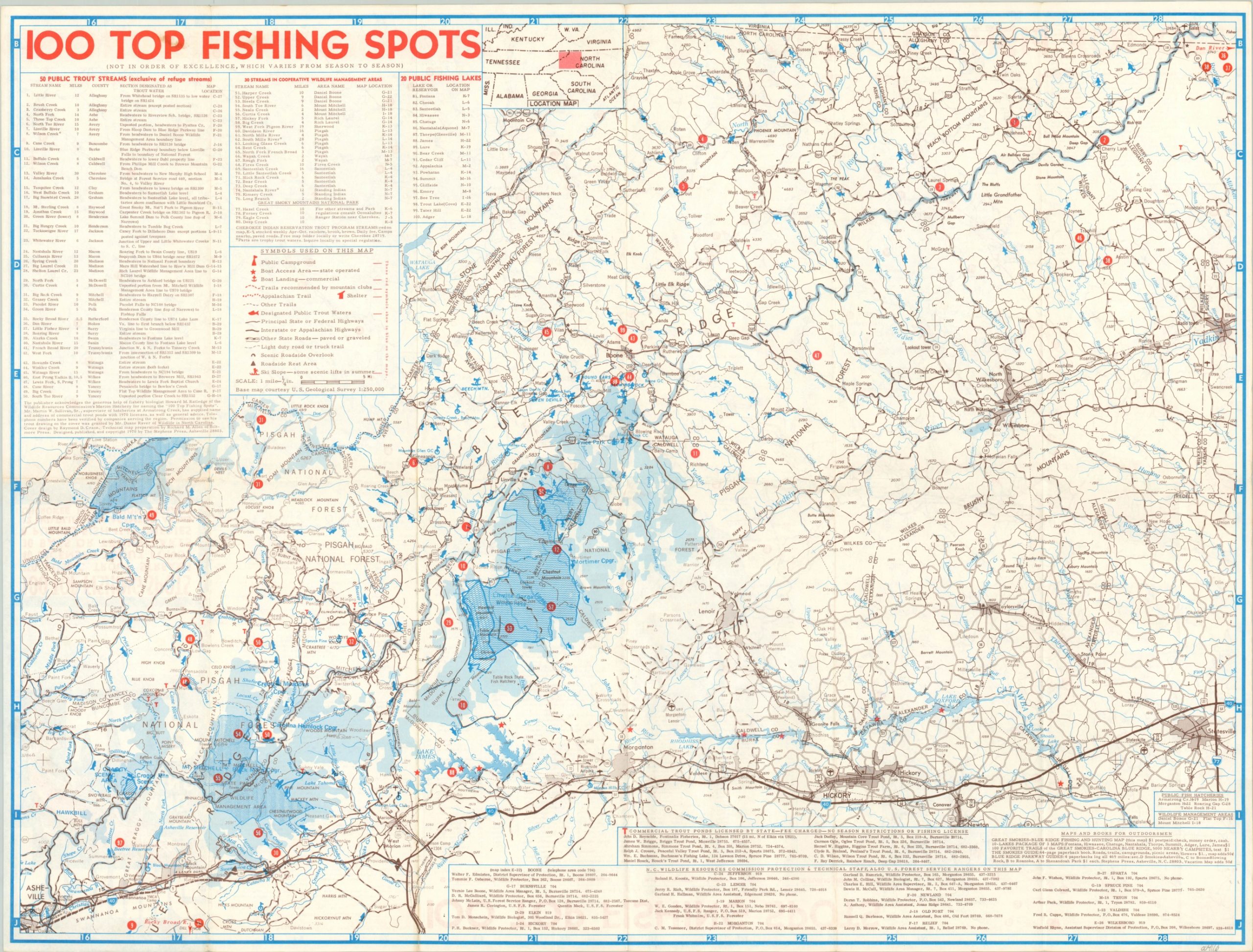
“100 Top Fishing Spots (Not In Order of Excellence, Which Varies from Season to Season)”
Out of stock
Description
This fun double-sided map claims to show the ‘Top 100’ fishing spots along the Blue Ridge Mountains, straddling the border of eastern Tennessee and western North Carolina. Fifty public trout streams, 30 streams in wildlife management areas, and 20 public fishing lakes are numbered across both sides.
Outdoor amenities like campgrounds, boat ramps, shelters, rest areas, ski slopes, and transportation routes are noted according to the legend. Detailed lists of hatcheries and commercial trout ponds are also provided.
Cover designed by Raymond Cream. Map preparation by Richard M. Allen. Published and copywritten in Asheville, North Carolina by the Stephens Press in 1970.
Map Details
Publication Date: 1970
Author: Richard Allen
Sheet Width (in): 24.4
Sheet Height (in): 18.3
Condition: A-
Condition Description: Double sided brochure folded into 12 panels, with moderate wear along fold lines.
Out of stock


