Great Northern Railway Map of the United States
$65.00
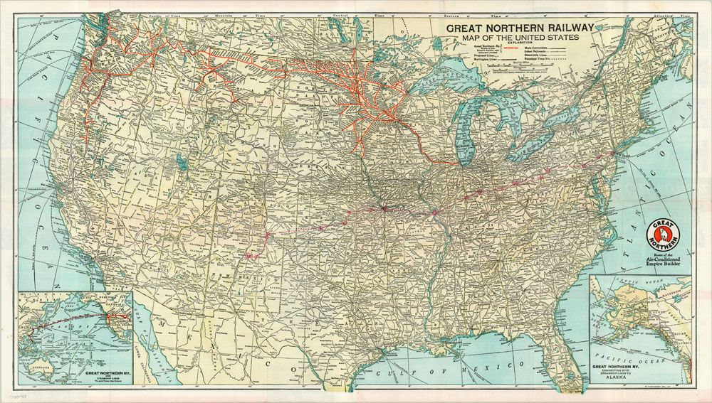
Folding map of the United States showing the route of the “Empire Builder” at the height of its popularity in pre-war America.
Description
The Great Northern Railway originated from the ashes of several short line rails that failed in the late 19th century, and was the brainchild of James Hill (also known as the “Empire Builder”). Its lines included the northernmost transcontinental railroad, which was the only such line that was entirely privately funded. Amtrak still operates daily trips from Chicago to Portland and Seattle along the same route.
This map shows the expanse of the Great Northern Railway through the northern United States, with branches that led to remote interiors of several western states, mostly for mining and agricultural purposes. The Great Northern also advertised settlements along their routes (purchased, rather than granted, from the federal government), primarily to Germans and Scandinavians. Two inset maps are shown; one depicting the steamship route to Alaska and one depicting the steamship route to Asia across the Pacific. It appears an earlier owner of this map traced the route of their trip from New York to Sante Fe, with stops circled along the way.
Map Details
Publication Date: 1941
Author: M.J. Grindhem
Sheet Width (in): 31.75
Sheet Height (in): 18
Condition: A-
Condition Description: The map is in excellent condition with the exception of red markings a previous owner applied to trace their route to Sante Fe.
$65.00