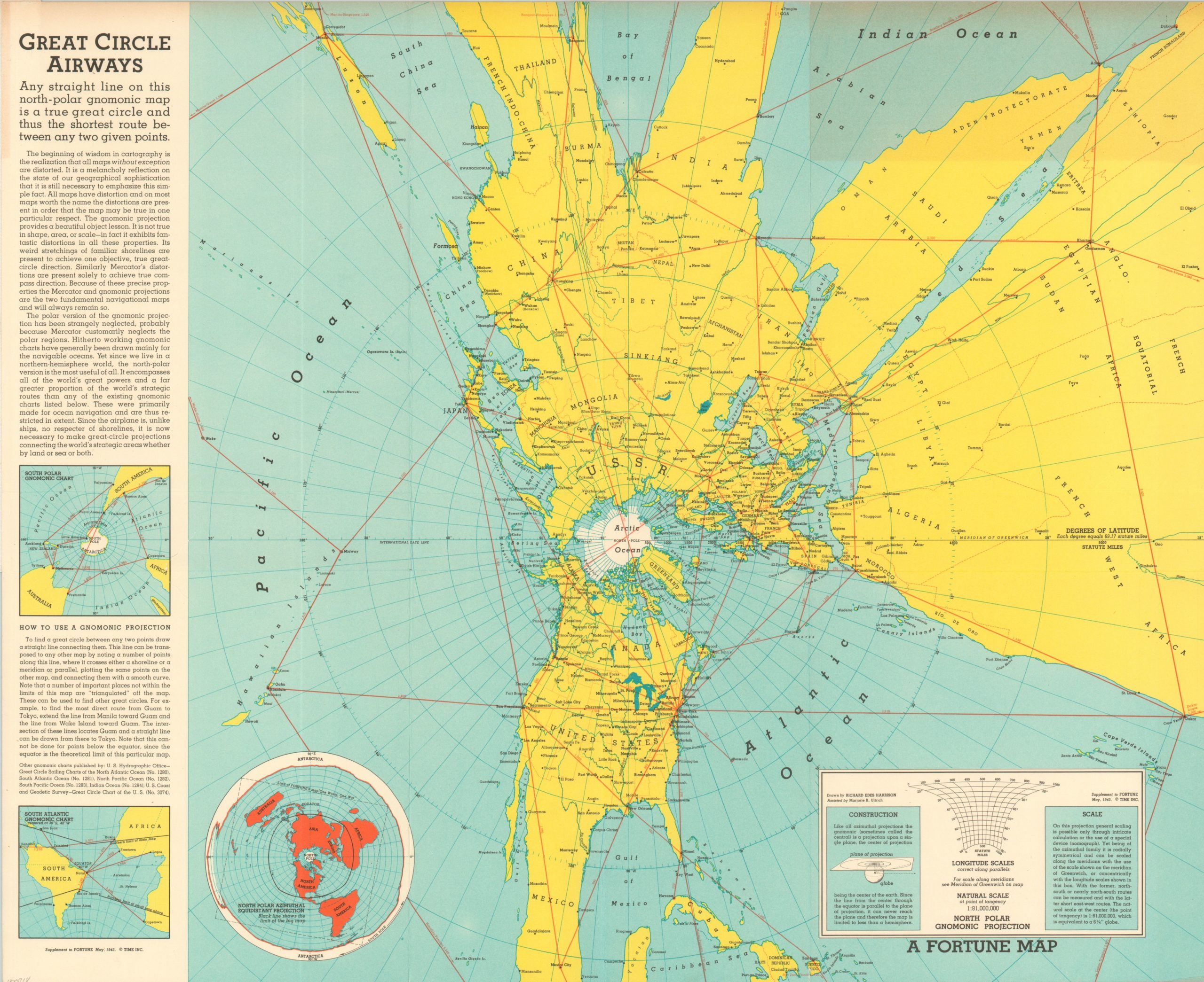
Great Circle Airways
“The closest distance between two points is a straight line.”
Out of stock
Description
In the words of Susan Schulten, “aviation collapsed distance and realigned geographical relationships, and nowhere was this more apparent than in the changing look of maps.” Cartography would need to “catch up” to aerial technology that was constantly developing; shortening distances and making remote corners of the world more accessible than ever before. Richard Edes Harrison was a pioneer in depicting the world from different perspectives, and it was he who brought us this polar view of the world on a gnomic projection.
According to the accompanying text, “any straight line on this north-polar gnomic map is a true great circle and thus the shortest route between any two given points.” This radical new view was issued as a supplement to the May 1943 issue of Fortune Magazine and would have helped the American wartime public better understand the new geographic truths resulting from aviation technology.
References
Schulten, Susan. A History of America in 100 Maps. Chicago: University of Chicago Press, 2018.
Map Details
Publication Date: 1943
Author: Richard Edes Harrison
Sheet Width (in): 24.20
Sheet Height (in): 19.50
Condition: A-
Condition Description: Discoloration visible along the top portion of the sheet and creasing along fold lines. Old library stamps on verso. Very good to excellent condition overall.
Out of stock