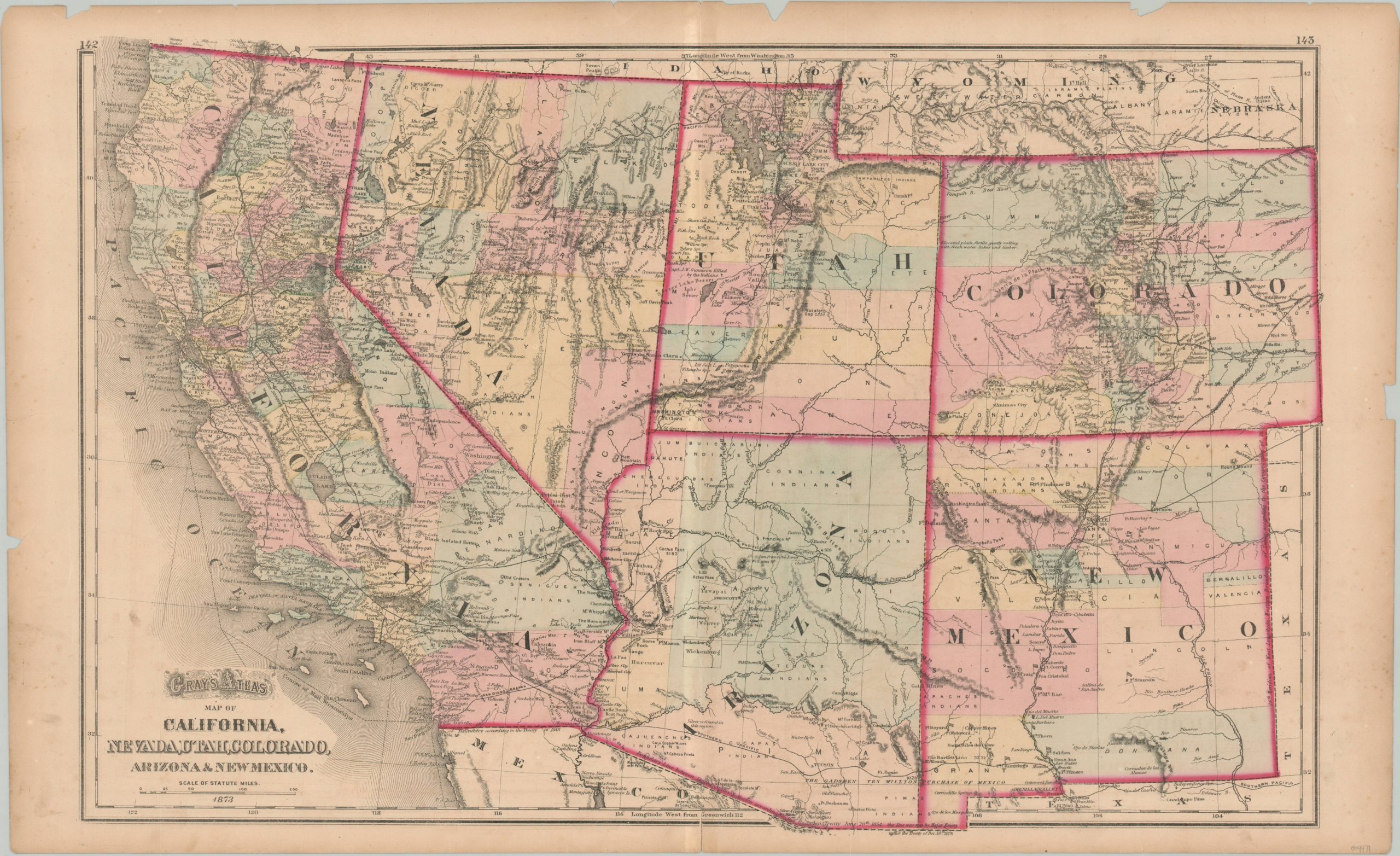
Gray’s Atlas Map of California, Nevada, Utah, Colorado, Arizona & New Mexico
The western United States less than a decade after the end of the Civil War.
Out of stock
Description
This delicately engraved map encompasses five states in the western U.S. – California, Nevada, Utah, Colorado, Arizona, and New Mexico. Attractive pastel colors, applied by hand, distinguish the county configurations within each. Some states, like California, are relatively developed and thus closely match a modern map, whereas others (like Arizona) would see significant growth and political reorganization in subsequent decades.
The image shows railroads, the primary catalyst for such development in the 19th century, in prominent black lines. The First Transcontinental Railroad was completed just four years prior to publication and can be seen running across the top of the page. Stagecoach routes are also shown.
Topography is depicted in hachure, highlighting the region’s rugged terrain, and an interesting mix of geographic features and locations of interest are labeled throughout. The latter category includes Native American reservations, military fortifications, trading posts, ranches, and much more.
The map was published in Philadelphia in 1873 as part of O.W. Gray’s National Atlas, one of the last commercial atlases to feature hand color.
Map Details
Publication Date: 1873
Author: O.W. Gray
Sheet Width (in): 28
Sheet Height (in): 17
Condition: B
Condition Description: Lithograph with hand color printed on a sheet that has become brittled and toned with age. Several chips and tears around the outer edges, many of which have been repaired on the verso with archival materials. Scattered spotting visible in the lower corners, probably from when previously turned. The image remains intact and is very clean.
Out of stock