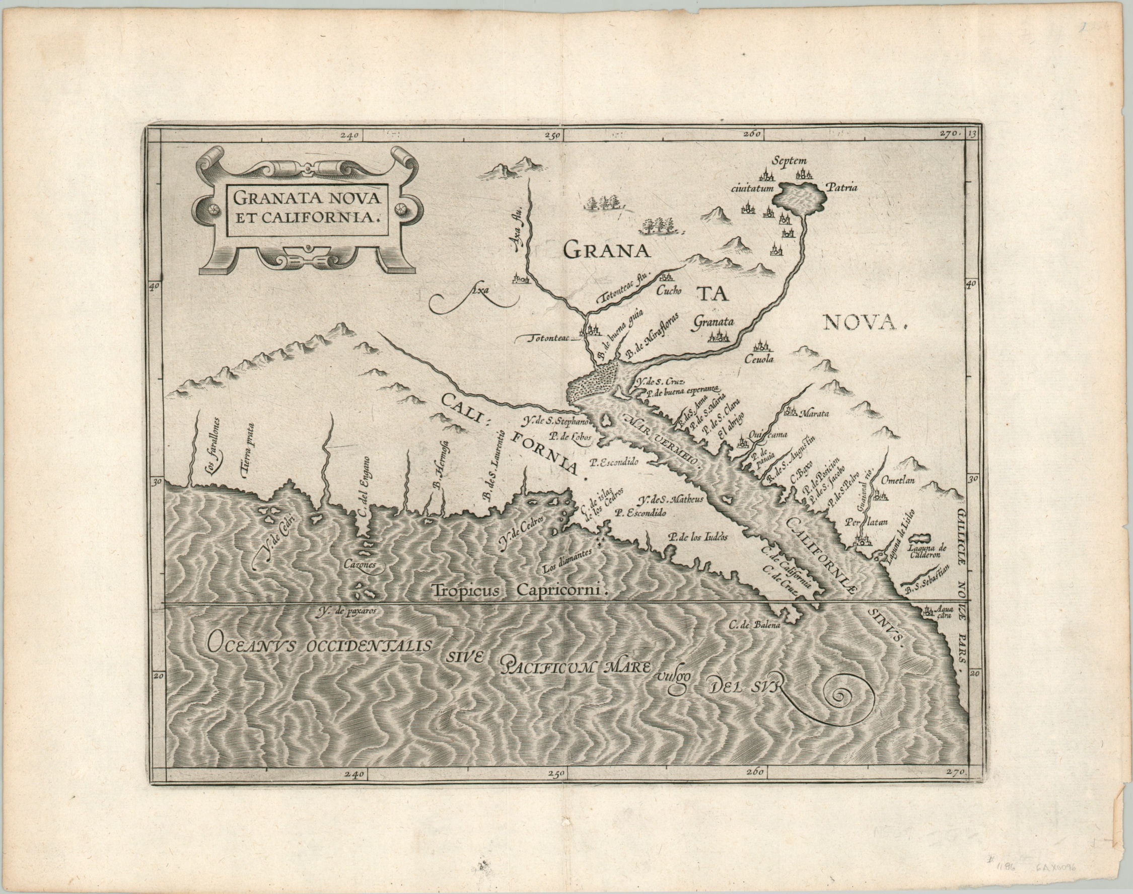
Granata Nova et California.
The first printed map dedicated to California and the American Southwest.
Out of stock
Description
This is an excellent example of the “only sixteenth-century printed map specifically devoted to southern California” (Schwarz & Ehrenberg), originally issued in the “first separately printed atlas related exclusively to the Americas” (Tooley). Granata Nova et California was first published in Louvain in 1597 as part of Cornelius Wyfliet’s Descriptionis Ptolemaicae Augmentum and is primarily based on a world map by Petrus Plancius from five years prior.
This is a later issue, likely printed around 1607, though the map is known in only one state. The image reflects Spanish explorations from the mid to late 16th century, including Coronado’s epic journey across Mexico and the American Southwest from 1540-1542. He was in charge of a large expedition to look for the legendary Seven Cities of Gold, which can be seen in the upper right surrounding a large lake. Though Coronado and his companions ultimately found only villages made of adobe, wood, or animal skins, the names associated with the myth – Cibola and Quivira – would persist on maps well into the 17th century.
Not all toponyms are fables, however, and compared to later maps, some of which would show California as an island, the geography is surprisingly accurate. A foundational map in the cartography of California and the American Southwest.
Sources; Burden #106, Wagner #187, Schwart & Ehrenberg Plate 41, Tooley’s Dictionary of Mapmakers.
Map Details
Publication Date: c. 1607
Author: Cornelius Wytfliet
Sheet Width (in): 15.10
Sheet Height (in): 11.90
Condition: A
Condition Description: Light creasing along the vertical centerfold and a bit of faint scattered soiling confined to the margins. Two small spots of toning on the verso from where previously matted, but it does not affect the image. Near fine overall.
Out of stock