Gouvernment General du Normandie
$110.00
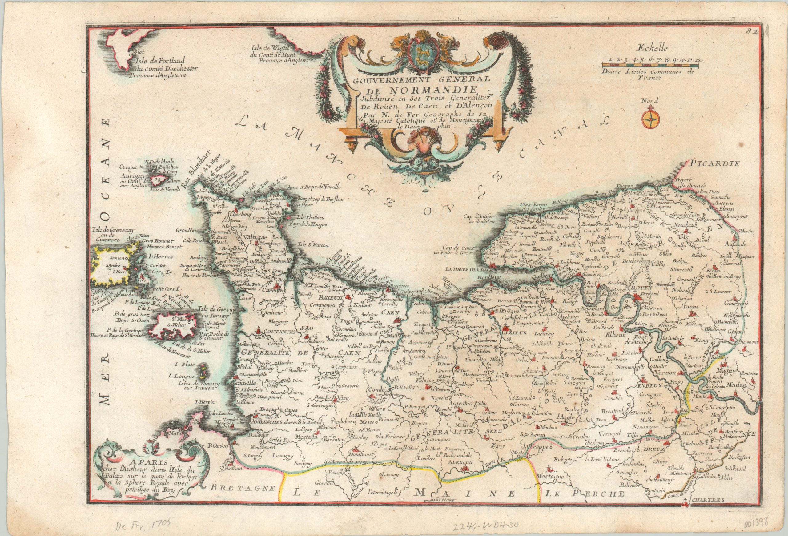
Early 18th century map of the French province of Normandy.
1 in stock
Description
This decorative map of Normandy and adjacent islands was published in Paris by Nicholas de Fer in 1705. It emphasizes the political organization and religious hierarchy of the historically turbulent French province; situated just across the English Channel from its longtime rival, the British.
Small symbols above the town identify the archbishopric of Rouen, bishoprics of Lizieux and Evreux, and several other regional ecclesiastical authorities. A decorative Baroque cartouche featuring Normandy’s coat of arms is draped across the top of the image, though it incorrectly uses a blue background instead of the distinctive Norman red.
Map Details
Publication Date: 1705
Author: Nicholas de Fer
Sheet Width (in): 15.50
Sheet Height (in): 10.50
Condition: A-
Condition Description: The sheet shows minor discoloration in the lower right quadrant and a few small spots of foxing. Faint stains in the corners of the margins. Very good condition overall, with lovely hand color.
$110.00
1 in stock