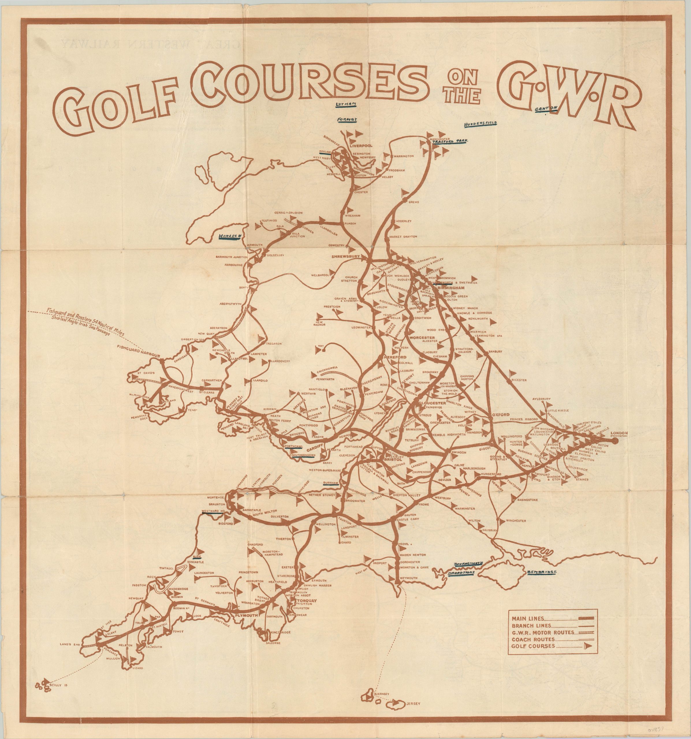
Golf Courses on the G.W.R.
$225.00
Double sided map promoting golf courses along the lines of the Great Western Railway.
1 in stock
Description
This interesting promotional map of Britain’s Great Western Railways uses two images to encourage tourism along its lines. One side shows a detailed diagram of the rail network and its various transportation branches such as the main lines, motor routes, steam boat paths and even coach routes. The distinction leads me to believe the latter lines, of which there are few, were still drawn by horses even in the second decade of the 20th century.
The verso presents a simplified outline highlighting the numerous golf courses available via the Great Western Railway. Again, main lines, branch lines, motor routes and coach routes are identified according to an accompanying legend. The G.W.R., like many of Britain’s railways, suffered through financial uncertainty in the years immediately following World War I, and sought to capitalize on the popularity of the ‘gentlemen’s game.’
The map is dated to approximately 1920, based on the lines depicted, because the following year the G.W.R. would undergo a significant restructuring as part of the Grouping Act. The image was engraved by Emery Walker and printed by Culross & Sproston, Ltd.
Map Details
Publication Date: c. 1920
Author: Culross & Sproston
Sheet Width (in): 21.00
Sheet Height (in): 22.25
Condition: B+
Condition Description: Moderate creasing and wear along former fold lines, including a few small pinholes at fold intersections. Minor wear visible in the margins. Several ink notations on the golf course map.
$225.00
1 in stock

