Going West? Going East? Take U.S. 12
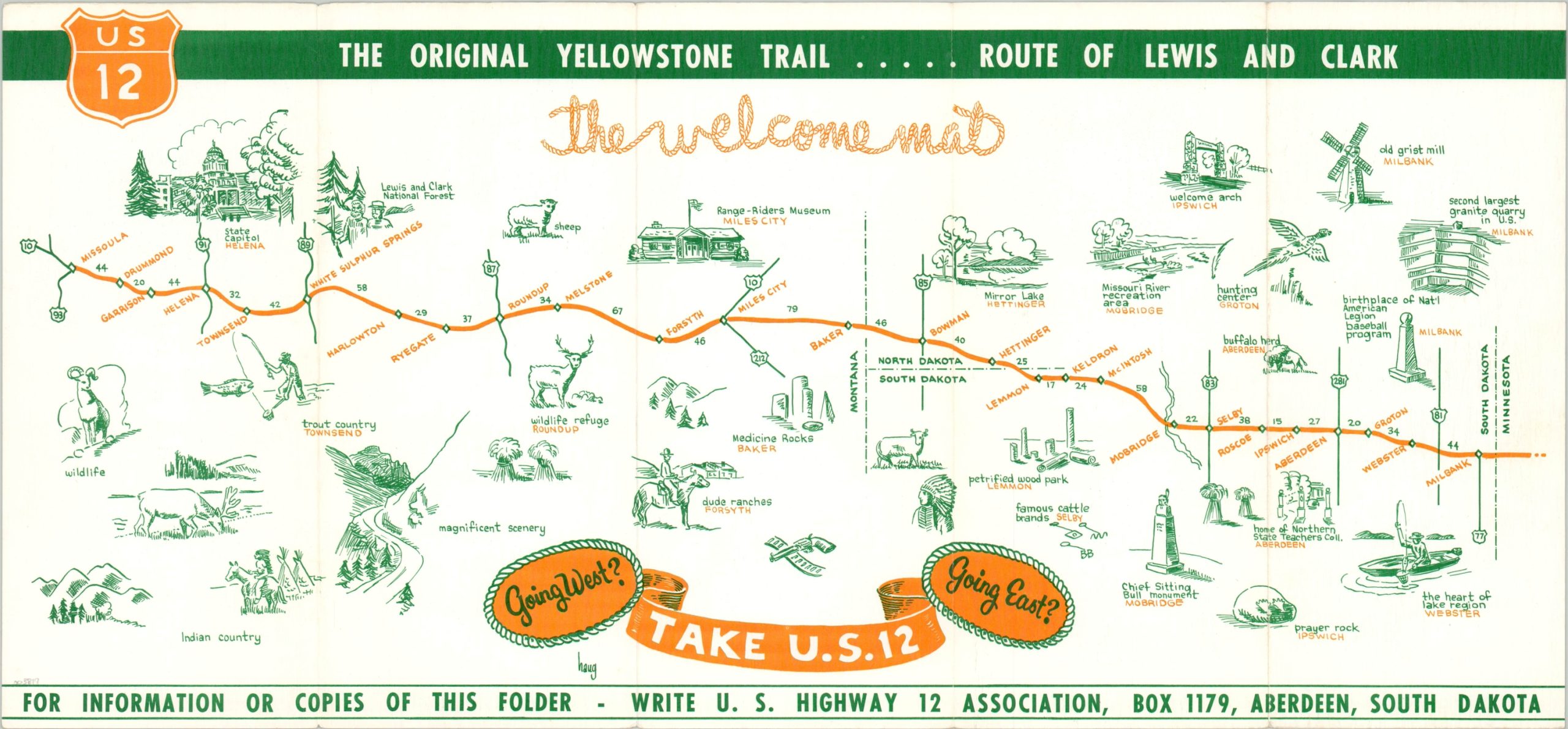
U.S. Highway 12 through South Dakota and Montana – ‘The Original Yellowstone Trail.’
Out of stock
Description
U.S. Highway 12 was first established in 1926 and would eventually run approximately 2,500 miles from Detroit, Michigan to Aberdeen, Washington. This strip map covers around 975 miles of the highway across the Dakotas and Montana, between Milbank and Missoula.
Illustrated vignettes highlight many of the points of interest along the route and include the Chief Sitting Bull monument in Mobridge, the Range-Riders Museum in Miles City, and the State Capitol in Helena, among many others. The verso lists the various participatory businesses of the U.S. Highway 12 Association, publisher of the map and headquartered in Aberdeen, South Dakota. The artist’s signature, Haug, can be seen below the title.
Map Details
Publication Date: c. 1960
Author: Haug
Sheet Width (in): 19.6
Sheet Height (in): 9.1
Condition: A-
Condition Description: Minor wear along the outer edges of the sheet and creased along former fold lines. Light discoloration visible on the verso that does not affect the image. Very good overall.
Out of stock

