
Girl Scout National Center West
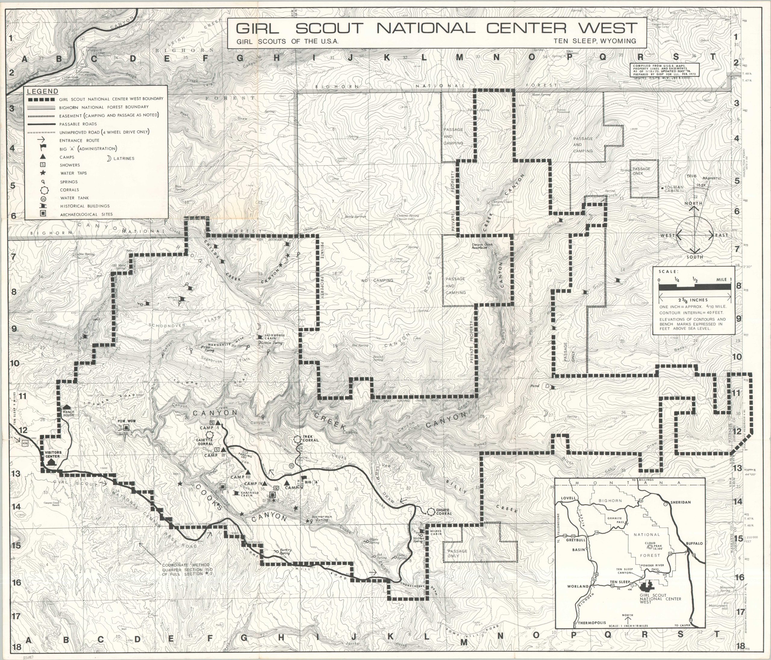
Detailed topographic map of the largest Girl Scout Camp in America.
Out of stock
Description
This informative topographic map presents the physical landscape of Girl Scout National Center West near Ten Sleep, Wyoming. The massive 15,000+ acre parcel was acquired in 1968 and hosted thousands of Girl Scouts before its closure in 1989. The image highlights the camp boundaries and those of the adjacent Bighorn National Forest. Roads and trails are noted, along with guest amenities (camps, showers, water taps, etc.) and infrastructure (historic buildings, corrals, water tanks).
The map was originally prepared by DJDP for LLL in Feb. 1973 (see upper right), though this example reflects later revisions, with an updated date of 1978 by MLW; JWS & Associates.
Map Details
Publication Date: 1978
Author: JWD & Associates
Sheet Width (in): 27.9
Sheet Height (in): 23.75
Condition: A-
Condition Description: Light creasing and faint toning along old fold lines, with tiny holes at fold intersections. Blank on verso. Very good condition overall.
Out of stock