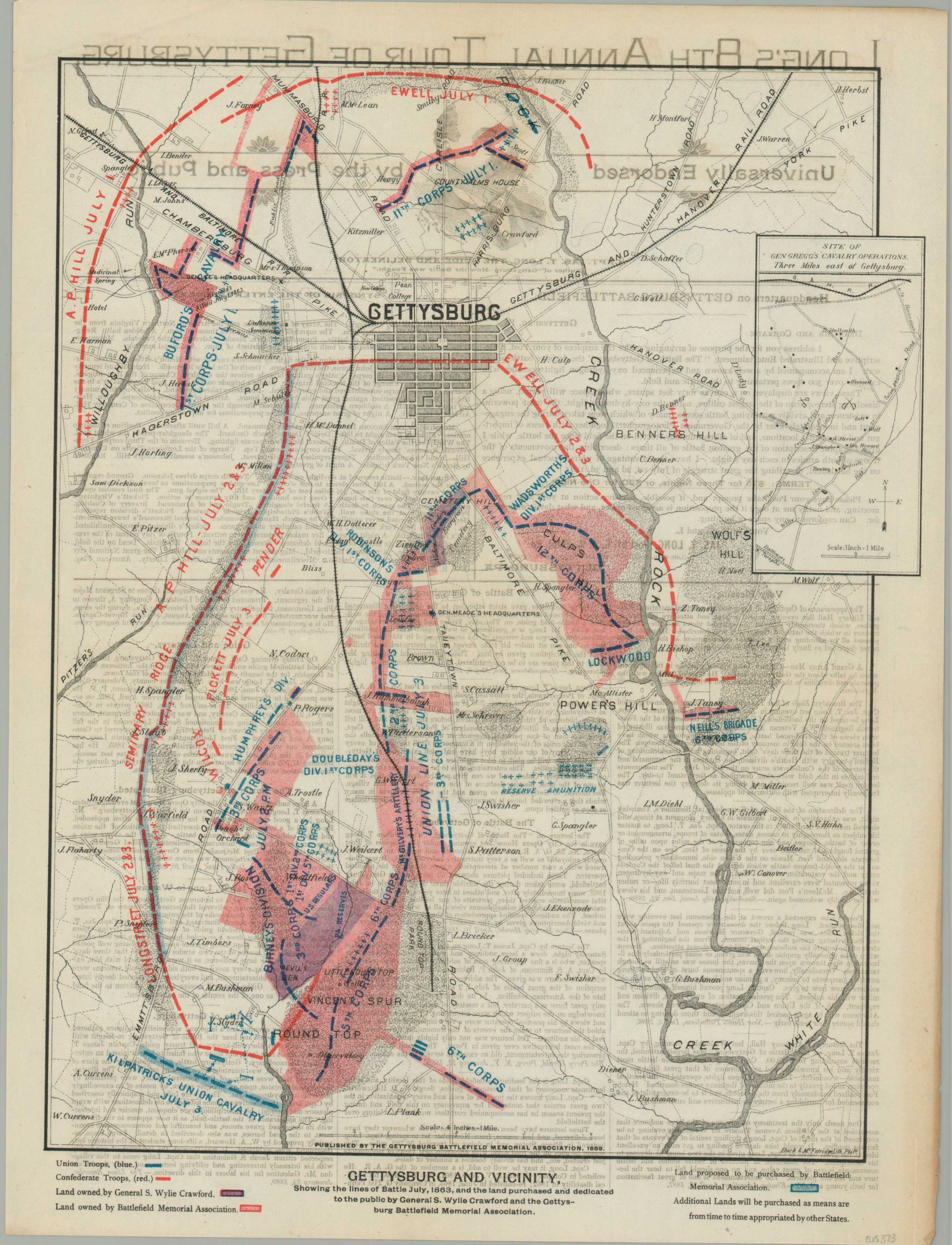
Gettysburg and Vicinity
$95.00
A relic of battlefield tourism just a few decades after the bloodbath of Gettysburg.
1 in stock
Description
This double-sided Gettysburg broadsheet from the late 19th century served a variety of purposes – informing the audience about the 3-day battle, highlighting the land parcels (acquired and desired) of the official memorial, and advertising the battlefield tour of Captain James T. Long.
A simple battle plan, lithographed in Philadelphia by Burk & McFetridge, shows the disposition of Union and rebel troops in early July, 1863. Splashes of pink show the land owned by the Gettysburg Battlefield Memorial Association, with other parcels shaded in blue either dedicated to the public or proposed for purchase.
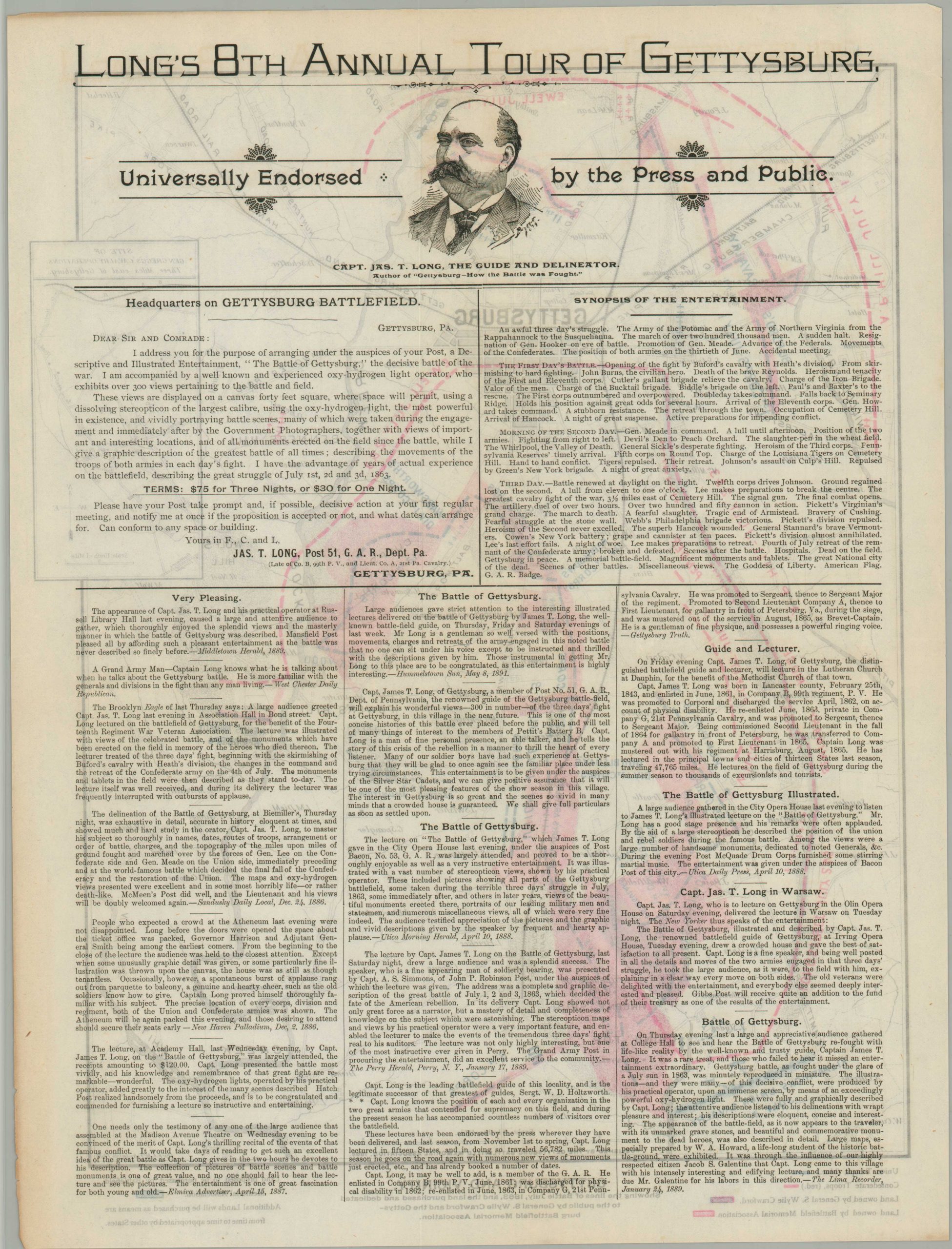
The verso describes Long’s 8th Annual Tour of Gettysburg, probably held in the spring and summer of 1889 based on the date of the last newspaper endorsement at the bottom of the page (1/24/1889). Text outlines a synopsis of the entertainment, which included a 40 sq. ft. canvas onto which ‘300 views pertaining to the battle and field’ were projected by an ‘experienced oxy-hydrogen light operator’ (presumably one who would not burn down the building).
Map Details
Publication Date: c. 1889
Author: James T. Long
Sheet Width (in): 13.6
Sheet Height (in): 17.9
Condition: A-
Condition Description: Printed on thin paper that has lightly toned along the outer edges. Faintly creased along vertical and horizontal fold lines, with a small spot of separation in the center (repaired on verso). Very good overall.
$95.00
1 in stock