[German Army Map – Lake Garda, Italy]
$450.00
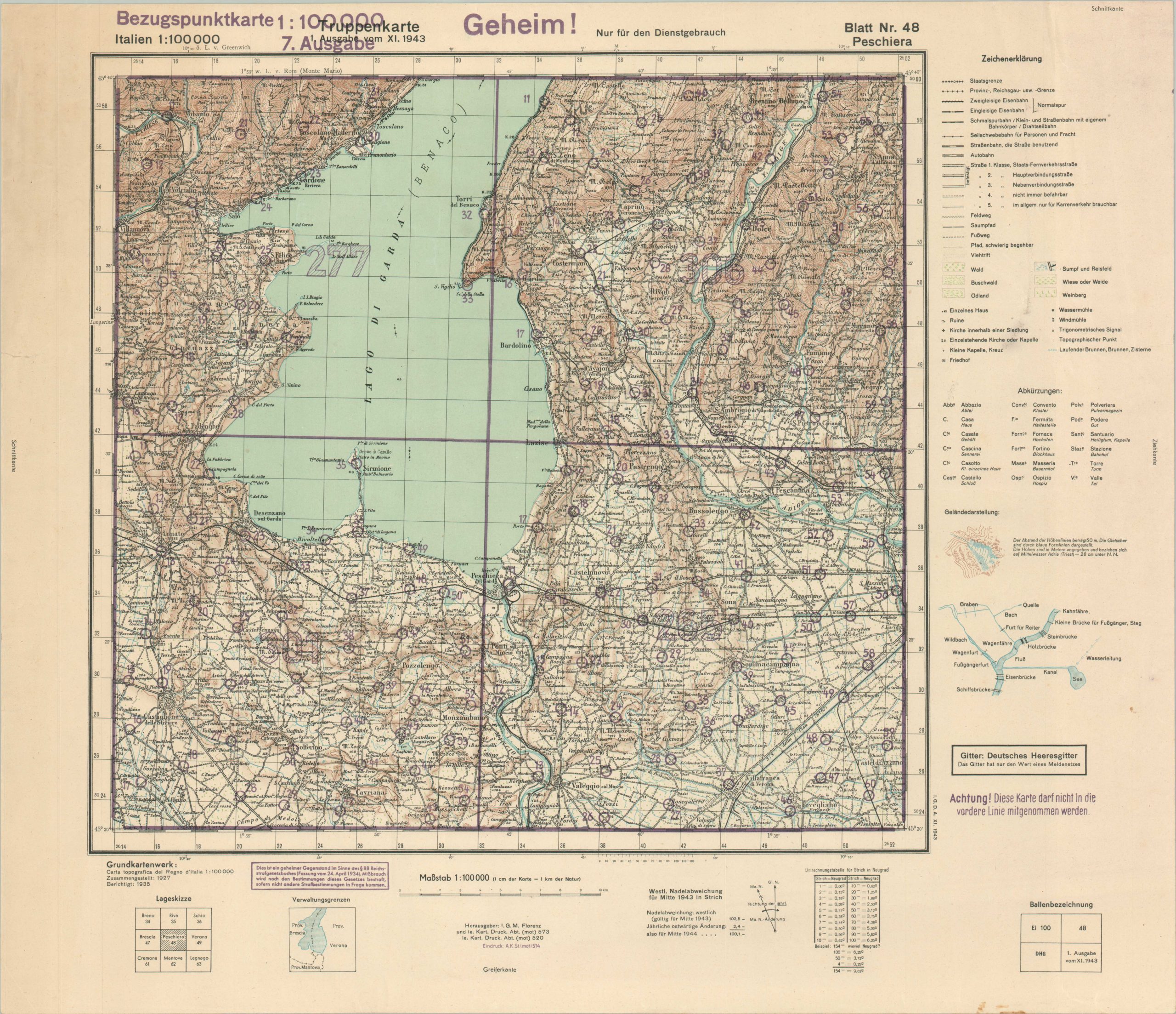
Secret German military map of the southern half of Italy’s Lake Garda.
1 in stock
Description
This detailed German ‘Reference Point Map’ (Bezugspunktkarte) covers a large region around the southern half of Italy’s Lake Garda. The sheet is named after Peschiera, a small town at the southernmost tip of the lake. The image was originally created by the Istituto Geografico Militare, but this is a later update likely issued as part of Germany’s forced restructuring of Italy after the latter’s capitulation to the Allies in September 1943.
Following Mussolini’s fall, Hitler established a puppet state in the north called the Italian Social Republic, ensuring additional bloodshed in the defense of the peninsula and prompting the Italian Civil War. Purple overprinting circles dozens of strategic chokepoints in each quadrant of the map. The purple ink also emphasizes the sheet’s military importance; with markings indicating Secret (Geheim!), Danger – Not to be Taken to the Front, and an ominous reminder of the Reich Criminal Code (lower left).
A short publication history can be seen in the lower center, with the latest entry reading “Eindruck: A.K. St. (mot) 514” This is likely a reference to Armee-Kartenstelle (Motorized) 514 – a German Army mapping unit. The lower right contains a Ballenbezeichnung (bale name) diagram with additional pertinent information, including the edition – November 1943.
Map Details
Publication Date: 1943
Author: Armee-Kartenstelle (Motorized) 514
Sheet Width (in): 22.9
Sheet Height (in): 19.6
Condition: A
Condition Description: Printed on thin paper that shows light toning, consistent with age. Faint wrinkling and a few tiny spots visible here and there. Very good to near fine overall.
$450.00
1 in stock

