Germany and its Approaches [Occupation Maps]
$550.00
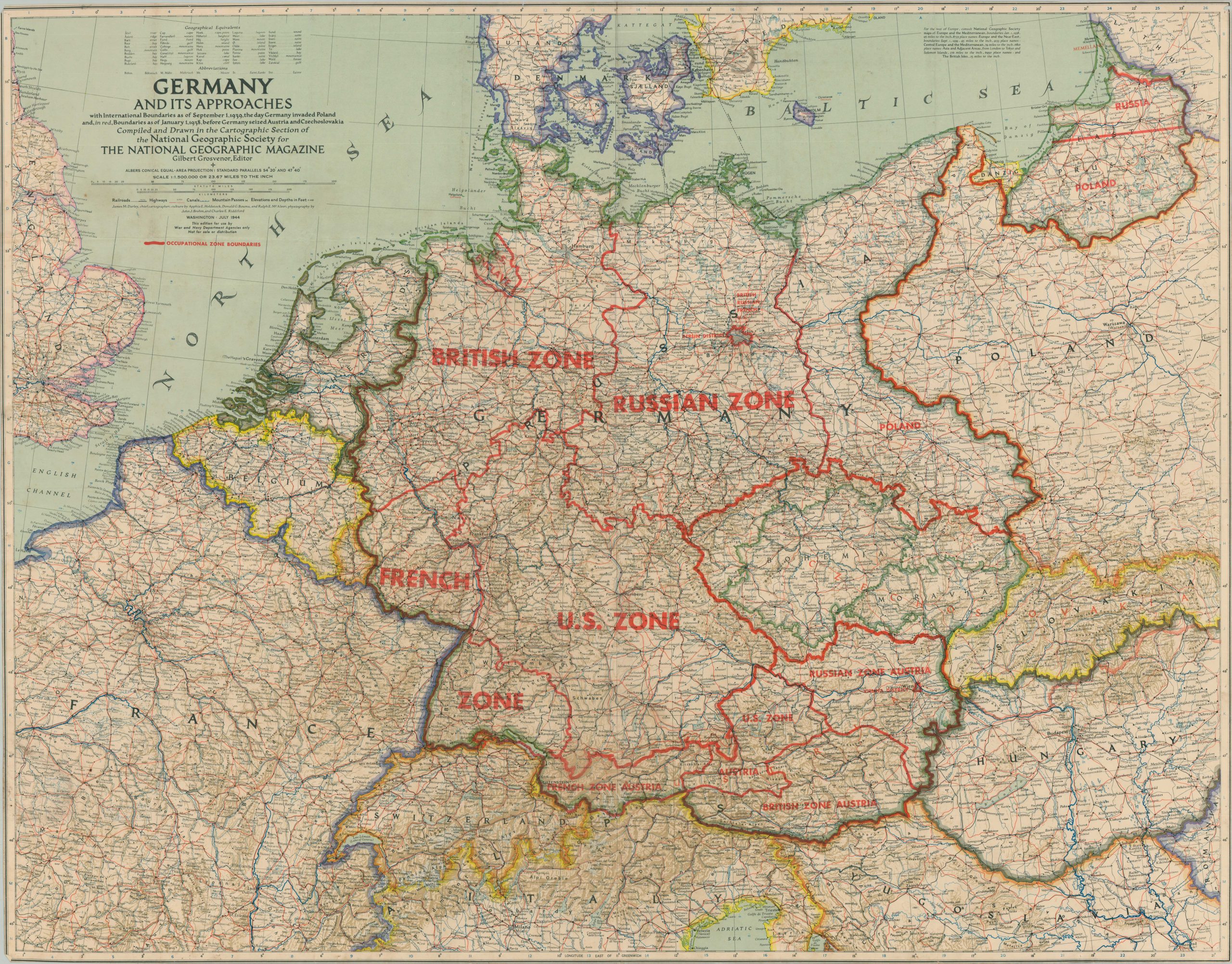
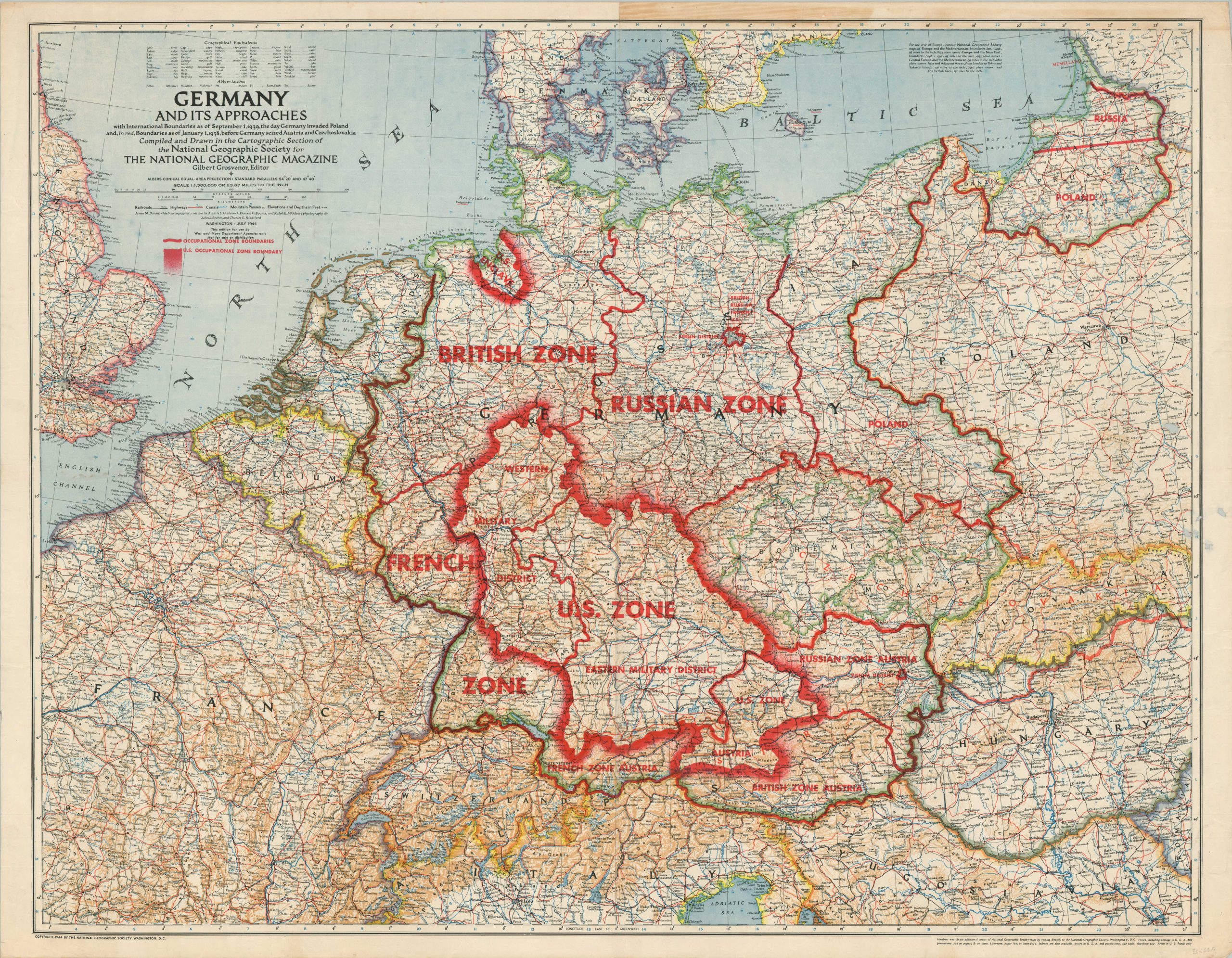
Using National Geographic Maps to plan for the occupation of defeated Axis powers.
1 in stock
Description
Following the collapse of the Third Reich and the Allied occupation of Germany and Austria, many questions remained on how to effectively adjudicate territorial disputes and divide political control among the victorious powers. Pre-war borders, large populations of distinct ethnic groups, and postwar geopolitical aspirations all had to be taken into consideration by four nations with very different goals and priorities.
This rare pair of maps perhaps played a small role in the momentous discussions that were taking place on the American side in the year leading up to victory in Europe. They were issued in July of 1944 by the National Geographic Society for express use by agencies of the War and Navy Departments. Sale and public distribution were prohibited, according to text under the title block.
A detailed base map shows the international boundaries prior to the German invasion of Poland, with additional lines noting the full extent of Austria and Czechoslovakia before annexation. The two maps are identical save for the red overprinting, which outlines two different (but very similar) proposals for the postwar occupation.
Both Germany and Austria are shown divided among France, Britain, the U.S., and the U.S.S.R.; with the Berlin and Vienna Districts outlined as distinct enclaves within the Russian Zones. On one sheet, the U.S. Occupation Zone boundaries are emphasized and subdivided further into Eastern and Western Military Districts (apparently the only change). Also of note is the division of East Prussia (former German Territory) between Russia and Poland and the large American enclave around the port of Bremen to facilitate a toehold in the North Sea (eventually reduced).
Map Details
Publication Date: 1945
Author: National Geographic Society
Sheet Width (in): See Description
Sheet Height (in): See Description
Condition: B+
Condition Description: A pair of large color printed maps of Germany and Austria on single sided sheets. One is trimmed to near the neatline and the other has several small holes in the center right. Moderate soiling and creasing along old fold lines visible on both. About good condition overall.
$550.00
1 in stock


