Geology and Ground Waters – Torrance-Santa Monica Area, California
$275.00
Federal efforts to prevent the salinization of groundwater in Southern California.
1 in stock
Description
This fascinating collection of twenty lithographed plates was published in Washington, D.C. by the Government Printing Office in 1959. They were originally issued to accompany a water-supply paper by J.F. Poland, A.A. Garrett, and Allen Sinnott of the United States Geographical Survey (U.S.G.S.) that discusses the hydrology of the area around Torrance and Santa Monica in Southern California, near Los Angeles. According to the abstract;
“[In] the Torrance-Inglewood subarea of this report the draft on ground water has been excessive for many years; and local water levels, which were drawn down to about sea level by 1930, now are as much as 70 feet below sea level. Saline contamination has developed extensively along the coast, and the ground-water supply is threatened with ultimate deterioration if the present draft is maintained.
This investigation, which covers the period from 1943 to 1947, was for the purpose of appraising the geologic conditions controlling the occurrence and circulation of ground water, the replenishment to the west basin, and the extent and sources of saline contamination and methods for its control.”
The plates are listed below.
1. Generalized geologic map of the coastal plain and contiguous areas in Los Angeles and Orange Counties, Calif.
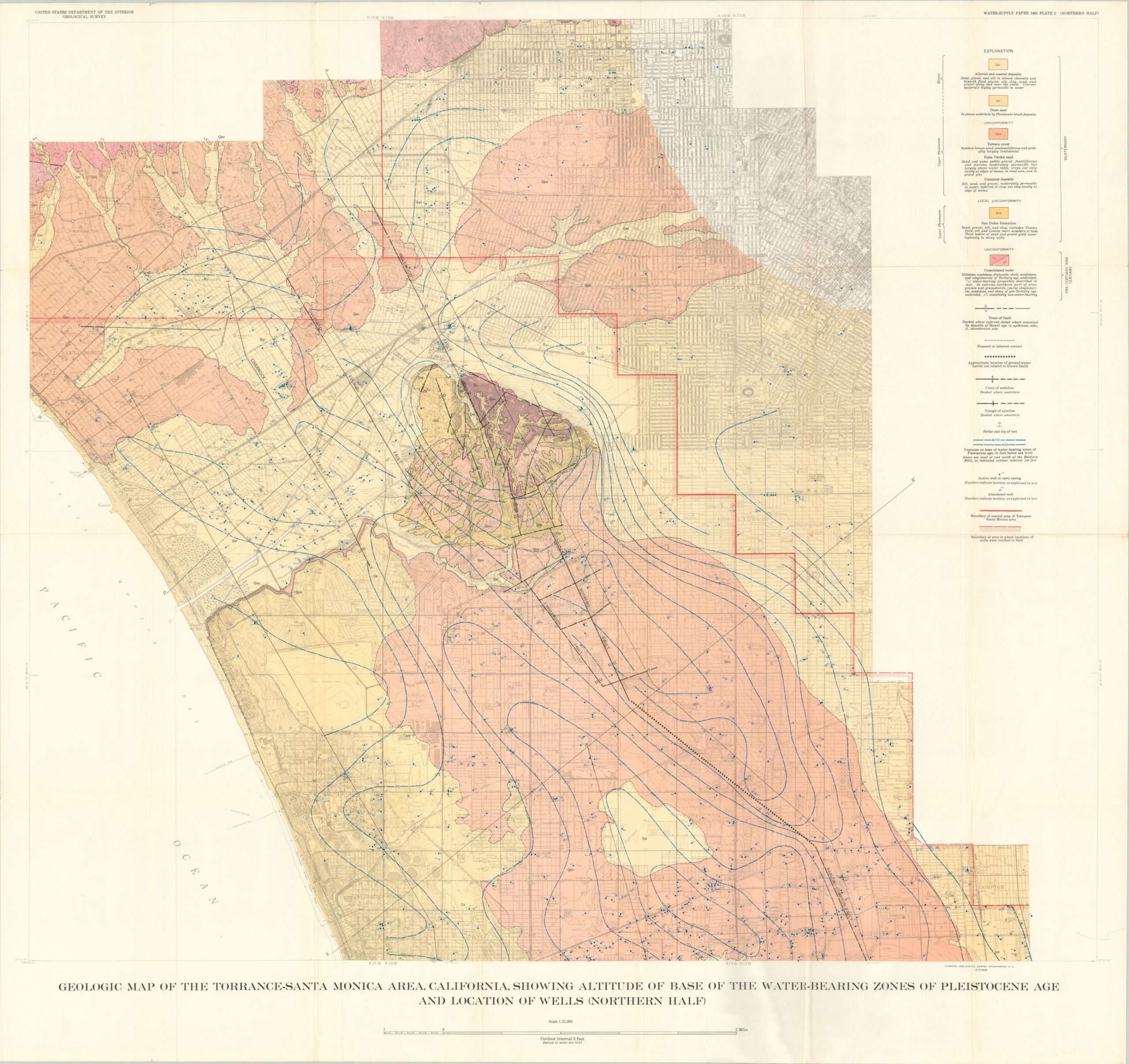
2. Geologic map of the Torrance-Santa Monica area, California.
3. Geologic sections of the Torrance-Santa Monica area.
4. Geologic section E-E’, from Manhattan Beach to Huntington Park; also water-level profiles of 1903-45.
5. Geologic section F-F’, from Redondo Beach to Long Beach; also water-level profiles of 1903-45.
6. Geologic section G-G’, from Terminal Island through Dominguez Gap.
7. Diagrammatic correlation of stratigraphic columns in the Torrance-Santa Monica area.
8. Map showing generalized contours on the base of the principal fresh-water body in the Torrance-Santa Monica area; also extent of the Gaspur water-bearing zone and the “50-foot gravel.”
9. Map of the Torrance-Santa Monica area showing water-level contours for March 1933; also for 1903-4 in the southern part of the area.
10. Map showing rise or fall of water levels in the Torrance-Inglewood subarea from March 1933 to April 1941.
11. Map of the Torrance-Santa Monica area showing water-level contours for April 1941.
12. Map of the Torrance-Santa Monica area showing water-level contours for November 1945; also distribution of pump age for public supply or industrial use in 1945.
13. Hydrographs for selected wells in the central part of the west basin and on Rosecrans Hills.
14. Hydrographs for selected wells in Ballona Gap.
15. Section along the crest of the Newport-Inglewood uplift from Baldwin Hills to Long Beach, showing the generalized position of water-bearing deposits; also water-level profiles indicating magnitude of dewatering.
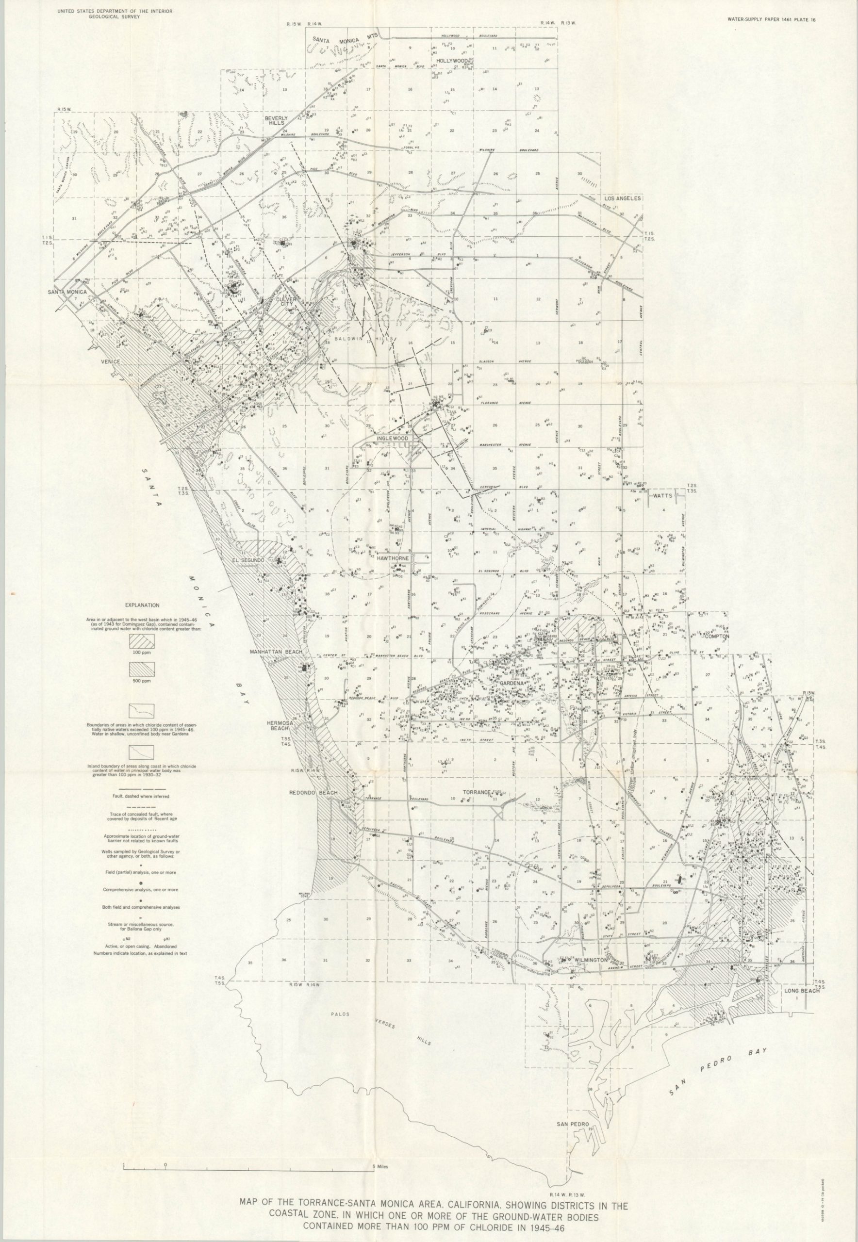
16. Map of the Torrance-Santa Monica area showing districts in the coastal zone in which one or more of the ground-water bodies contained more than 100 ppm of chloride in 1945-46.
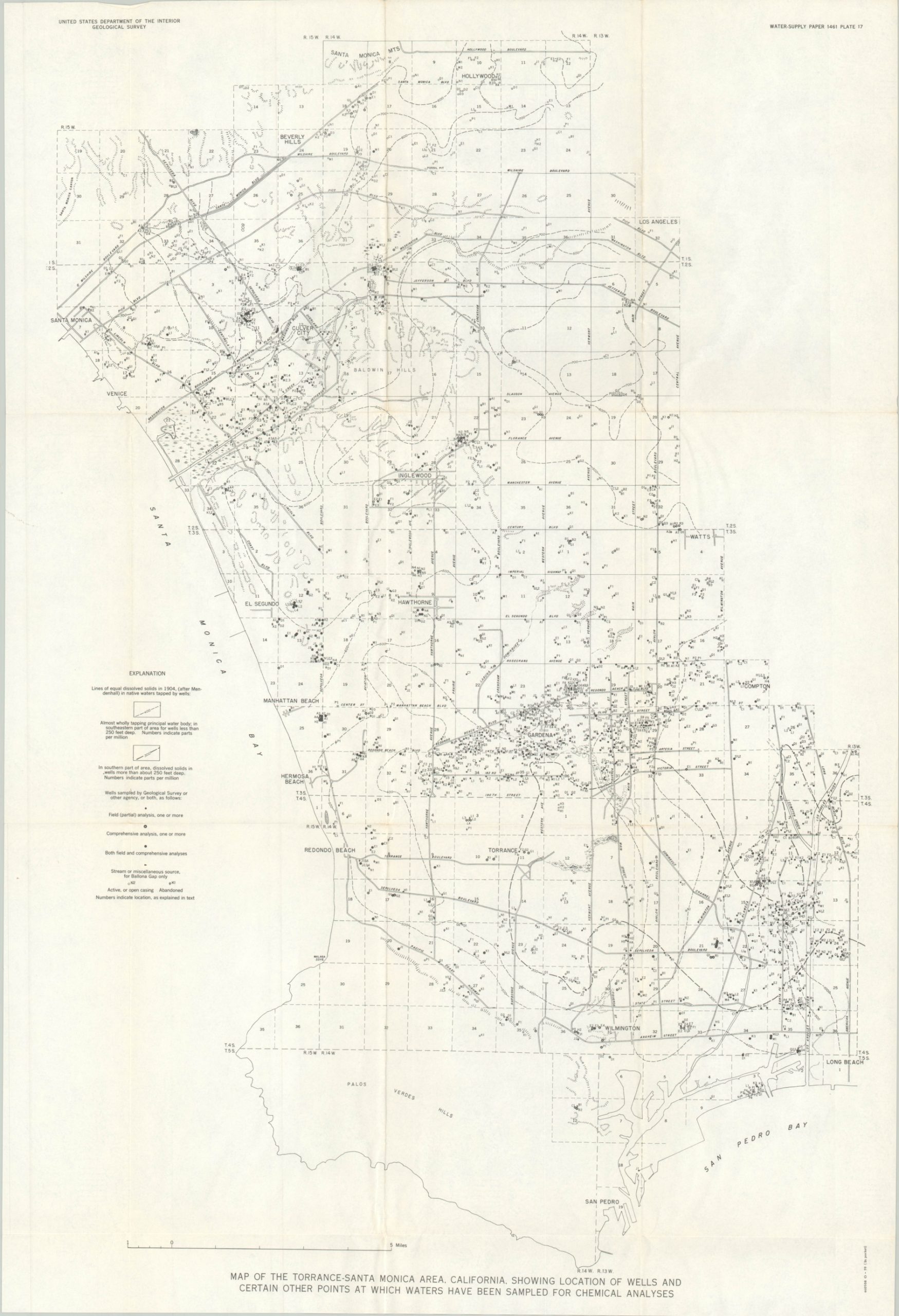
17. Map of the Torrance-Santa Monica area showing location of wells and certain other points at which waters have been sampled for chemical analyses.
18. Map of the Torrance-Santa Monica area showing sources of representative native waters from the shallow unconfined water body.
19. Map of the Torrance-Santa Monica area showing sources of representative native waters from the Silverado water-bearing zone and from the San Pedro and Pico formations.
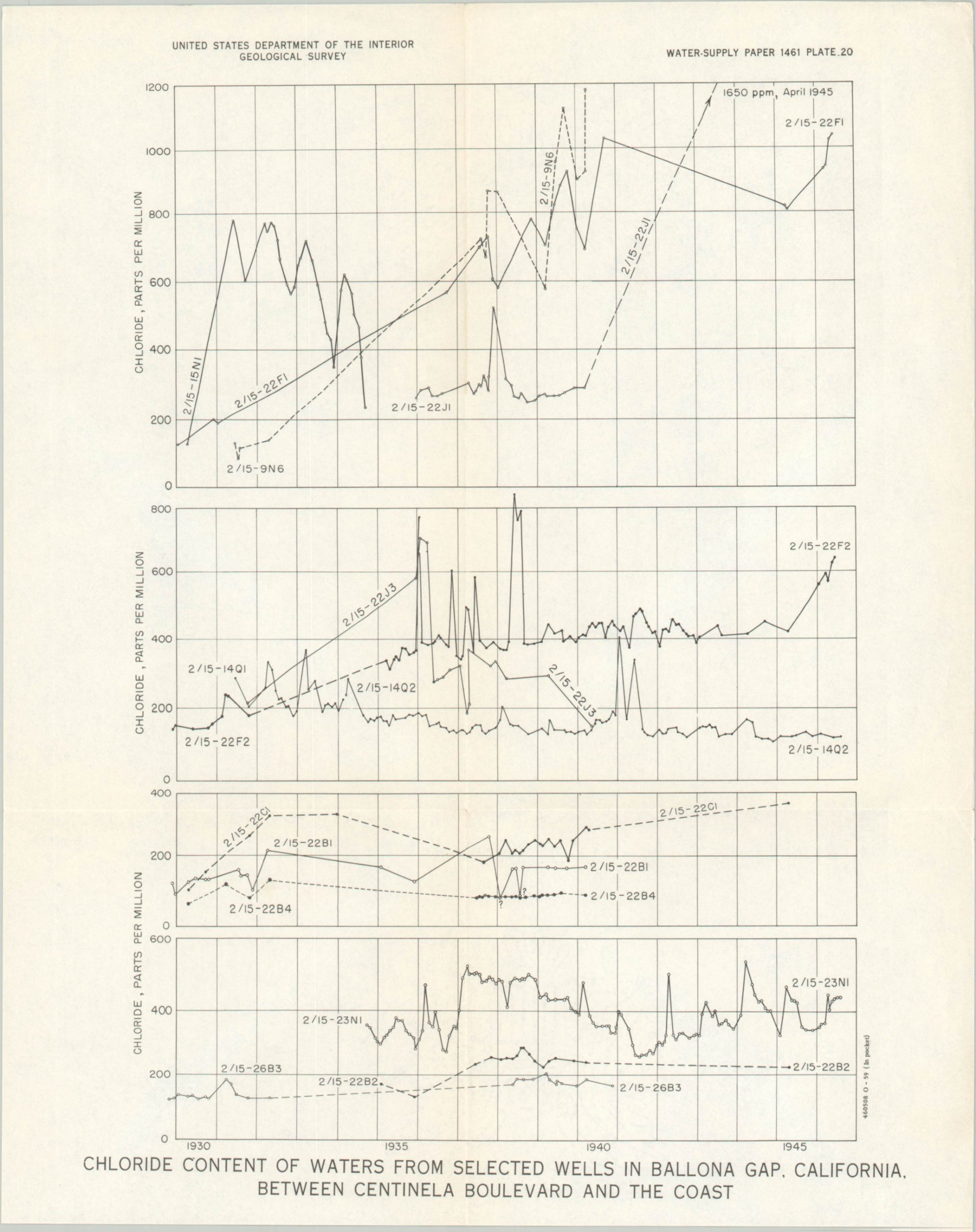
20. Chloride content of waters from selected wells in Ballona Gap between Centinela Boulevard and the coast.
Map Details
Publication Date: 1959
Author: Joseph Fairfield Poland et. al.
Sheet Width (in): See Description
Sheet Height (in): See Description
Condition: B+
Condition Description: Ex-library. Complete set of 20 folding plates (actually 21 sheets, one figure is two parts) with orange slipcase. Case is heavily worn and shows cellophane tape repairs, but remains intact. Maps are in very good condition overall; creased along fold lines with some light soiling and extraneous wrinkling.
$275.00
1 in stock


