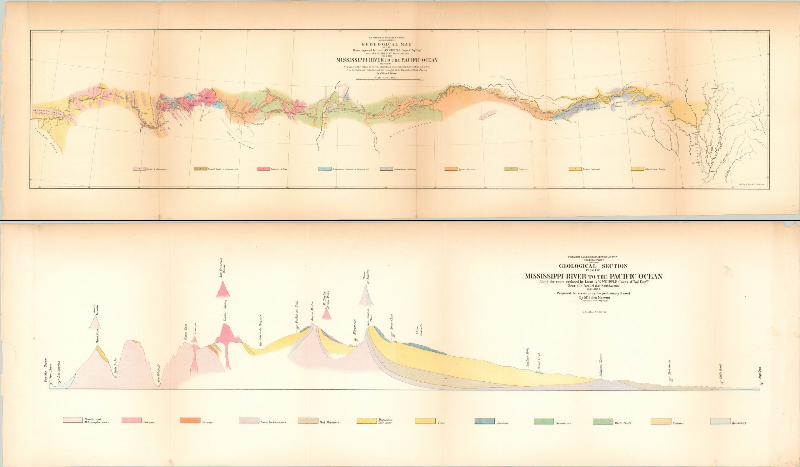
Geological Section from the Mississippi River to the Pacific Ocean [with] Geological Map…
$250.00
A pair of geological maps from the Pacific Railroad Survey.
1 in stock
Description
Before he was mortally wounded in the Battle of Chancellorsville during the Civil War, Amiel Weeks Whipple led one of several federally funded surveys across the American West to find the most suitable route for a transcontinental railroad. Lieutenant Whipple’s party departed Fort Smith, Arkansas in July of 1853 and would arrive in Los Angeles the following March.
Among the group was Jules Marcou, a Swiss geologist whose notes allowed for the construction of these detailed geologic overviews of the route. The geological map was drawn by William P. Blake and uses vibrant color to distinguish the different compositions of substrata between the Mississippi River and Pacific Ocean. The geological section presents similar data, but with a profile view that emphasizes the drastic changes in topography from east to west.
Map Details
Publication Date: 1854
Author: Jules Marcou
Sheet Width (in): See Description
Sheet Height (in): See Description
Condition: B
Condition Description: Two sheets, each with moderate wear and toning around the edges and creasing along former fold lines. The Geological Section measures approximately 35.75" x 10.75" and is in good condition, other than the aforementioned issues. The Geological Map is a bit longer, 39.75", and was formerly separated at the seam between the Cretaceous and Tertiary symbols in the legend. Repaired on the verso.
$250.00
1 in stock


