Geological Map of the United States
$120.00
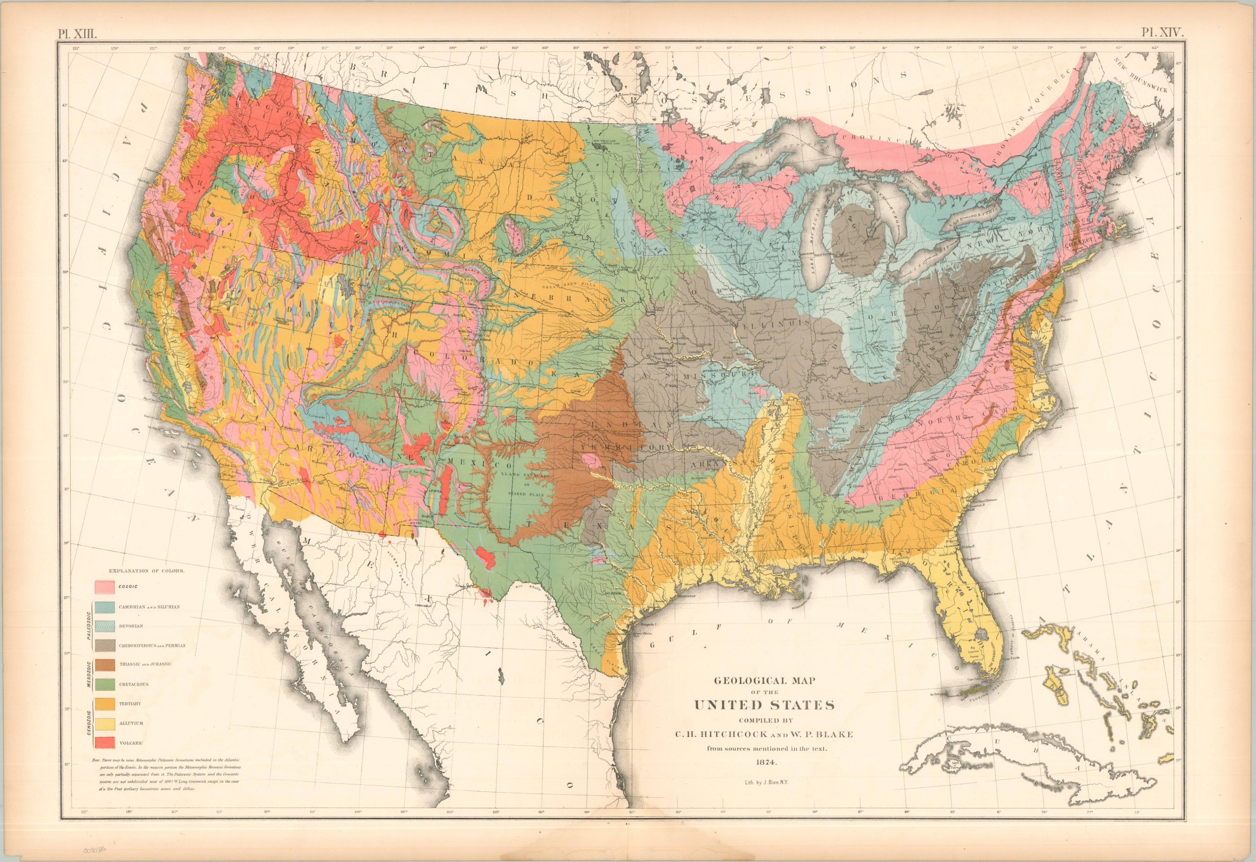
An early geologic map of the United States.
1 in stock
Description
This important map of the United States reflects one of the first comprehensive attempts to visualize the nation’s complex geological foundations using vibrant colored lithography. The continent is categorized into distinctive chronological layers, outlined in the lower left. Designed by influential geologists Charles Henry Hitchcock and William Phipps Blake.
The map was originally issued as part of The Statistical Atlas of the United States Based on the Results of the Ninth Census, 1870, compiled by Census Superintendent Francis A. Walker. Lithographed by Julius Bien and published in 1874. The atlas serves as the ultimate 19th-century “data portrait” of a reunified nation, meticulously synthesizing geography, climate, and demographics into a visual manifesto of America’s industrial and economic potential.
Map Details
Publication Date: 1874
Author: C.H. Hitchcock and W.P. Blake
Sheet Width (in): 31.50
Sheet Height (in): 21.75
Condition: B+
Condition Description: Lithographed sheet on somewhat brittle paper with moderate marginal wear, including toning, damp staining at the bottom, and a few tiny tears.
$120.00
1 in stock