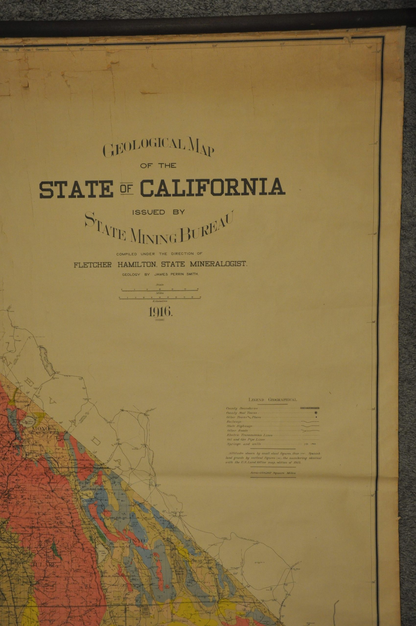
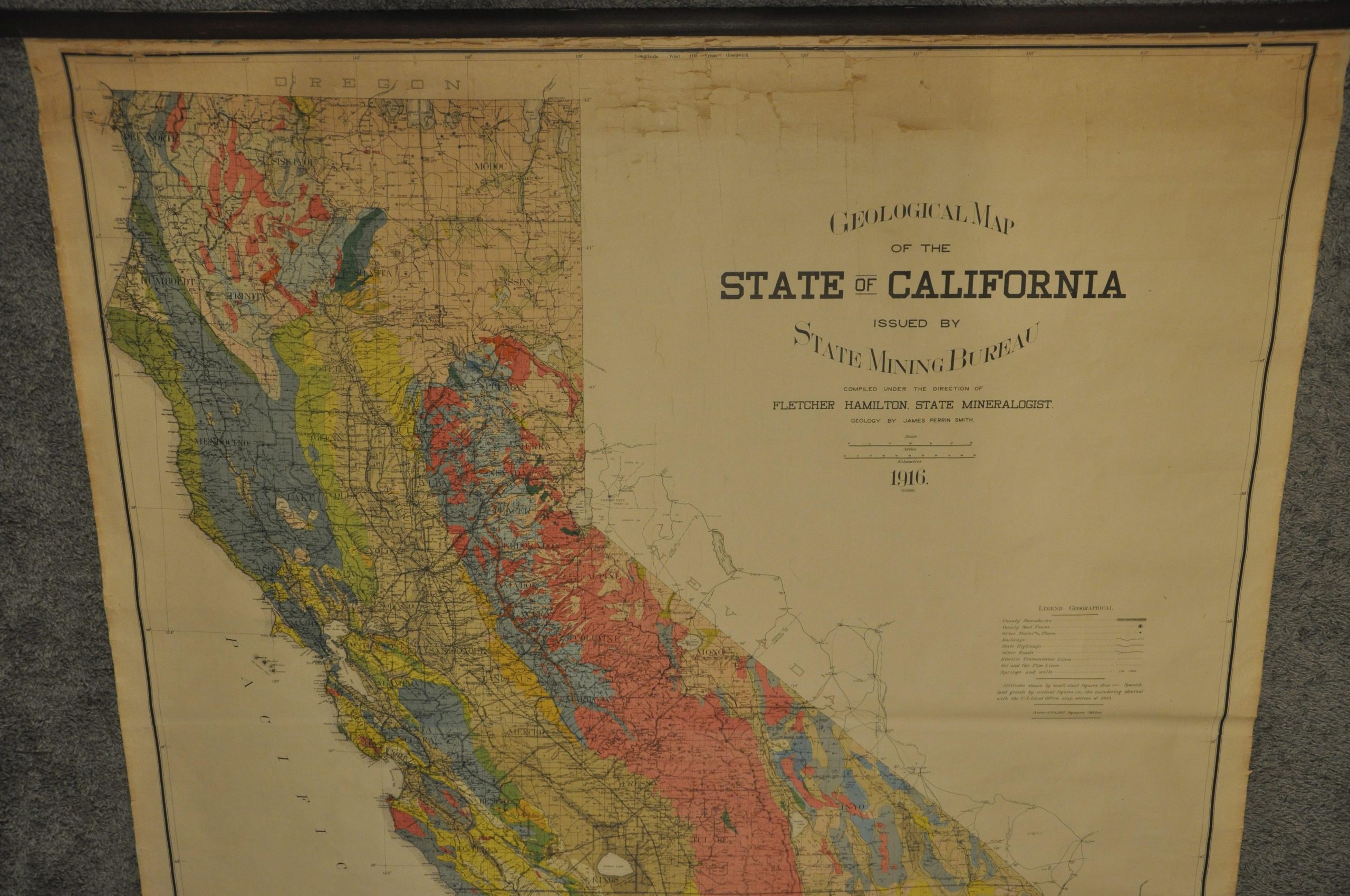
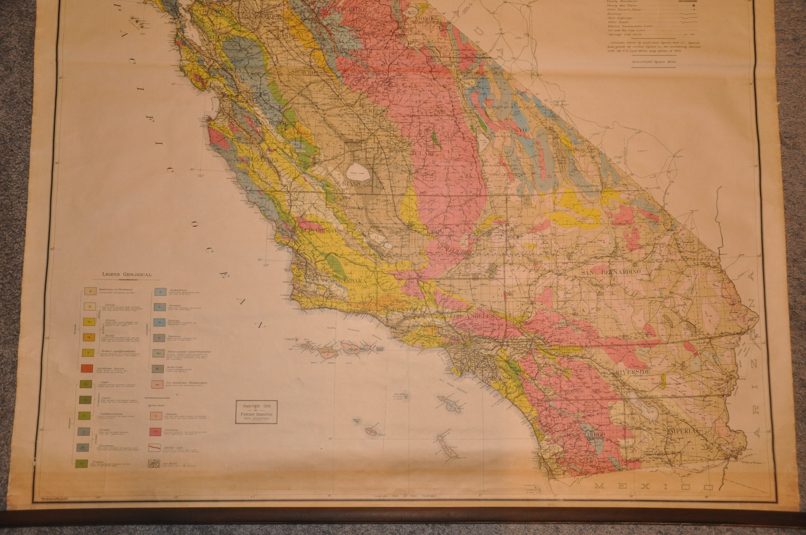
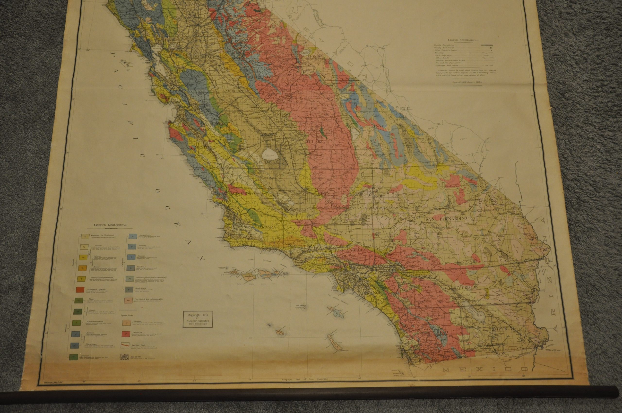
Geological Map of the State of California
$950.00
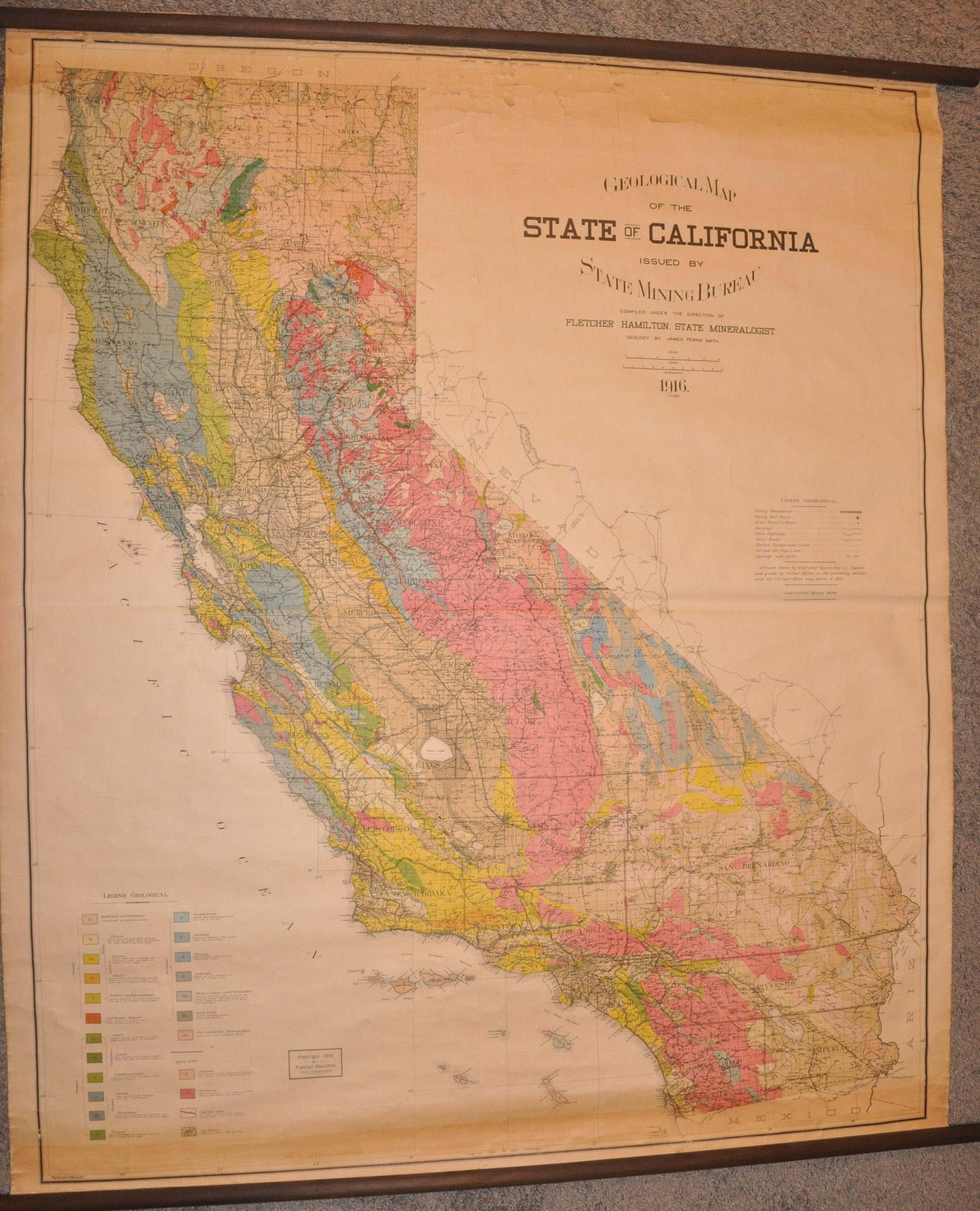
Detailed geologic map of California published in the midst of World War I.
1 in stock
Description
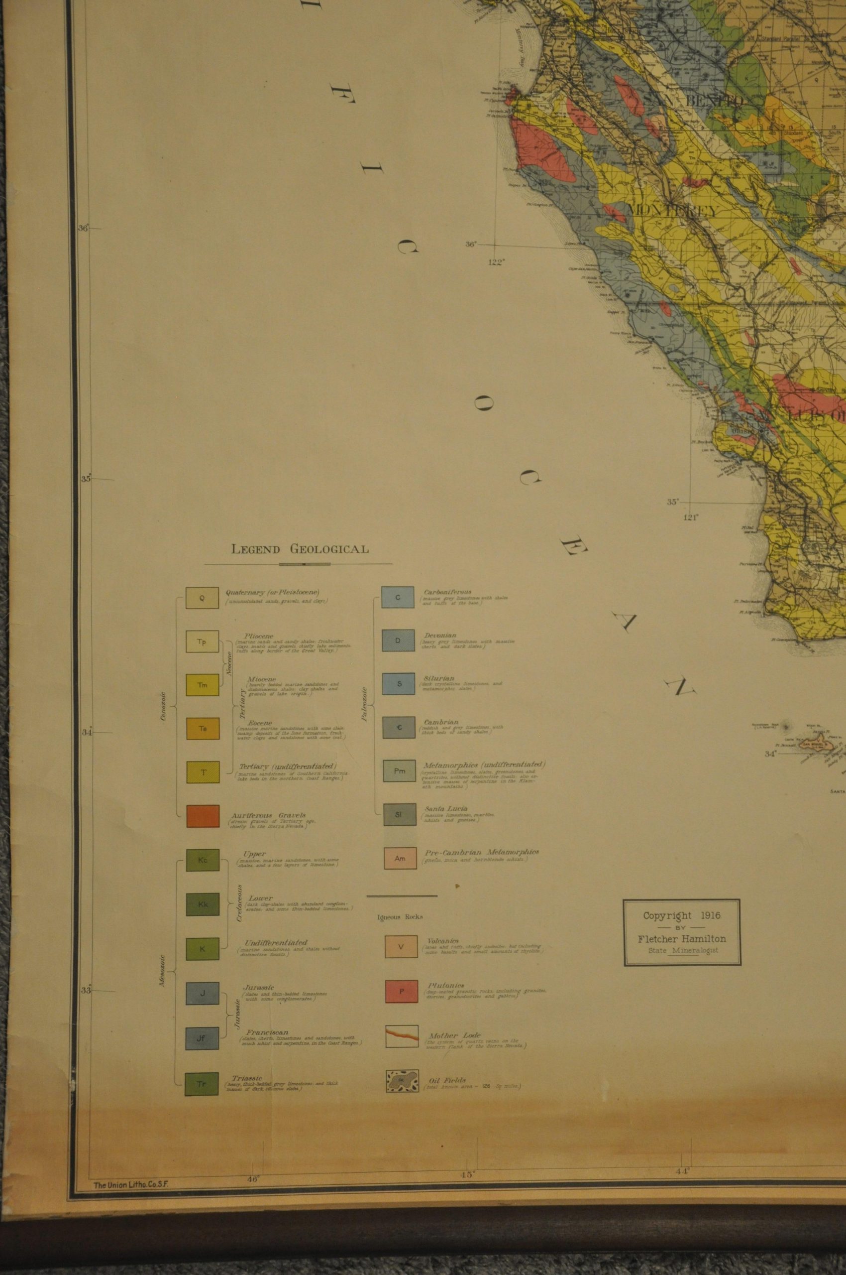
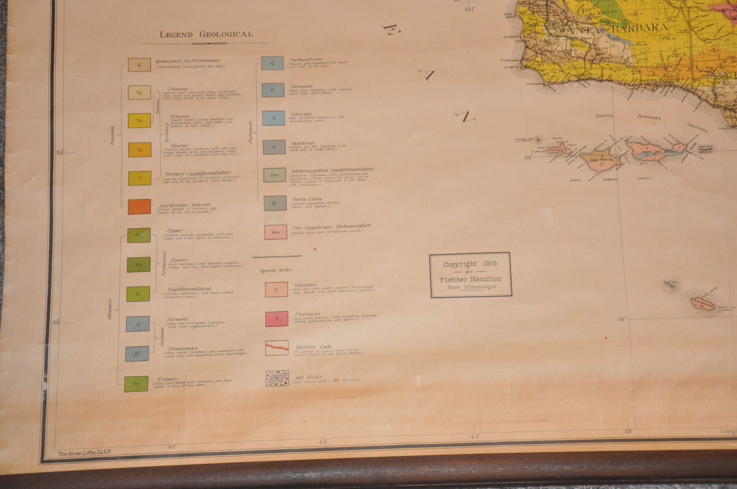
This meticulous overview of California’s geography was compiled by James Perkins Smith and Fletcher Hamilton and issued by the State Mining Bureau in 1916. Bright splashes of color identify various stratigraphic layers according to the legend in the lower left, which also denotes the symbols used to identify oil fields and the geographic extent of ‘The Mother Lode’ (a massive gold-bearing quartz vein). Both were critical to the economic development of the Golden State during the early 20th century.
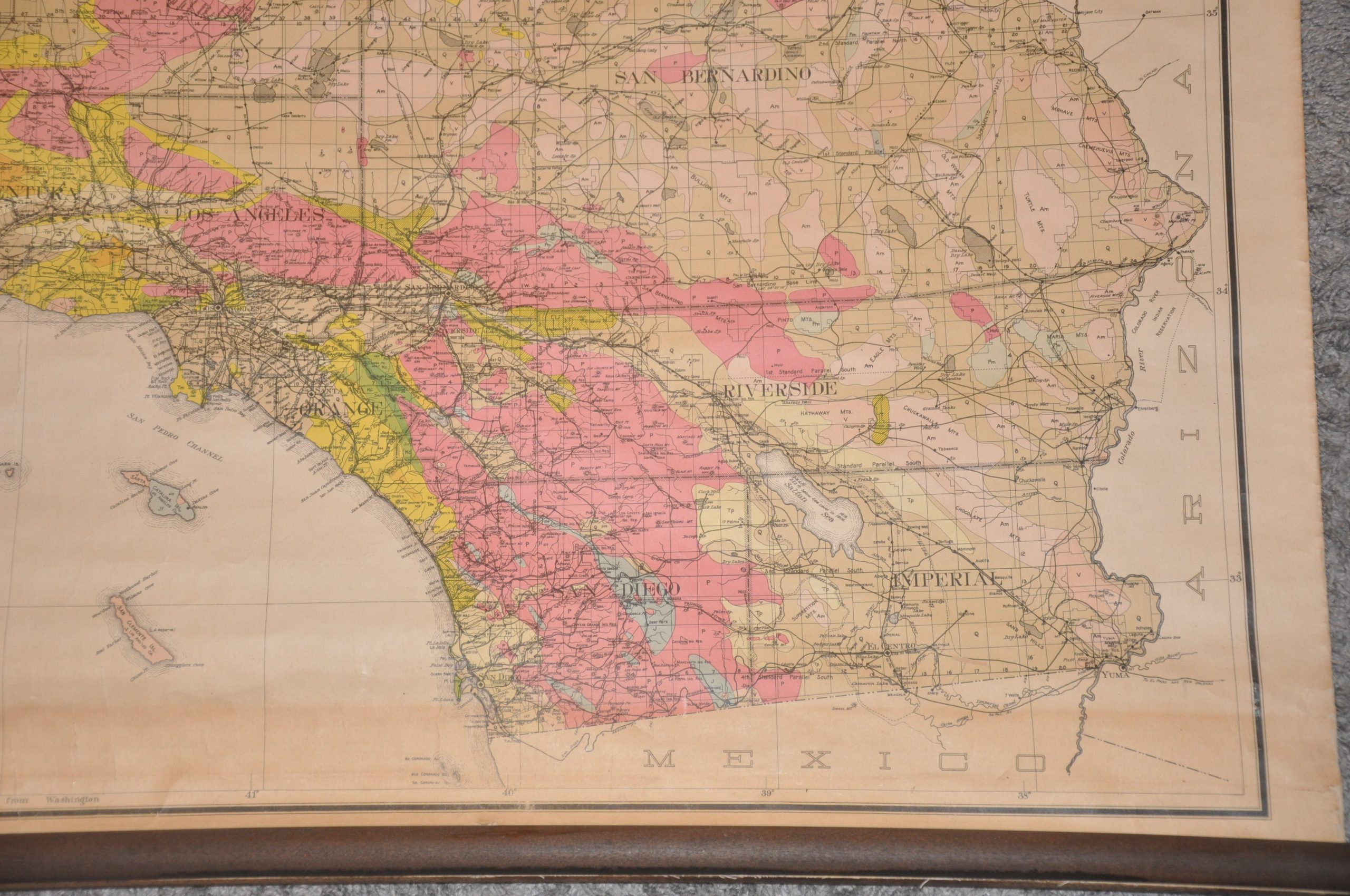
The detailed image also captures a snapshot of the local infrastructure and transportation network. The system of state highways was less than a decade old at the time of printing and railways remained dominant for freight and passenger travel, at least for the time being. Oil and gas pipelines, electric transmission wires, and water sources (springs and wells) are also identified, reflecting the contemporary priorities of the Mining Bureau.
A version of the map was first issued by the organization in 1891 and was subsequently reprinted numerous times with additional information. The 1916 example, printed by the Union Lithographic Company of San Francisco, is uncommon on the market. According to the California Department of Conservation;
“Twenty-five years after the 1891 Preliminary Mineralogical and Geological Map of the State of California, another 1:750,000 scale state geologic map was published by the California State Mining Bureau. This map was prepared by J. P. Smith, Professor of Paleontology at Stanford University, and was accompanied by a brief bulletin describing the geology (Smith, 1916). The map legend lists 21 geologic units.
Although Professor Smith’s bulletin clearly explains that certain areas of California were still unmapped, his map, unlike the earlier 1891 edition, shows the entire area of the state covered by colors representing geologic units with delineated contacts. This, unfortunately, leaves the map-user without any clue as to what is known and what has merely been projected.
The absence of geologic faults on this map is also somewhat puzzling. Although faults were by this time widely recognized and mapped—as, for example, in the atlas accompanying the “State Earthquake Investigation Commission” report on the disastrous 1906 San Francisco earthquake— not even the San Andreas fault is shown on the 1916 geologic map of California.”
Map Details
Publication Date: 1916
Author: James Perkins Smith
Sheet Width (in): 58.5
Sheet Height (in): 49.5
Condition: B+
Condition Description: Large wall map comprised of two lithographed sheets mounted on linen and affixed to original wooden rollers. About 4-6" of wear and toning are visible along the top and bottom of the map as a result of contact with the rollers and oxidization from the environment when rolled. The paper is starting to flake along the top resulting in some marginal paper loss and one or two spots within the image. The sheet is really starting to curl away from the page at the very top. The bottom is in stronger condition, with no loss of paper, but the toning is a hair darker. Overall in about good condition.
$950.00
1 in stock


